Plizio Visual Lab
Entraigues-sur-la-Sorgue
ℹ️Practical info — Entraigues-sur-la-Sorgue
▾
🌤 Weather — 5 days
📍 Nearby
Sights nearby
💡 Tips
- Walk along the riverbanks to see the historical paper mill remnants and ancient washing places (lavoirs).
- Bring mosquito repellent during summer evenings, as the abundant waterways attract insects.
- Use the local train station for stress-free day trips to Avignon and Carpentras without worrying about parking.
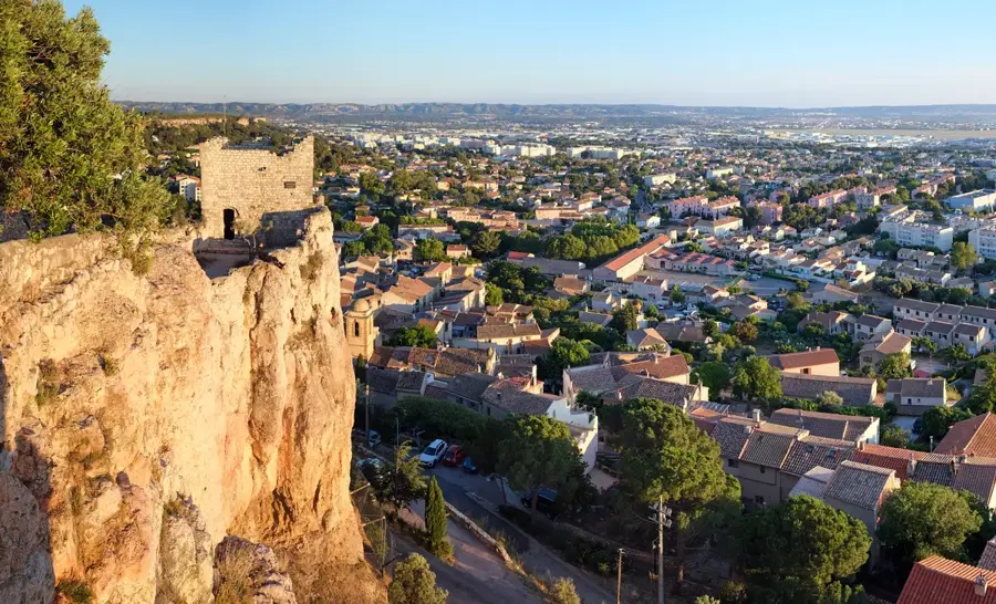
- Look out for the Tour des Templiers, the imposing historical tower that dominates the town's skyline.
🍽 Food
Look for a riverside restaurant serving locally sourced freshwater fish.
Pick up this olive-based spread from a local market vendor for a great picnic snack.
Enjoy this sweet regional fruit in the summer months, available at local greengrocers.
🛍 Shopping · 🧘 Quiet spots
Visit Place de la Mairie for fresh Provencal herbs, olives, and seasonal fruits.
Grab a 'fougasse', a traditional Provencal flatbread, from a bakery in the town center.
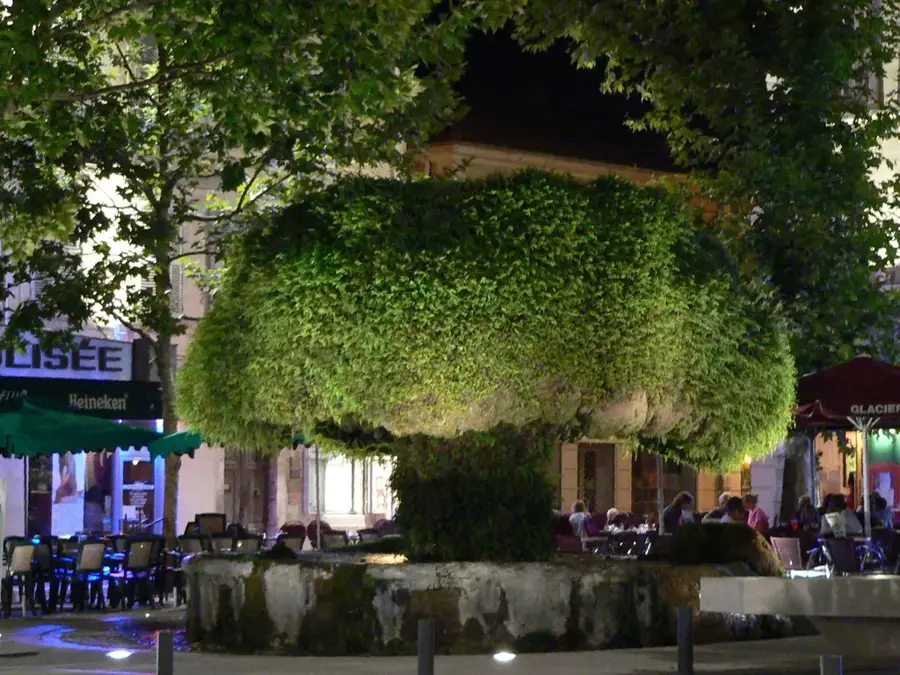
Enjoy a shaded, peaceful stroll under the plane trees along the water.
A quiet historical spot tucked away from the main commercial streets.
Water temperature…
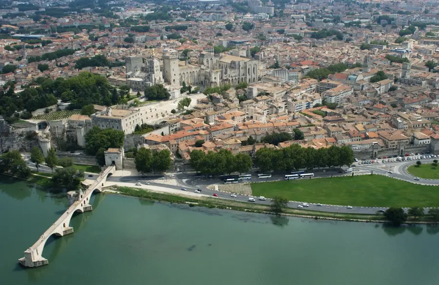
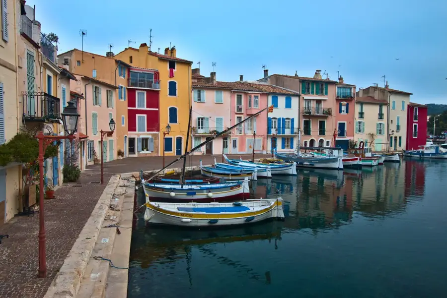
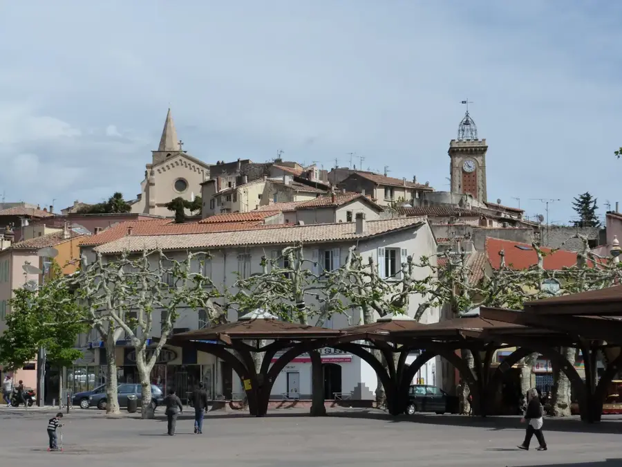
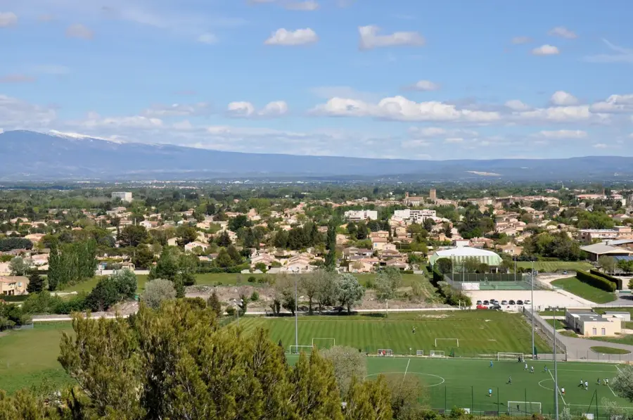
Positioned between Avignon and Carpentras, Entraigues-sur-la-Sorgue is a historic town deeply shaped by the various branches of the Sorgue river that flow through its territory. The town's heritage is anchored by the 12th-century Templars' Tower (Tour des Templiers), a massive 20-meter-tall fortification that dominates the skyline and serves as a reminder of the region's medieval military importance. A walk through the old town center reveals the church of Saint-Léger and several old paper and silk mills that once relied on the river's steady current. The surrounding landscape consists of the fertile plains of the Comtat Venaissin, known for extensive orchards producing cherries, apricots, and melons, which are a staple at the local farmers' markets. Waterways are lined with thick vegetation, offering shaded, tranquil walking paths during the hot Provençal summers. Its location features a train station with direct connections to the Avignon TGV, making it an incredibly practical base for travelers wanting a quiet, water-cooled retreat while exploring the papal city or the nearby Mont Ventoux region.
- Location: Provence-Alpes-Côte d'Azur, France
- Top sights: Berges de la Sorgue · Ancien Lavoir · Pont sur la Sorgue
- Nearby: Sorgues (4 km)
- Population: ~8.913
Best time to visit & climate
The most pleasant time to visit is Jun–Aug.
| Jan | Feb | Mar | Apr | May | Jun | Jul | Aug | Sep | Oct | Nov | Dec | |
|---|---|---|---|---|---|---|---|---|---|---|---|---|
| Avg °C | 4 | 5 | 8 | 12 | 16 | 22 | 25 | 24 | 19 | 15 | 9 | 5 |
| Rain mm | 49 | 40 | 44 | 56 | 56 | 37 | 25 | 31 | 62 | 85 | 98 | 52 |
Live webcam – Entraigues-sur-la-Sorgue
See what it looks like near Entraigues-sur-la-Sorgue right now.
Vedene › South: Autoroute du Soleil · 4.1 km · Open webcam on Windy · Webcams provided by Windy.com
Geography
Facts
- Postal code: 84320.
- Total area: 16.57 square kilometers.
- Elevation range: 24 to 42 meters.
- Home to the 12th-century Templars' Tower, a national monument.
- The Sorgue river divides into several branches within the town.
- Located within the Greater Avignon metropolitan area (Grand Avignon).
Explore nearby
Notable places around
Route planner — Car & Motorhome
Where do you start? We build the route here, with stops and country notes along the way.
© OpenStreetMap contributors · OpenRouteService
Start the day at the historic square, soaking in the morning light. A short walk leads to the bridge over the Sorgue, where you can watch the clear waters flow. Stroll along the peaceful riverbanks, surrounded by lush vegetation. This shaded area is perfect to enjoy a relaxed midday break away from the town center. Continue towards the southern neighborhoods to discover a lovely local green space. The park offers a glimpse into daily life with room to rest under mature trees. Conclude with a visit to the historic washhouse, a testament to the region's heritage. The old stones glow warmly at dusk, offering a reflective end to the tour.
Place du 8 Mai 1945
Pont sur la Sorgue
Berges de la Sorgue
Square Les Jardins
Ancien Lavoir
The morning begins on the rain-slicked main square under an umbrella. At noon, the Sorgue bridge offers an atmospheric view of the swollen river. In the afternoon, the riverbank paths are lush and green, but beware of slippery mud. The day ends dry inside the historic wash house. Wear waterproof shoes for this moody Provencal walk through the misty town.
Place du 8 Mai 1945
Pont sur la Sorgue
Berges de la Sorgue
Square Les Jardins
Ancien Lavoir
The winter morning is crisp and clear on the main square. At noon, the low sun warms the bridge over the Sorgue. The afternoon by the riverbank is quiet and peaceful under the bare branches. As sunset arrives early at 17:00, the day concludes at the illuminated wash house. Dress in warm layers for this chilly but bright winter stroll through the town.
Place du 8 Mai 1945
Pont sur la Sorgue
Berges de la Sorgue
Square Les Jardins
Ancien Lavoir
Kick off your tour in the lively center, taking in the historical square before riding over the iconic bridge. Follow the gentle curves of the riverbank. Leave the quiet river pathways behind and cycle northwards towards the entertainment district. The flat Provencal roads make for an easy and pleasant ride. Dive into the excitement with comic-themed rollercoasters and attractions. Swap your bike helmet for a swimsuit and cool off in the giant tropical pools. Finish your active day by testing your balance on the ultimate artificial surf simulator. It's an energetic way to cap off a thrilling bike trip.
Place du 8 Mai 1945
Pont sur la Sorgue
Berges de la Sorgue
Parc Spirou
Wave Island
Da wave
A rainy cycling day starts at the main square. Watch for slick asphalt on your way to the Sorgue bridge. At noon, cycle carefully along the slippery riverbanks. In the afternoon, Parc Spirou and Wave Island offer thrills despite the rain, often with shorter queues. End your ride cautiously at Da Wave. Waterproof gear and reliable brakes are essential today.
Place du 8 Mai 1945
Pont sur la Sorgue
Berges de la Sorgue
Parc Spirou
Wave Island
Da wave
Start your winter ride well-bundled at the main square. The headwind along the Sorgue at noon can be bitingly cold. In the afternoon, Parc Spirou and Wave Island offer a quieter experience with winter charm. End your day at Da Wave, where you can escape the freezing air. As it gets dark at 17:00, working bike lights are essential for the return journey.
Place du 8 Mai 1945
Pont sur la Sorgue
Berges de la Sorgue
Parc Spirou
Wave Island
Da wave
Start your driving tour at the historic washhouse on the town's outskirts, appreciating its ancient architecture. Drive into the center to experience the vibrant morning atmosphere. Park nearby and take a leisurely walk along the beautiful banks of the Sorgue river. Cross the scenic bridge to capture photos of the sparkling waters. Hop back in the car for a short drive to the exciting amusement cluster to the north. Spend the afternoon solving puzzles and exploring the themed zones. Wind down your road trip splashing and relaxing at the nearby mermaid bay. The calm aquatic environment provides a refreshing conclusion to a diverse day.
Ancien Lavoir
Place du 8 Mai 1945
Berges de la Sorgue
Pont sur la Sorgue
Le château des Aventuriers
La Baie des Sirènes
A relaxed rainy day starts at the covered Ancien Lavoir. At noon, the main square offers quick access to cafes. In the afternoon, enjoy views of the Sorgue comfortably from your car or during short stops. Venues like Le Château des Aventuriers provide dry entertainment. Allow extra time for parking in the rain and be mindful of deep puddles.
Ancien Lavoir
Place du 8 Mai 1945
Berges de la Sorgue
Pont sur la Sorgue
Le château des Aventuriers
La Baie des Sirènes
Start your winter day comfortably with the car heater on at Ancien Lavoir. At noon, the main square provides a bright backdrop for a short walk. In the afternoon, admire the quiet Sorgue from your car window. Visit Le Château des Aventuriers for some winter exploration. Since the sun sets at 17:00, the drive back in the dusk is particularly scenic.
Ancien Lavoir
Place du 8 Mai 1945
Berges de la Sorgue
Pont sur la Sorgue
Le château des Aventuriers
La Baie des Sirènes
Sights in the town Entraigues-sur-la-Sorgue (7)
Frequently asked questions
What is the landmark of Entraigues-sur-la-Sorgue?
Can you take a walk along the banks of the Sorgue?
How far is Avignon?
Are there cycle paths nearby?
Is the town suitable for families?
Entraigues-sur-la-Sorgue: where is it located?
Entraigues-sur-la-Sorgue: what is there to see?
Entraigues-sur-la-Sorgue: when is the best time to visit?
Entraigues-sur-la-Sorgue: why is it worth visiting?

Nearby cities