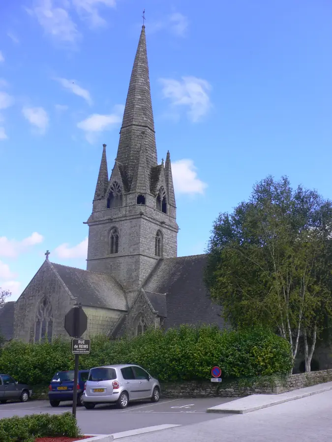
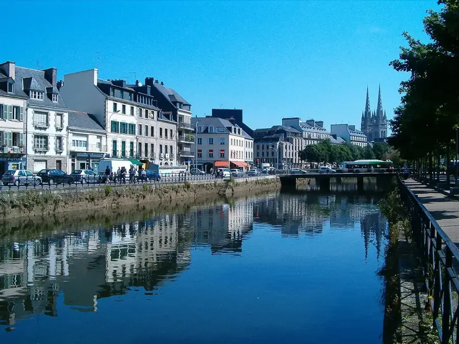
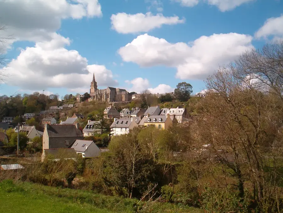
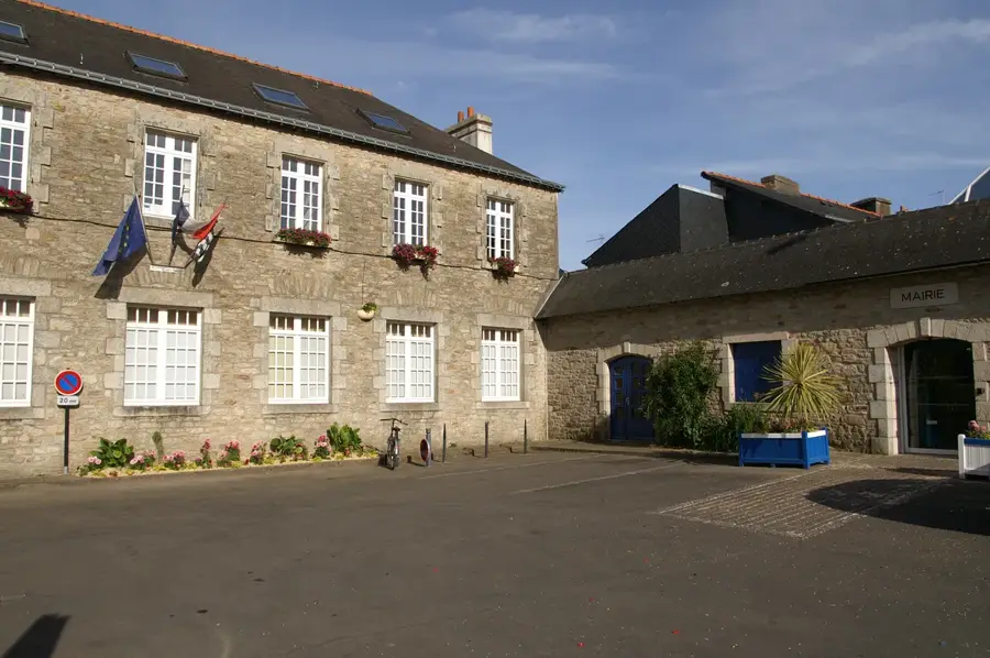
Rosporden is a quintessential Breton town located in the Finistère department, famously known as the 'Cité des Étangs' due to the large ponds that define its urban landscape. The primary pond, Étang du Moulin, covers over 40 hectares and was historically the lifeblood of the town's milling industry. In the mid-19th century, Rosporden was transformed by the arrival of the railway, becoming a major transit point between the cities of Quimper and Lorient. This accessibility sparked industrial growth, particularly in food processing and cider production. The town's historic center features the beautiful Church of Notre-Dame, a listed monument with a 14th-century tower and ornate interior carvings. Rosporden remains a stronghold of Breton identity, hosting active 'Cercles Celtiques' (Celtic cultural groups) and maintaining local traditions that are showcased during the annual summer festivals. Geographically, it serves as a gateway between the rugged interior of Brittany and the Atlantic coast, with the 'Green Ways' (Voies Vertes) cycling paths providing scenic routes through the countryside. Today, it is a thriving community that successfully blends its industrial railway heritage with a commitment to preserving its unique natural and cultural environment.
Location: Bretagne, France
Top sights: Rosporden Lake · Notre-Dame d'Indulgence Church · Voie Verte (Greenway)
Nearby: Bannalec (11 km)
Population: ~7.780
Best time to visit & climate
The most pleasant time to visit is Jul–Sep.
Jan
Feb
Mar
Apr
May
Jun
Jul
Aug
Sep
Oct
Nov
Dec
Avg °C
6
6
8
10
13
16
18
18
16
13
9
7
Rain mm
103
85
68
56
55
52
54
55
44
96
107
109
Live webcam – Rosporden
See what it looks like near Rosporden right now.
Rosporden › North-west · 0.8 km · Open webcam on Windy · Webcams provided by Windy.com
Geography
Population
6,779
Coordinates
47.96060, -3.83470
Facts
Postal code: 29140.
Total land area: 57.35 square kilometers.
Member of the Concarneau Cornouaille Agglomération.
The town pond was created by damming the Aven river.
Pick weather + travel mode, get a concrete day plan.
09:00→14:271.5 km walk5 places0/5
Day budget: ≈ 16–22 €Entries 19€ · Transport 0€
Begin your morning by embracing the natural tranquility of Rosporden Lake, enjoying the fresh air and birdlife. Midday brings you to the famous Voie Verte, perfect for a refreshing walk. In the afternoon, marvel at the Notre-Dame d'Indulgence Church's architecture. Conclude your evening immersed in local arts at the Cultural Center, reflecting on the day's charming discoveries.
← swipe for more places →
📍
09:10 · 60'
Rosporden Lake
Stroll around this beautiful lake to admire the tranquil water reflections, and be sure to bring bread crumbs for the local ducks along the scenic shores.
Discover the start of this historic greenway which is excellent for a leisurely morning walk, so wear comfortable shoes to enjoy the flat and paved terrain.
Continue your journey along this shaded recreational trail offering rich local flora, and rent a bicycle from nearby shops to explore it more efficiently.
Admire the striking Gothic architecture of this central church and look closely at the striking stained glass windows best viewed during morning sunlight.
Start your rainy morning observing the mist over Rosporden Lake, well wrapped in a waterproof coat. By noon, tread carefully along the damp Voie Verte, enjoying the fresh scent of wet nature. The afternoon offers a perfect refuge inside the historic Notre-Dame d'Indulgence. Conclude your day exploring the indoor exhibitions at the cultural center as the rain continues to fall outside.
← swipe for more places →
📍
09:10 · 60'
Rosporden Lake
Watch the raindrops creating ripples on the lake's surface; make sure to wear sturdy waterproof boots as the grassy banks get quite muddy.
Start your crisp winter morning with a brisk walk around Rosporden Lake, wrapping up warmly against the biting cold. By noon, enjoy the peaceful, bare beauty of the Voie Verte, keeping moving to stay warm. Spend the afternoon admiring the quiet solemnity of Notre-Dame d'Indulgence. As the early evening sets in around 17:00, seek refuge in the cozy cultural center before the temperature drops further.
← swipe for more places →
📍
09:10 · 60'
Rosporden Lake
Experience the serene, frosty landscape of the lake in winter; a warm thermal layer and gloves are essential against the chilly morning winds.
Walk along the frosty path under bare branches, offering clear views of the surroundings; wear thick socks to keep your toes toasty on the frozen ground.
The winter greenway is crisp and quiet, well-suited for a brisk hike to elevate your heart rate; thermal leggings under your trousers are highly recommended.
Warm up your freezing hands in this engaging cultural space before the sun sets early around 17:00, making it a well-suited, cozy end to your winter walk.
Start your cycling adventure at the peaceful Chapelle Saint-Éloi before coasting down to the scenic shores of Rosporden Lake. Around midday, pedal past the grand Notre-Dame d'Indulgence Church and join the tree-lined Voie Verte. Your afternoon features a longer ride to the historic Chapelle Bonne-Nouvelle. Wrap up the journey at the Cultural Center, soaking in the town's creative spirit.
← swipe for more places →
⛪
09:10 · 50'
Chapelle Saint-Éloi
Step inside this peaceful religious sanctuary dedicated to Saint Eligius, and notice the beautifully carved wooden statues that decorate the quiet interior.
Stroll around this beautiful lake to admire the tranquil water reflections, and be sure to bring bread crumbs for the local ducks along the scenic shores.
Admire the striking Gothic architecture of this central church and look closely at the memorable stained glass windows best viewed during morning sunlight.
Continue your journey along this shaded recreational trail offering rich local flora, and rent a bicycle from nearby shops to explore it more efficiently.
Uncover the deeply rooted local history at this photogenic northern chapel, taking a moment to photograph its characterful stone facade against the sky.
Embark on your wet cycling journey starting at the atmospheric Saint-Éloi Chapel. By noon, pedaling past Rosporden Lake requires caution as the paths are slick. The afternoon is best spent visiting Notre-Dame d'Indulgence and the misty Voie Verte, where mudguards are essential. Conclude the rainy evening safely at the local cultural center, swapping your wet gear for indoor warmth.
← swipe for more places →
⛪
09:10 · 50'
Chapelle Saint-Éloi
Discover the serene beauty of this chapel amidst the rain; ensure your bike's tires are slightly deflated for better grip on the wet cobblestones nearby.
Take a moment to admire this characterful chapel against the moody, grey sky, being very careful not to brake too hard on the slippery, rain-slicked approach.
Your frosty morning ride begins at the Saint-Éloi Chapel, demanding thermal gloves and layers. By noon, the stark beauty of Rosporden Lake is captivating, though the biting wind is fierce. Spend the short afternoon cycling the Voie Verte to Bonne-Nouvelle. Remember, darkness falls around 17:00, so ensure your lights are charged before concluding your chilly day at the cultural center.
← swipe for more places →
⛪
09:10 · 50'
Chapelle Saint-Éloi
Start your winter ride at this historic chapel; freezing temperatures mean tire pressure drops, so pump them up and wear a thick windproof cycling jacket.
The frozen edges of the lake are remarkable to observe, but be wary of black ice on the paved trails around the water, keeping your speed conservative.
Pause here to appreciate the stark Gothic architecture in the winter light, taking a moment to flex your fingers and toes to keep the circulation flowing.
Visit this quiet chapel as the winter shadows lengthen; be prepared for the fast-approaching dusk around 17:00 by testing your front and rear bike lights now.
End your freezing ride at this welcoming indoor venue, an excellent place to thaw out and explore local history away from the biting frost of the winter night.
Your scenic drive begins at the historic Chapelle Bonne-Nouvelle, followed by a tranquil morning stroll by Rosporden Lake. Midday highlights include the stunning Notre-Dame d'Indulgence Church and the quiet Chapelle Saint-Éloi. Drive south in the afternoon to discover the isolated Chapelle Saint-Grégoire de Cadol. Your day concludes at the Cultural Center, celebrating local heritage.
← swipe for more places →
🏛️
09:10 · 80'
Chapelle Bonne-Nouvelle
Uncover the deeply rooted local history at this photogenic northern chapel, taking a moment to photograph its characterful stone facade against the sky.
Stroll around this beautiful lake to admire the tranquil water reflections, and be sure to bring bread crumbs for the local ducks along the scenic shores.
Admire the striking Gothic architecture of this central church and look closely at the memorable stained glass windows best viewed during morning sunlight.
Step inside this peaceful religious sanctuary dedicated to Saint Eligius, and notice the beautifully carved wooden statues that decorate the quiet interior.
Visit this isolated southern chapel surrounded by verdant fields, and pack a small picnic to enjoy the absolute tranquility of the natural environment.
Your rainy morning starts with a scenic drive to Bonne-Nouvelle Chapel, letting the car wipers do the work. By noon, drive carefully to Rosporden Lake; the roads can be quite slick. The afternoon is ideal for church hopping between Notre-Dame, Saint-Éloi, and Saint-Grégoire without getting soaked. Wind down your evening at the cultural center, enjoying dry, indoor exhibits while the storm continues outside.
← swipe for more places →
🏛️
09:10 · 80'
Chapelle Bonne-Nouvelle
Admire this quaint chapel from the comfort of your warm car or make a quick dash inside with a large umbrella, as the adjacent parking gets very muddy.
Park near the lake to watch the dramatic raindrops hitting the water; ensure your car's defroster is on to prevent windows from fogging up in the damp air.
Step directly from your car into the grand, dry sanctuary of this beautiful church, offering a massive, vaulted refuge from the relentless coastal downpours.
Explore this rural chapel while enjoying the rhythmic sound of rain on your car roof; bring waterproof walking shoes for the short, soggy path to the entrance.
Another remarkable historic shelter providing brief respite from the weather; ensure your headlights are switched on as heavy rain severely reduces driving visibility.
Finish your day exploring dry, fascinating local art and history exhibitions, with convenient parking nearby so you don't have to brave the rain for too long.
Begin your frosty morning drive at Bonne-Nouvelle Chapel, with the car heater blasting. By noon, the frozen Rosporden Lake offers a spectacular icy view right from the roadside. Spend your short winter afternoon visiting the beautiful stone chapels, letting the car seat warmers keep you toasty between stops. With darkness falling rapidly around 17:00, finish your journey indoors at the brightly lit cultural center.
← swipe for more places →
🏛️
09:10 · 80'
Chapelle Bonne-Nouvelle
Start your day admiring this historic chapel; make sure your car battery is healthy for cold starts and always keep an ice scraper handy for frosty windshields.
Enjoy the remarkable views of the icy lake from the warmth of your vehicle; be mindful of black ice forming on the shaded curves of the adjacent lakeside road.
The majestic stone walls are freezing in winter, so leave your heavy coat on while exploring inside before hurrying back to the comfort of your heated car.
A gorgeous winter stop with frosty surroundings; ensure your car's antifreeze levels are topped up before embarking on these rural, freezing country lane routes.
The bare winter trees offer unobstructed views of this ancient chapel; keep a thermos of hot tea in the car to warm your chest after a brief, chilly walk outside.
Visit this quiet sanctuary as the late afternoon light fades swiftly; the sunset around 17:00 means you must rely on your high beams on the unlit rural roads.
Retreat from the freezing, pitch-black winter evening into this well-lit, culturally bustling center, the ultimate indoor haven to conclude your chilly road trip.
This large pond in the city center gives easy on the eye walking paths and is a haven for birds and nature lovers.
Notre-Dame d'Indulgence Church⛪ religious
A beautiful 14th-century church featuring a striking spire and ornate religious sculptures inside its historic walls.
Voie Verte (Greenway)🎡 recreation
A converted railway line used for hiking and cycling, offering a scenic route through the lush Breton countryside.
Chapelle Saint-Éloi⛪ religious
Chapelle Saint-Éloi is a traditional place of worship in Rosporden.
Chapelle Saint-Grégoire de Cadol⛪ religious
Chapelle Saint-Grégoire de Cadol is a chapel and place of worship located in Rosporden.
Chapelle Bonne-Nouvelle🏺 historical
Chapelle Bonne-Nouvelle features historical ruins of a former chapel in Rosporden.
Voie Verte à Rosporden📍 landmark
Voie Verte à Rosporden is an outdoor path and attraction in Rosporden.
Centre culturel de Rosporden🎭 culture
Centre culturel de Rosporden is a local arts and cultural center.
Frequently asked questions
What is Rosporden known for?
Rosporden is often called the 'city of ponds' and is located in the heart of Brittany.
Are there cycling paths?
Yes, the town is a hub for 'Voies Vertes' (Greenways) on old railway tracks.
What can you do at the pond?
Walking, bird watching, or simply enjoying the view of the church.
Are there historic buildings?
The 14th-century Notre-Dame church on the banks of the large pond.
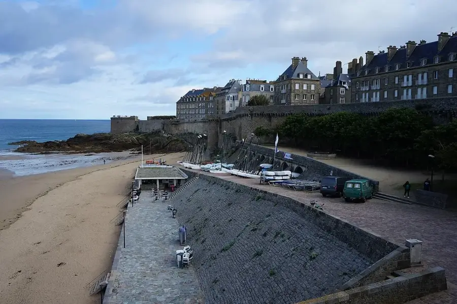
How far is the sea?
The beaches of Concarneau are only about 15 km away.
Rosporden: where is it located?
Rosporden is located in Bretagne, France.
Rosporden: what is there to see?
Highlights include Rosporden Lake, Notre-Dame d'Indulgence Church, Voie Verte (Greenway).
Rosporden: when is the best time to visit?
The most pleasant time to visit is Jul, Sep.
Rosporden: why is it worth visiting?
Rosporden is a quintessential Breton town located in the Finistère department, famously known as the 'Cité des Étangs' due to the large ponds that define its urban landscape.