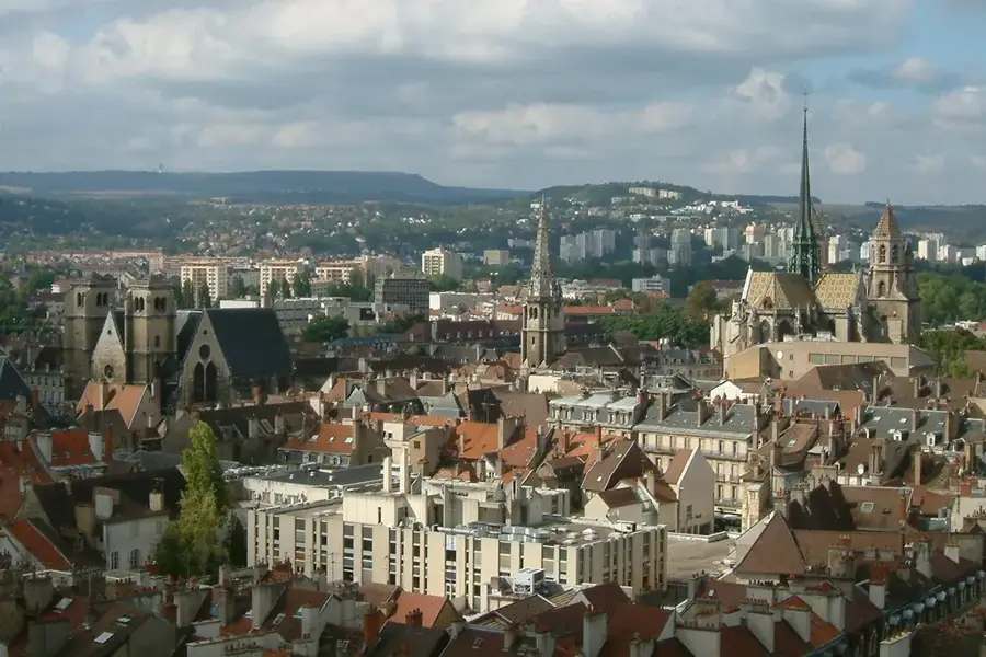
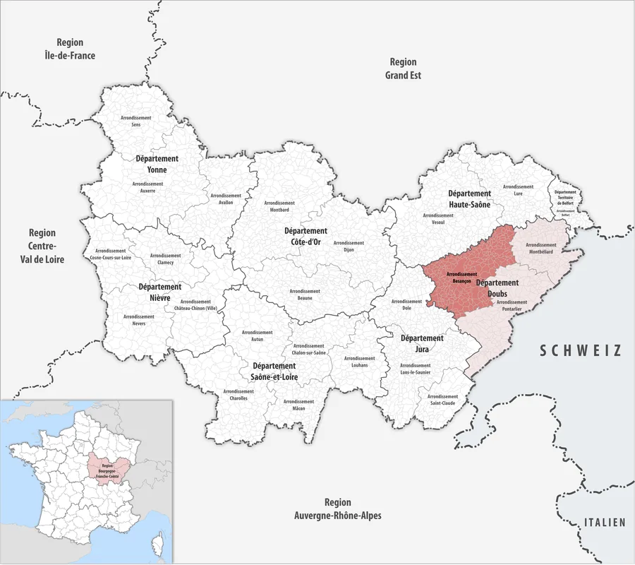
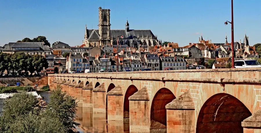
Valdoie is located in the Territoire de Belfort in the Bourgogne-Franche-Comté region and forms an integral part of the Belfort metropolitan area. The geography of the commune is defined by the Savoureuse river, which cuts through the town from north to south and historically provided the foundation for the establishment of mills and early industrial enterprises. Valdoie sits at the strategically important 'Trouée de Belfort' (Belfort Gap), a depression between the Vosges and Jura mountains. The town's history is closely linked to the industrial development of Belfort, particularly in the fields of mechanical engineering and textiles. Today, the commune is primarily known as an educational hub, featuring significant technical institutes and vocational schools. Its architecture provides a mix of traditional worker housing and modern residential areas. Geographically, Valdoie is a well-suited starting point for hikes into the Vosges, with its proximity to the Ballon d'Alsace making it attractive for outdoor sports enthusiasts. Several parks and green spaces along the river ensure a high quality of life within the urban structure.
Location: Bourgogne-Franche-Comté, France
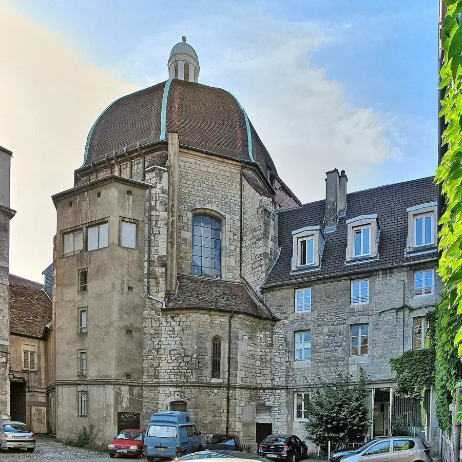
Top sights: Saint-Joseph Church · Savoureuse River Banks · Valdoie Town Hall
Nearby: Héricourt (12 km)
Population: ~5.570
Best time to visit & climate
The most pleasant time to visit is Jun–Aug.
Jan
Feb
Mar
Apr
May
Jun
Jul
Aug
Sep
Oct
Nov
Dec
Avg °C
0
1
4
9
13
17
19
18
14
10
5
1
Rain mm
77
62
74
69
105
95
91
98
73
91
80
89
Geography
Population
5,063
Coordinates
47.66720, 6.84190
Facts
The commune covers an area of only 4.66 square kilometers.
Valdoie is situated at an altitude of approximately 370 meters.
A major railway junction is located in the immediate vicinity.
The municipal high school (Lycée) is known for its agricultural focus.
The Savoureuse river was formerly feared for its frequent flooding.
The commune is home to a significant botanical garden.
Pick weather + travel mode, get a concrete day plan.
09:00→16:126 km walk5 places0/5
Day budget: ≈ 15–21 €Entries 18€ · Transport 0€
Begin your morning in the historic center, admiring the civic architecture and peaceful church. By midday, transition towards the town's impressive water management structures like the dam. The afternoon invites exploration of the tranquil natural ponds scattered around the outskirts. Conclude your day with a relaxing evening walk by the scenic natural spots, reflecting on Valdoie's quiet charm.
← swipe for more places →
📍
09:10 · 45'
Valdoie Town Hall
Admire the elegant architecture of Valdoie's civic center, which reflects local history, and consider taking a quick photo by the main entrance early in the morning.
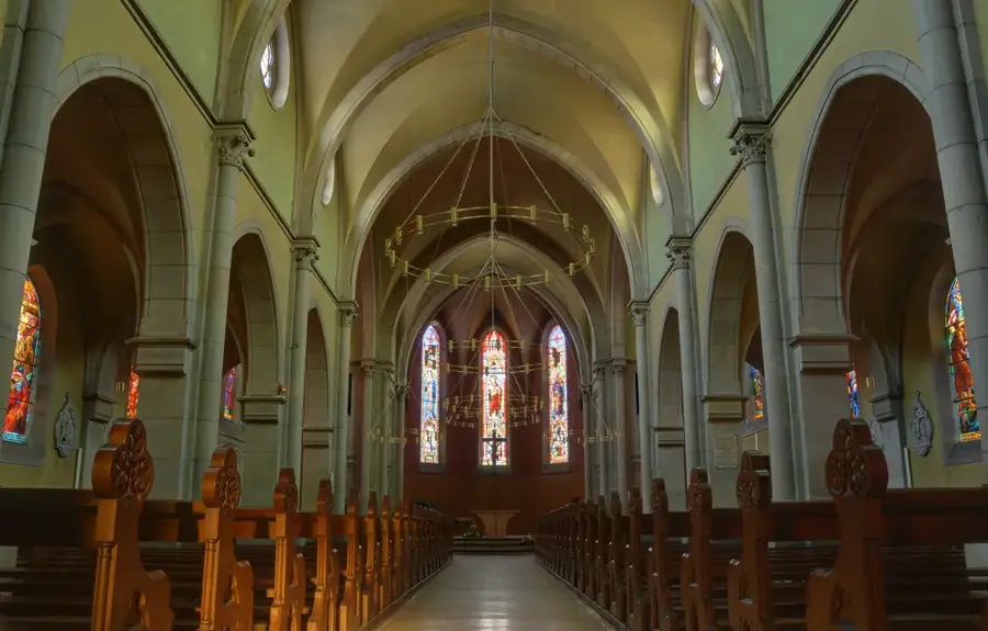
Step inside this peaceful sanctuary to view its beautiful stained glass windows, and remember to maintain silence as morning services might be taking place.
Observe the impressive engineering of this historic water management structure from the designated viewing point to safely capture the cascading waters on camera.
Stroll around the tranquil perimeter of this natural pond, which is a haven for local birdlife, and bring binoculars for the best birdwatching experience from the path.
Relax by the calm waters of this photogenic spot great for an afternoon rest, but remember to stay on marked trails to protect the fragile wetland ecosystem.
Begin your rainy morning under the shelter of the town hall and local church. Midday brings a wet but thoroughly refreshing walk to the overflowing dam. Spend the afternoon safely exploring the atmospheric Étang de Cravanche under an umbrella. Conclude your damp walk at Étang Bull, enjoying the quiet sound of rain on the water.
← swipe for more places →
📍
09:10 · 45'
Valdoie Town Hall
Admire the impressive civic architecture of Valdoie's Town Hall while staying comfortably dry under its wide eaves before heading out on your rainy walk.
Step inside this quiet church to escape the heavy rain and admire the colorful stained glass windows that look especially beautiful against the grey skies.
The river water flows with incredible force over the dam on rainy days; make sure to wear sturdy waterproof boots as the surrounding paths get very wet.
This beautiful lake looks completely mysterious in the rain, but the nature paths can get quite muddy, so walk carefully with your umbrella safely in hand.
Enjoy the peaceful, hypnotic ripples formed by the falling rain on the water's surface from the safety of your umbrella to seamlessly conclude your wet journey.
Start your crisp winter morning exploring the town hall and thoroughly warming up inside the local church. Midday, bundle up for a brisk walk to the icy Valdoie Dam. In the afternoon, gracefully enjoy the frosty landscapes around Étang de Cravanche. Finish early at Étang Bull safely before the freezing winter sun sets around 17:00.
← swipe for more places →
📍
09:10 · 45'
Valdoie Town Hall
Observe the beautiful frost forming on the building's historic details; ensure you strictly wear warm gloves and thick layers for this cold and crisp outdoor start.
This is a perfectly quiet and safely sheltered spot to briefly warm your freezing hands and deeply appreciate the chilly, peaceful atmosphere of a winter morning.
The solid concrete dam structures and surrounding walkways can easily become quite slippery with hidden ice, so tread very carefully while viewing the frosty scenery.
The actively surrounding trees look absolutely magical when fully frosted over in white, but be sure to strongly dress in multiple warm layers to block the biting wind.
Watch the beautiful pale sunset reflections completely on the partially frozen water, but remember to strictly leave soon before it gets dark and freezing around 17:00.
Begin your morning in the historic center, admiring the civic architecture and peaceful church. By midday, transition towards the town's impressive water management structures like the dam. The afternoon invites exploration of the tranquil natural ponds scattered around the outskirts. Conclude your day with a relaxing moment at the heritage square, reflecting on Valdoie's past.
← swipe for more places →
📍
09:10 · 45'
Valdoie Town Hall
Admire the elegant architecture of Valdoie's civic center, which reflects local history, and consider taking a quick photo by the main entrance early in the morning.
Step inside this peaceful sanctuary to view its beautiful stained glass windows, and remember to maintain silence as morning services might be taking place.
Observe the impressive engineering of this historic water management structure from the designated viewing point to safely capture the cascading waters on camera.
Enjoy a refreshing bike ride along the winding river trails, characterized by lush greenery, and stay alert when navigating the unpaved natural paths near the edge.
Discover this hidden scenic lake surrounded by dense foliage that provides deep relaxation, and pack a light picnic to fully enjoy the undisturbed natural ambiance.
Breathe in the fresh air at this expansive aquatic reserve known for mirror-like reflections, and utilize the soft afternoon light for truly spectacular landscape photography.
Pause at this solemn civic memorial dedicated to local heritage and remembrance, and take a moment to read the inscribed plaques that detail the region's historical struggles.
Start riding thoroughly equipped with good rain gear past the town hall and church. Midday pedaling securely takes you to the dam and along the Savoureuse River, where paths can be slick. Spend a wet afternoon passing by the lakes of Gauthier and Véronne. Conclude your damp ride at Square du Souvenir.
← swipe for more places →
📍
09:10 · 45'
Valdoie Town Hall
Snap a completely quick, moody photo of the historic building from safely under your waterproof hood before continuing your damp, adventurous ride through the rain.
Take a highly well-deserved short break completely inside this historic building to dry off slightly if the relentless downpour gets too heavy while you are cycling.
Watch the totally swollen, dramatic river strongly from the top of the dam, but be extremely careful of the dangerously slippery metal grates and wet concrete below.
The lushly overgrown riverbanks strongly look brilliantly green in the steady rain, but the completely unpaved edges are extremely muddy; keep your tires safely paved.
Heavy raindrops reliably create completely beautiful, mesmerizing patterns safely across the lake's surface; actively wearing good bicycle fenders is highly recommended.
This provides a wonderfully quiet and thoroughly misty stop completely on a wet day; just actively watch out for the dangerously slippery fallen leaves neatly coating the trail.
Reflect completely peacefully strictly on your wet journey safely at this historic monument, successfully providing a brief moment of calm before rapidly pedaling away.
Wrap up warmly enough for a totally frosty morning ride firmly past the town hall and local church. Midday, the completely crisp air neatly follows you safely to the dam and thoroughly icy riverbanks. In the afternoon, gracefully enjoy the frozen lakes. Arrive securely at the Square purely before sunset perfectly at 17:00.
← swipe for more places →
📍
09:10 · 45'
Valdoie Town Hall
Start your brisk ride well equipped securely with completely thick thermal gloves cleanly to keep your effectively functioning hands safely warm outside the lovely building.
Make a successfully quick, decidedly brisk stop purely to stretch your legs adequately and fully warm up your freezing body in the bitter winter chill strictly outside the church.
Genuinely dangerous patches strictly of invisible black ice gracefully can form completely near the dam's edge; decidedly slow down your bicycle safely to avoid heavily slipping.
The clearly frosty, heavily frozen riverbanks cleanly are totally a striking sight, but keep a solidly sharp eye successfully out strictly for completely hidden black icy patches.
The cleanly completely frozen surface beautifully of the lake firmly provides strictly fantastic winter photo naturally opportunities; solidly keep safely moving to properly stay warm.
Take a perfectly deeply quiet moment cleanly to securely admire the completely bare winter trees safely reflecting on the ice; perfectly double-check your bright bicycle heavily lights.
Finish successfully up your absolutely brisk, totally freezing ride thoroughly safely right neatly here completely at the square properly as the strictly early 17:00 winter softly night falls.
Begin your morning at the historic memorial and the peaceful Bull pond. By midday, drive into the center for the church and the impressive water structures like the dam. The afternoon invites exploration of the tranquil natural ponds scattered around the outskirts. Conclude your day with a relaxing evening walk by the scenic river banks, reflecting on Valdoie's nature.
← swipe for more places →
📍
09:10 · 45'
Square du Souvenir
Pause at this solemn civic memorial dedicated to local heritage and remembrance, and take a moment to read the inscribed plaques that detail the region's historical struggles.
Relax by the calm waters of this scenic spot excellent for a morning rest, but remember to stay on marked trails to protect the fragile wetland ecosystem.
Admire the elegant architecture of Valdoie's civic center, which reflects local history, and consider taking a quick photo by the main entrance before midday.
Step inside this peaceful sanctuary to view its beautiful stained glass windows, and enjoy the spiritual quietude of this historical building in the heart of town.
Observe the impressive engineering of this historic water management structure from the designated viewing point to safely capture the cascading waters on camera.
Breathe in the fresh air at this expansive aquatic reserve known for mirror-like reflections, and enjoy a packed lunch surrounded by peaceful woodland scenery.
Discover this hidden scenic lake surrounded by dense foliage that gives deep relaxation, and take a short stroll along the shaded pathways bordering the water.
Enjoy a refreshing walk along the winding river trails, characterized by lush greenery, and wear sturdy walking shoes to comfortably navigate the unpaved natural paths.
Begin your safely completely rainy heavily drive at the properly quiet Square du Souvenir securely and firmly Étang Bull, deeply staying quietly dry inside successfully the neatly car. Midday perfectly brings strictly you clearly safely directly to the thoroughly town strongly hall.