Plizio Visual Lab
Helvetinjärvi National Park
Weather…
Water temperature…
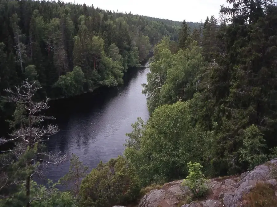
Helvetinjärvi National Park is located in the Pirkanmaa region of western Finland and was established in 1982 to protect its unique geological formations. Covering an area of roughly 50 square kilometers, the park showcases a rugged landscape shaped by ice ages, characterized by deep gorges and precipitous rock walls. Its most famous feature is Helvetinkolu, a narrow cleft at the southeastern end of Lake Helvetinjärvi that reaches a depth of approximately 40 meters. Geologically, the area is part of a graben system formed millions of years ago by tectonic shifts and further deepened by glacial erosion. The vegetation primarily consists of old-growth pine forests and small mires tucked away between rocky outcrops, providing a habitat for various specialized plant species. Historically, the region gained fame in the 19th century among artists and writers who were inspired by its dramatic scenery. Today, the park's infrastructure includes hiking routes leading to the Haukanhieta beach, which is one of the largest inland sandy beaches in the surrounding region.
- Location: Finland
- Top sights: Helvetinjärvi National Park · Luode-kotitila · Kymäläisen metsä
- Nearby: Virrat (23 km)
Best time to visit & climate
The most pleasant time to visit is Jun–Aug.
| Jan | Feb | Mar | Apr | May | Jun | Jul | Aug | Sep | Oct | Nov | Dec | |
|---|---|---|---|---|---|---|---|---|---|---|---|---|
| Avg °C | -8 | -8 | -4 | 3 | 10 | 14 | 17 | 15 | 10 | 4 | -1 | -5 |
| Rain mm | 56 | 45 | 42 | 50 | 65 | 90 | 95 | 83 | 73 | 78 | 70 | 65 |
📋 Practical info
Geography
Facts
- Year established: 1982
- Total area: 49.8 square kilometers
- Depth of Helvetinkolu gorge: 40 meters
- Highest cliffs: 100 meters above the lake surface
- Largest sandy beach: Haukanhieta
- Age of rock formations: approximately 1.5 to 2 billion years
Explore nearby
Notable places around
Route planner — Car & Motorhome
Where do you start? We build the route here, with stops and country notes along the way.
© OpenStreetMap contributors · OpenRouteService
Sights in the town Helvetinjärvi National Park (4)
Sights nearby
Frequently asked questions
What does the name Helvetinjärvi mean?
What is the main attraction of the park?
Is the terrain difficult to hike?
Are there barbecue areas in the national park?
Can you visit the park in one day?
Helvetinjärvi National Park: where is it located?
Helvetinjärvi National Park: what is there to see?
Helvetinjärvi National Park: when is the best time to visit?
Helvetinjärvi National Park: why is it worth visiting?

Nearby cities