Plizio Visual Lab
Karakoram Range
Weather…
Water temperature…
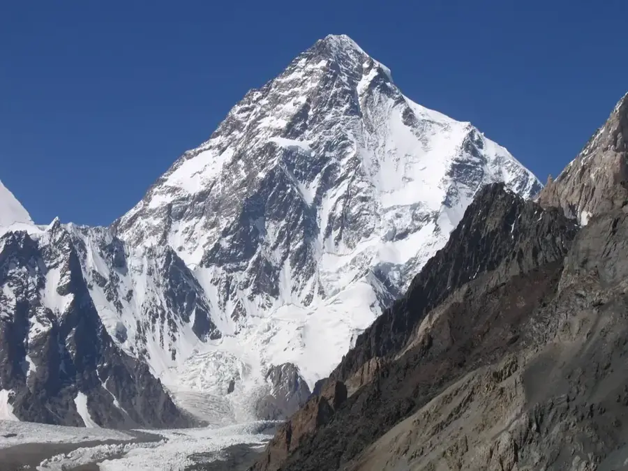
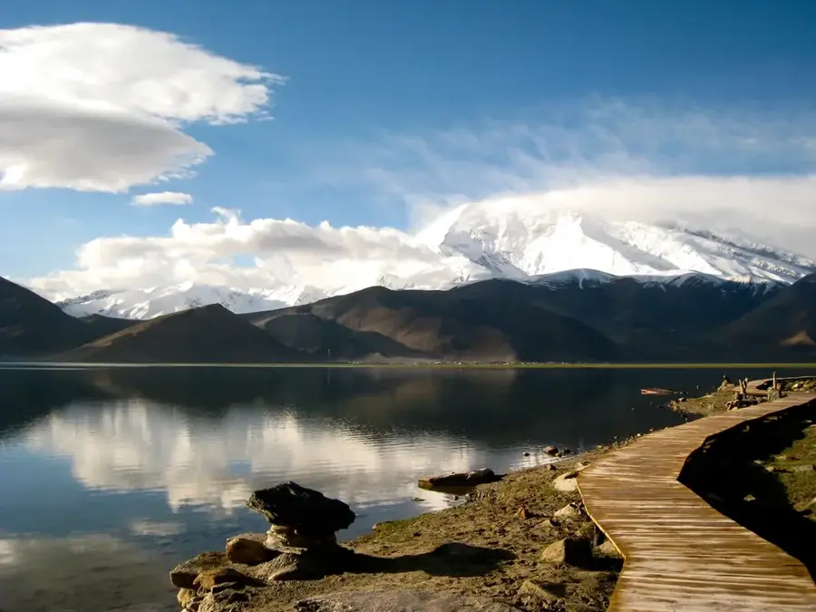
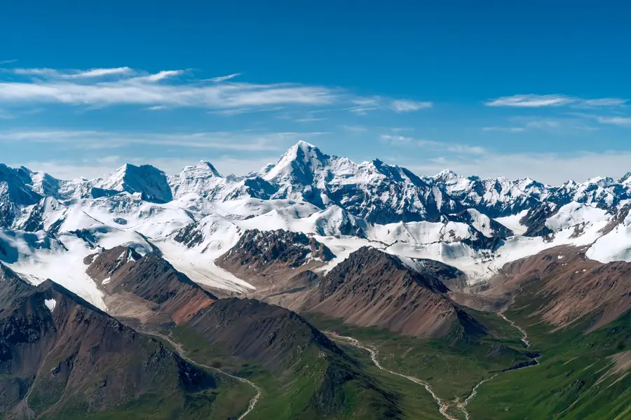
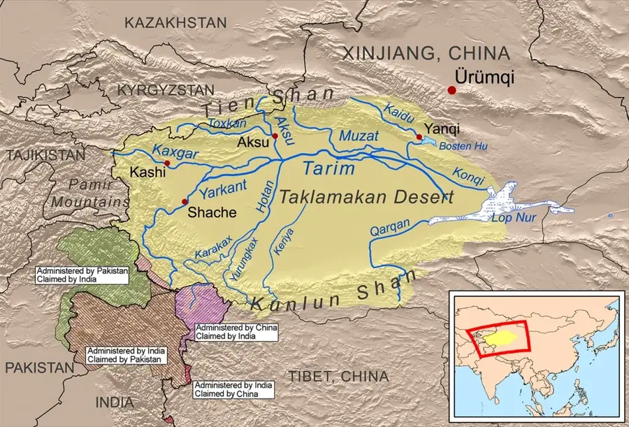
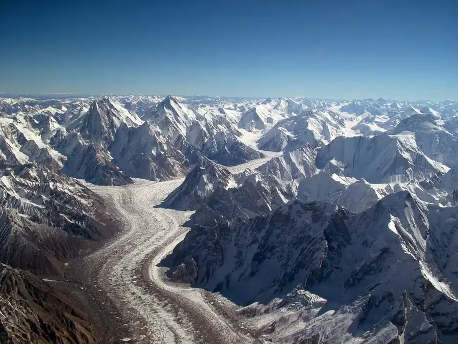
The Karakoram Range is a colossal mountain system in Central Asia, spanning the borders of Pakistan, India, and China. It features the highest concentration of peaks over 8,000 meters outside the Himalayas, including K2, the world's second-highest mountain at 8,611 meters. Geographically situated northwest of the Himalayas, the Karakoram is geologically distinct, characterized by sharper ridges and steeper slopes. The range is world-renowned for its extensive glaciation; it contains some of the longest glaciers outside the polar regions, such as the Baltoro and Siachen glaciers. The climate is notoriously harsh, featuring extreme cold and gale-force winds that make the high-altitude landscape one of the most inhospitable on Earth. Historically, the Karakoram Pass was a vital link on ancient trade routes connecting the Indian subcontinent with the Tarim Basin. In modern times, the Karakoram Highway serves as an extraordinary engineering feat, being the highest paved international road in the world, connecting China and Pakistan. The range is a premier destination for high-altitude mountaineers, though access to certain areas is often restricted by ongoing geopolitical border disputes.
- Location: China
- Top sights: Praqpa Kangri · Marble Peak · Broad Peak Central
Best time to visit & climate
The most pleasant time to visit is Jun–Aug.
| Jan | Feb | Mar | Apr | May | Jun | Jul | Aug | Sep | Oct | Nov | Dec | |
|---|---|---|---|---|---|---|---|---|---|---|---|---|
| Avg °C | -24 | -21 | -18 | -12 | -8 | -4 | 0 | 0 | -5 | -11 | -18 | -22 |
| Rain mm | 19 | 22 | 19 | 22 | 24 | 20 | 25 | 25 | 16 | 7 | 13 | 9 |
📋 Practical info
Geography
Facts
- K2, at 8,611 meters, is the highest point in the Karakoram Range.
- There are four peaks above 8,000 meters located within the range.
- The Baltoro Glacier is one of the longest glaciers outside the poles at 63 km.
- The Karakoram Highway reaches its highest point at Khunjerab Pass (4,693 m).
- Glaciers cover approximately 28% of the total area of the range.
- The range is roughly 500 kilometers in length from east to west.
Explore nearby
Notable places around
Route planner — Car & Motorhome
Where do you start? We build the route here, with stops and country notes along the way.
© OpenStreetMap contributors · OpenRouteService
Sights in the town Karakoram Range (3)
Sights nearby
Frequently asked questions
What is the Karakoram?
Which is the highest mountain in the Karakoram?
What is the Karakoram Highway?
Are there glaciers there?
What animals can be found in the Karakoram?
Karakoram Range: where is it located?
Karakoram Range: what is there to see?
Karakoram Range: when is the best time to visit?
Karakoram Range: why is it worth visiting?

Nearby cities
History & landmarks
Nature
More places