Plizio Visual Lab
Angamma Escarpment

Weather…
Water temperature…
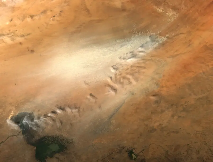
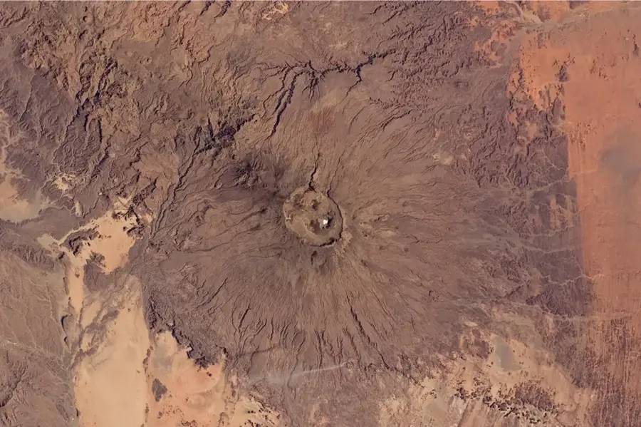
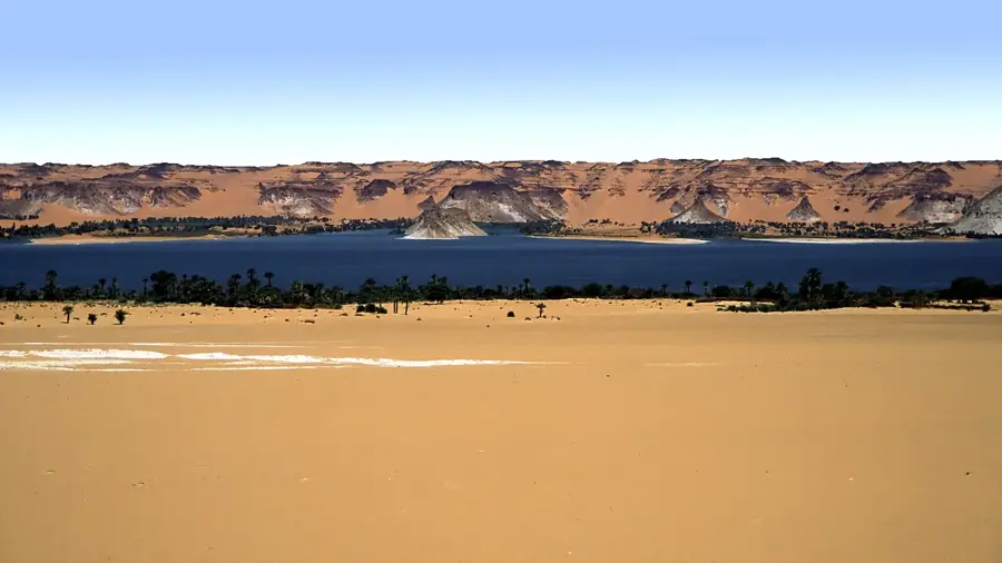
The Angamma Escarpment is a striking geological feature in northern Chad, defining the northeastern boundary of the Bodélé Depression. This sandstone formation serves as a natural transition between the elevated plateaus leading to the Tibesti Mountains and the low-lying desert basin. The cliffs rise several hundred meters above the surrounding plains and exhibit dramatic signs of wind-driven erosion. Historically, the escarpment marks the ancient shoreline of prehistoric Lake Mega-Chad, which once filled a significant portion of the Chad Basin. Erosion over millennia has carved unique rock shapes and deep canyons into the sandstone, creating a rugged and largely inaccessible landscape. Fossilized remains of aquatic life, including fish vertebrae, are frequently found at the base of the cliffs, testifying to the area's wet environmental history. The Angamma Escarpment also plays a key role in regional climatology by funneling the northeasterly Harmattan winds. This wind-tunnel effect increases the wind velocity, contributing to the intense dust storm activity characteristic of the Bodélé region.
Best time to visit & climate
The most pleasant time to visit is Feb, Nov, Dec.
| Jan | Feb | Mar | Apr | May | Jun | Jul | Aug | Sep | Oct | Nov | Dec | |
|---|---|---|---|---|---|---|---|---|---|---|---|---|
| Avg °C | 18 | 22 | 26 | 31 | 34 | 35 | 35 | 34 | 33 | 30 | 24 | 19 |
| Rain mm | 0 | 0 | 0 | 0 | 0 | 1 | 11 | 29 | 2 | 0 | 0 | 0 |
📋 Practical info
Geography
Facts
- The escarpment marks the northeastern edge of the Bodélé Depression.
- It is primarily composed of sandstone shaped by intense wind erosion.
- The cliffs reach heights of over 400 meters above the basin floor.
- The formation corresponds to the shoreline of the ancient Mega-Chad lake.
- Aquatic fossils found here prove the region was once underwater.
- The cliffs help channel and accelerate the regional Harmattan winds.
Route planner — Car & Motorhome
Where do you start? We build the route here, with stops and country notes along the way.
© OpenStreetMap contributors · OpenRouteService
Sights nearby
Frequently asked questions
What is the Angamma Escarpment?
Is the place accessible for tourists?
What logistical requirements are there?
What dangers are there in the escarpment?
Is there civilization in the area?
Angamma Escarpment: where is it located?
Angamma Escarpment: when is the best time to visit?
Angamma Escarpment: why is it worth visiting?

Nearby cities


History & landmarks
More places