Plizio Visual Lab
Licancabur
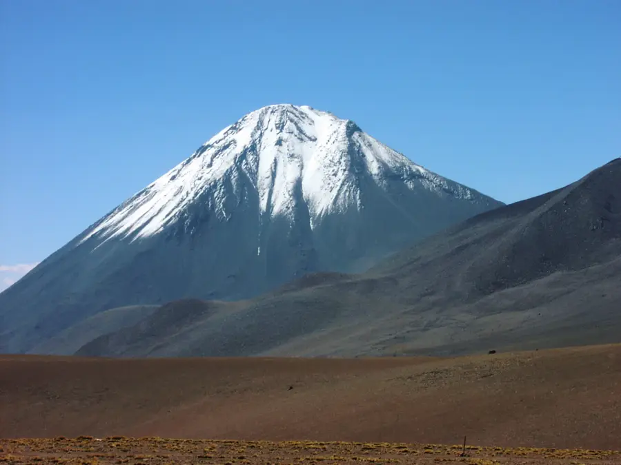
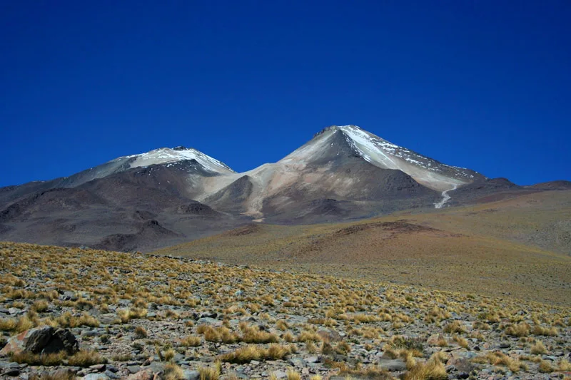
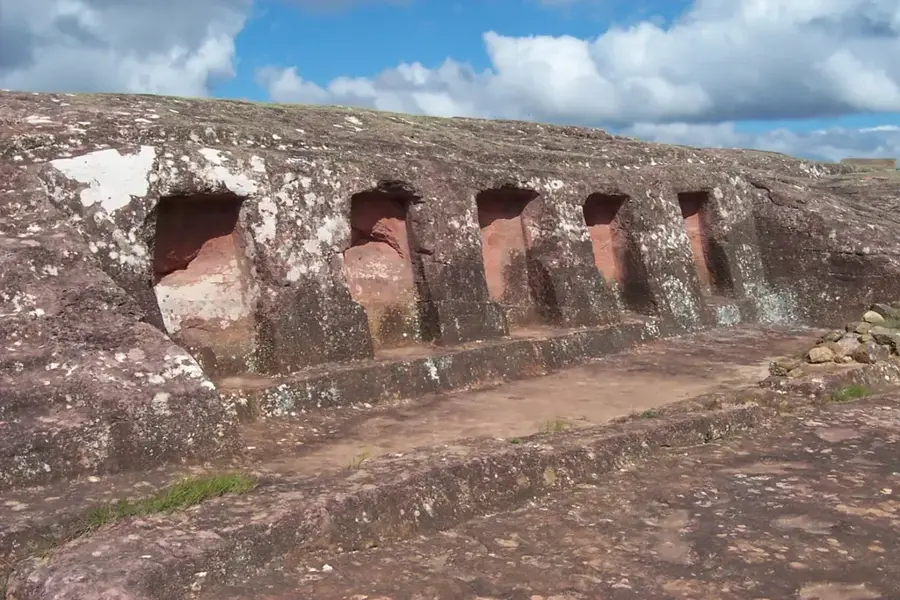
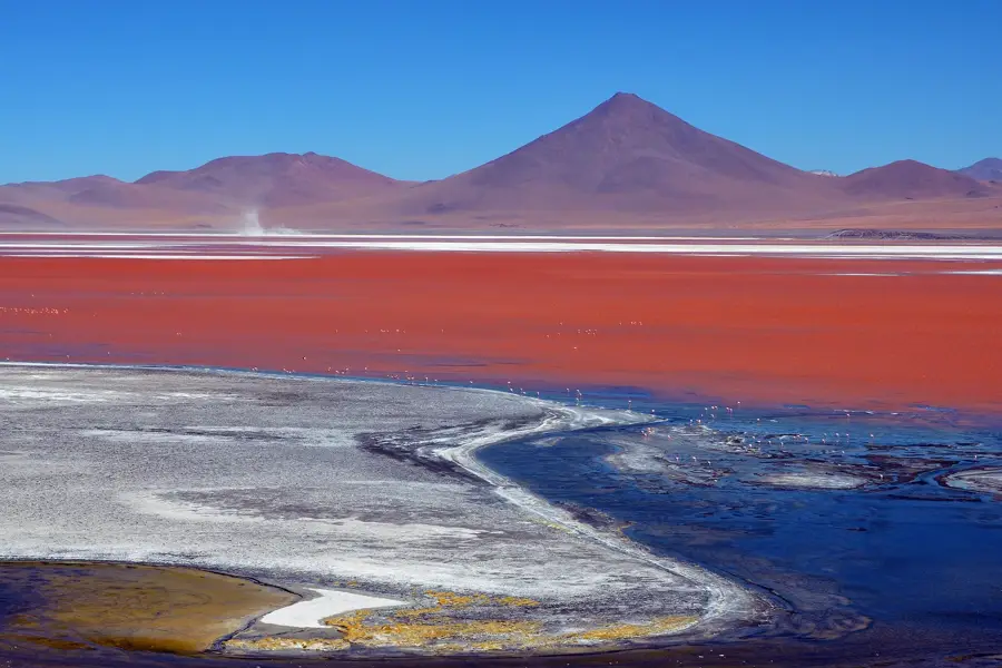
Licancabur is a prominent, nearly symmetrical stratovolcano situated on the border between Bolivia and Chile, rising to an elevation of 5,920 meters. It towers over the emerald-colored Laguna Verde within Bolivia's Eduardo Avaroa Andean Fauna National Reserve. The volcano is world-renowned for hosting one of the highest lakes on Earth inside its summit crater, which remains liquid despite extreme UV radiation and temperatures that drop to -30°C at night. This unique environment has made it a key site for NASA researchers studying extremophiles and Mars-like conditions. Archaeological evidence, including stone structures and firewood, shows that the Inca people climbed the summit for ceremonial purposes centuries ago. Today, it is a popular trekking destination, offering hikers a non-technical but physically demanding ascent characterized by loose scree, high winds, and the effects of high altitude.
- Location: Bolivia
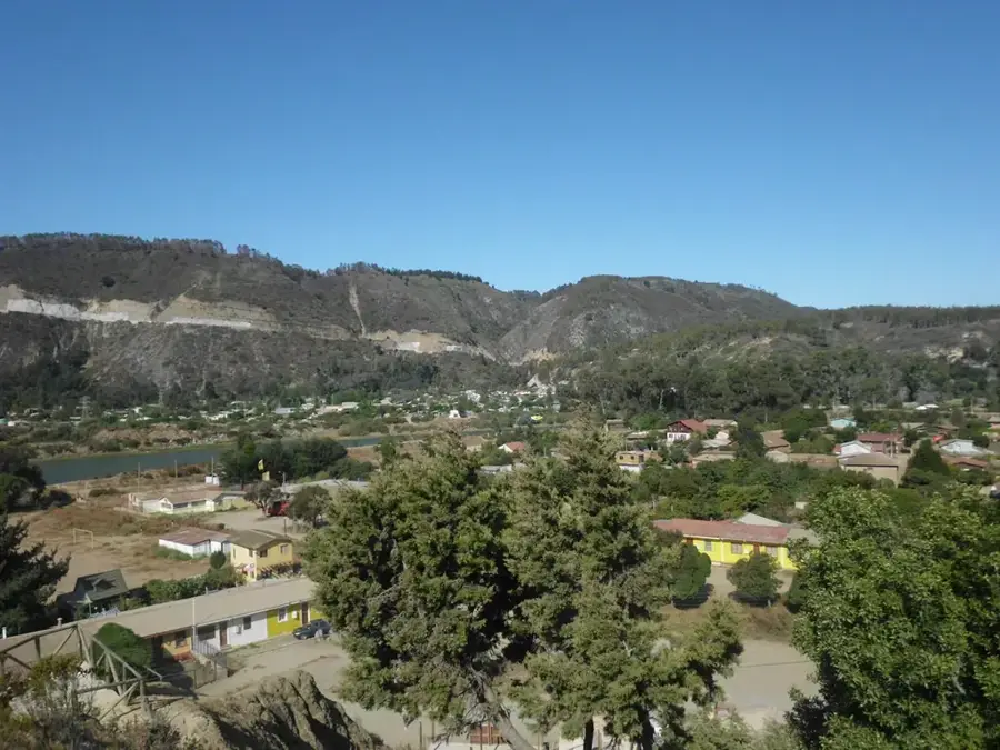
- Top sights: Access point to the Licancabur Volcano's trail · Cráter del Volcan Licancabur · Ruinas Incas Tata Maico Licanco
Best time to visit & climate
The most pleasant time to visit is Jan, Feb, Dec.
| Jan | Feb | Mar | Apr | May | Jun | Jul | Aug | Sep | Oct | Nov | Dec | |
|---|---|---|---|---|---|---|---|---|---|---|---|---|
| Avg °C | 17 | 17 | 16 | 14 | 11 | 9 | 9 | 10 | 12 | 14 | 16 | 17 |
| Rain mm | 7 | 8 | 4 | 1 | 2 | 0 | 1 | 0 | 0 | 1 | 1 | 4 |
📋 Practical info
Geography
Facts
- The summit reaches an elevation of 5,920 meters (19,423 feet).
- The crater lake is approximately 90 meters long and 70 meters wide.
- Inca ruins found on the summit date back to the late 15th century.
- The volcano is considered dormant, with no recorded historical eruptions.
- NASA has conducted astrobiology experiments at the summit lake.
- It is located at the triple point where Bolivia, Chile, and Argentina meet nearby.
Explore nearby
Notable places around
Route planner — Car & Motorhome
Where do you start? We build the route here, with stops and country notes along the way.
© OpenStreetMap contributors · OpenRouteService
Sights in the town Licancabur (5)
Sights nearby
Frequently asked questions
On which border is the Licancabur volcano located?
What can be found in the Licancabur crater?
Can the volcano be climbed from the Bolivian side?
What height does Licancabur reach?
Why is the summit archaeologically interesting?
Licancabur: where is it located?
Licancabur: what is there to see?
Licancabur: when is the best time to visit?
Licancabur: why is it worth visiting?

History & landmarks

Nature
More places