Plizio Visual Lab
Minsk Upland
Weather…
Water temperature…
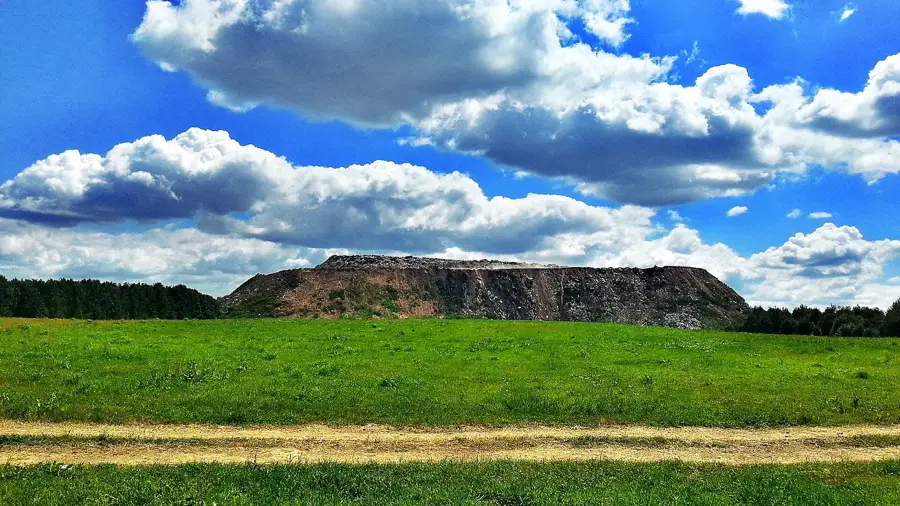
The Minsk Upland, situated in the central part of Belarus, constitutes the core and most massive section of the Belarusian Ridge. Stretching for over 150 kilometers in length and up to 60 kilometers in width, this rugged moraine landscape hosts the country's highest peaks, including Dzyarzhynskaya Hara (345 meters) and Lysaya Hara (342 meters). The upland is characterized by a heavily undulating terrain deeply dissected by valleys and depressions; its average elevation ranges between 200 and 250 meters above sea level, featuring local relative height variations of up to 100 meters. Geologically, the region is a legacy of massive terminal moraine deposits left by the Sozh and Würm glaciations. Furthermore, the Minsk Upland acts as a vital continental drainage divide, separating the basin of the Dnieper River, which flows south to the Black Sea, from the river systems of the Neman and Western Dvina, which drain northwards into the Baltic Sea.
- Location: Belarus
- Nearby: Zhdanovichi (8 km)
Best time to visit & climate
The most pleasant time to visit is Jun–Aug.
| Jan | Feb | Mar | Apr | May | Jun | Jul | Aug | Sep | Oct | Nov | Dec | |
|---|---|---|---|---|---|---|---|---|---|---|---|---|
| Avg °C | -8 | -6 | -1 | 6 | 13 | 16 | 19 | 18 | 12 | 6 | 1 | -5 |
| Rain mm | 53 | 43 | 45 | 48 | 85 | 80 | 103 | 83 | 50 | 66 | 54 | 51 |
📋 Practical info
Geography
Explore nearby
Notable places around
Route planner — Car & Motorhome
Where do you start? We build the route here, with stops and country notes along the way.
© OpenStreetMap contributors · OpenRouteService
Sights in the town Minsk Upland (1)
Sights nearby
Frequently asked questions
What is the highest point of the upland?
What is the area used for?
Are there ski resorts there?
What is the terrain like?
Is the area developed for tourism?
Minsk Upland: where is it located?
Minsk Upland: when is the best time to visit?
Minsk Upland: why is it worth visiting?

Nearby cities