Plizio Visual Lab
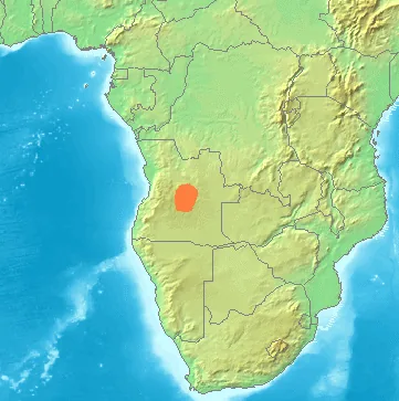
Lunda Plateau
Weather…
Water temperature…
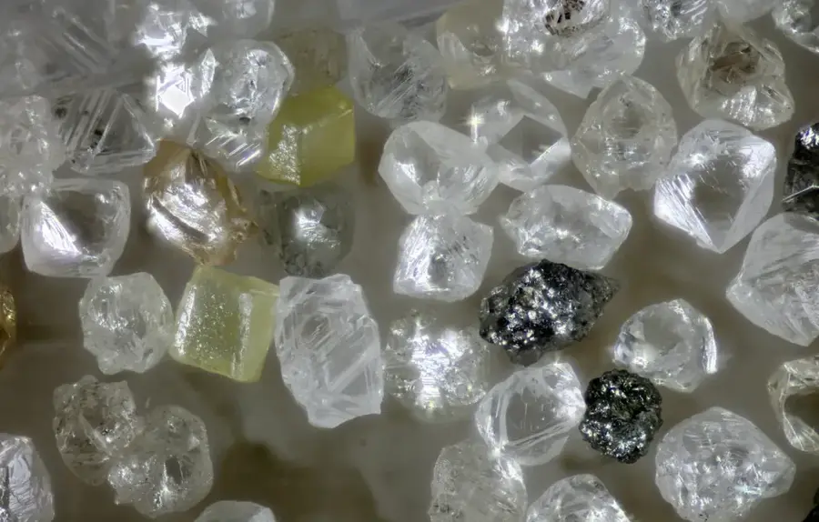
The Lunda Plateau is an extensive highland region in northeastern Angola, known for its geological stability and wealth of mineral resources. Situated at an average altitude of approximately 1000 to 1200 meters, it forms a vital hydrographic hub in Africa. The plateau functions as a watershed between the Congo Basin to the north and the Zambezi Basin to the south. Geologically, it is characterized by a crystalline basement overlain by thick layers of sandstones and diamond-bearing conglomerates. Climatically, a tropical savanna climate prevails, supporting dense Miombo woodland vegetation. The region has a long history, intertwined with the powerful Lunda Empire in the 17th and 18th centuries before falling under Portuguese rule. Today, the Lunda Plateau is the heart of the Angolan diamond industry, with cities like Saurimo and Dundo serving as major logistics and mining centers. The topography is predominantly flat to gently rolling, interrupted by deep river valleys that drain the plateau.
Best time to visit & climate
The most pleasant time to visit is May–Jul.
| Jan | Feb | Mar | Apr | May | Jun | Jul | Aug | Sep | Oct | Nov | Dec | |
|---|---|---|---|---|---|---|---|---|---|---|---|---|
| Avg °C | 22 | 23 | 23 | 23 | 23 | 22 | 22 | 25 | 26 | 24 | 23 | 22 |
| Rain mm | 107 | 116 | 149 | 75 | 13 | 2 | 0 | 14 | 60 | 113 | 158 | 139 |
📋 Practical info
Geography
Facts
- The total area of the plateau covers over 150,000 square kilometers.
- The highest point is approximately 1400 meters in the southwestern part of the plateau.
- The rivers Cuango, Kasai, and Luanginga all originate in this region.
- Diamond mining has been conducted here since the early 20th century.
- The plateau is partly composed of sandstones from the Karoo Supergroup.
- The average annual temperature ranges between 21 and 23 degrees Celsius.
Explore nearby
Notable places around
Route planner — Car & Motorhome
Where do you start? We build the route here, with stops and country notes along the way.
© OpenStreetMap contributors · OpenRouteService
Sights nearby
Frequently asked questions
How strenuous is the Lunda Highlands area?
When is the best time to go?
Do you need a local guide?
Are there services along the way?
What is the region known for?
Lunda Plateau: where is it located?
Lunda Plateau: when is the best time to visit?
Lunda Plateau: why is it worth visiting?

Nearby cities

Nature

More places