Plizio Visual Lab
Gabela
ℹ️Practical info — Gabela
▾
🌤 Weather — 5 days
📍 Nearby
Sights nearby
💡 Tips
- A sturdy vehicle is recommended, as the roads leading up to the city are often steep and uneven.
- Explore the remnants of the old colonial-era coffee plantations in the surrounding area.
- The climate here in the highlands is cooler than on the coast; bring a light jacket for the evenings.
- Portuguese is the main language, so learning basic phrases will be very helpful.
🍽 Food
Try this traditional cassava porridge in the local restaurants.
Taste fresh coffee in the local cafes or directly on the farms.
A popular snack that you will find from street vendors in the center.
🛍 Shopping · 🧘 Quiet spots
Purchase coffee beans at the markets or directly at the plantations.
Stock up on fresh produce at the city's main market.
Handy for scenic and historical walks in a quiet atmosphere.
They offer fantastic views over the Cuanza Sul landscape.
Water temperature…
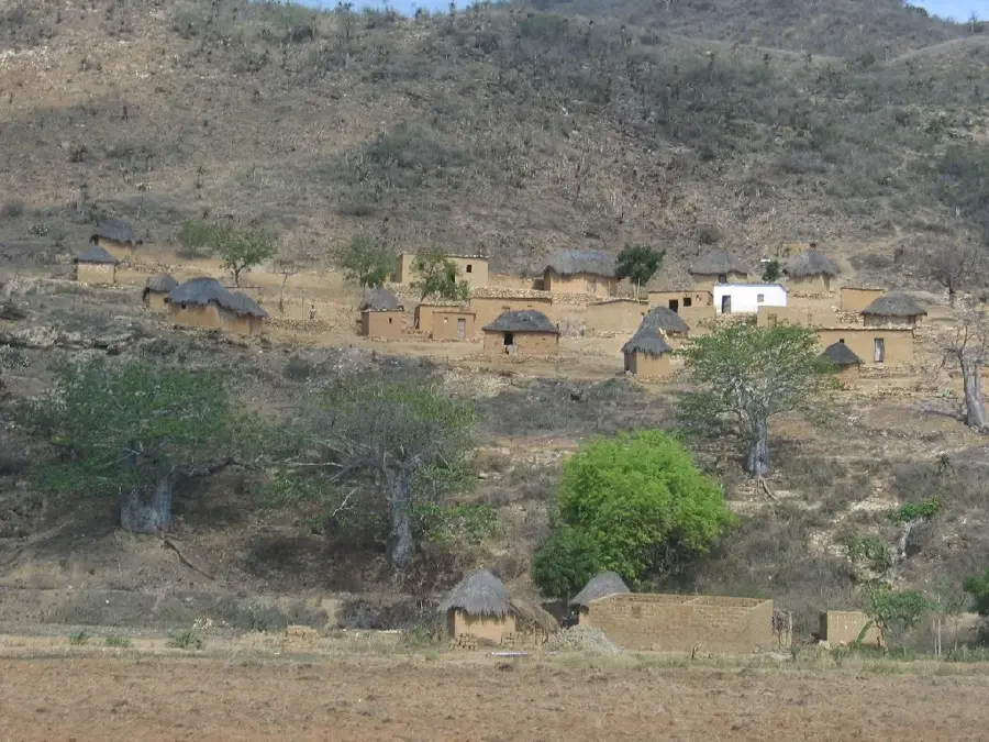
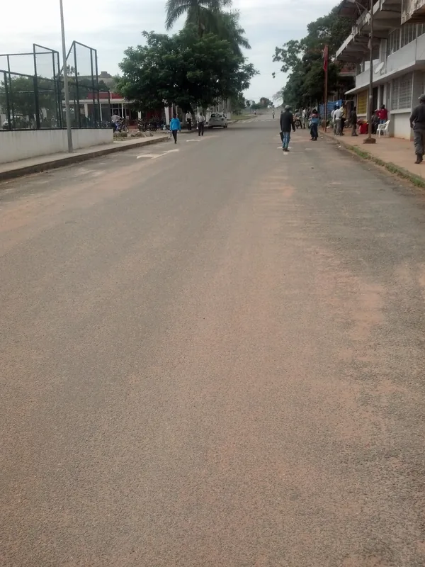
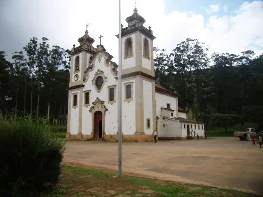
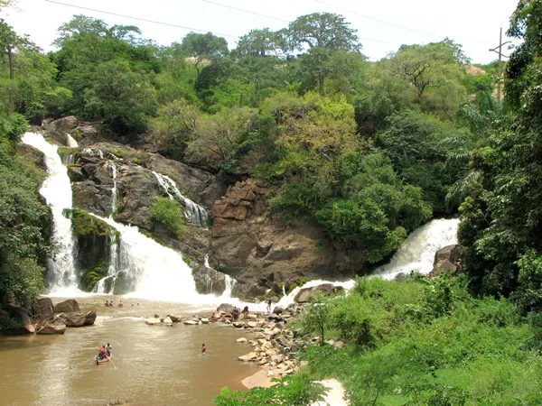
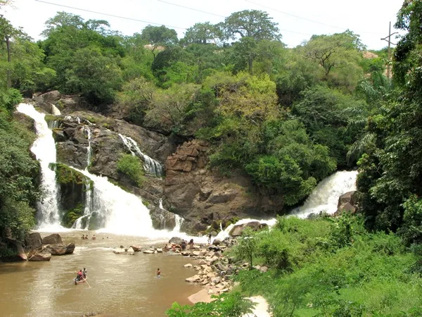
Gabela is a town in western Angola's Cuanza Sul province, situated at an elevation of approximately 920 meters above sea level. Founded in 1907, the town rapidly emerged as a center for coffee production due to the fertile soil and cool climate of the Amboim highlands. During the colonial era, Gabela was internationally renowned for its Amboim coffee, which was transported via a narrow-gauge railway directly to the port of Porto Amboim. The surrounding region is characterized by lush vegetation and waterfalls, making it an ecologically valuable area. In addition to coffee cultivation, subsistence farming now plays a major role, with maize, beans, and cassava being the primary crops. The town center's architecture still reflects Portuguese colonial influences, despite many buildings suffering damage during the civil war. Gabela remains a vital regional commercial hub serving the surrounding rural communities.
- Location: Angola
- Nearby: Binga Falls (34 km)
- Population: ~116.903 (2026)
Best time to visit & climate
The most pleasant time to visit is Jun–Aug.
| Jan | Feb | Mar | Apr | May | Jun | Jul | Aug | Sep | Oct | Nov | Dec | |
|---|---|---|---|---|---|---|---|---|---|---|---|---|
| Avg °C | 23 | 23 | 24 | 24 | 24 | 22 | 22 | 22 | 23 | 24 | 23 | 23 |
| Rain mm | 66 | 75 | 119 | 73 | 20 | 1 | 0 | 6 | 32 | 72 | 142 | 86 |
Geography
Facts
- Gabela was officially founded on September 28, 1907.
- The town is situated on a plateau 920 meters above sea level.
- The Gabela Falls on the Cuvo River are located nearby.
- Gabela was the terminus of the 123 km railway from Porto Amboim.
- The area is home to rare bird species like the Gabela Bush-shrike.
- Annual rainfall in the region often exceeds 1,000 mm.
Explore nearby
Notable places around
Route planner — Car & Motorhome
Where do you start? We build the route here, with stops and country notes along the way.
© OpenStreetMap contributors · OpenRouteService
Sights in the town Gabela (1)
Frequently asked questions
What is Gabela known for?
Can you visit the old coffee plantations?
What is the landscape around Gabela like?
How to get to Gabela?
Are there cultural attractions in Gabela?
Gabela: where is it located?
Gabela: when is the best time to visit?
Gabela: why is it worth visiting?

Nearby cities
Nature
More places