Plizio Visual Lab
Cunene
Weather…
Water temperature…
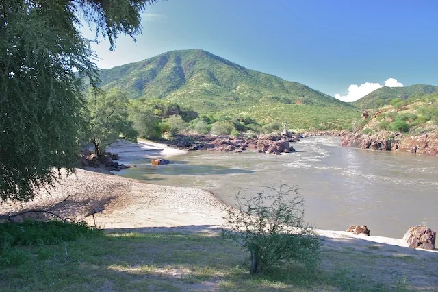
The Cunene River is one of the most significant rivers in Southern Africa, forming the natural border between Angola and Namibia on its lower course. It originates in the central highlands of Angola near the city of Huambo and covers a distance of approximately 1,050 kilometers until it reaches the Atlantic. Geographically, the river is characterized by dramatic elevation changes that produce spectacular waterfalls such as Epupa Falls and Ruacana Falls. These falls are not only tourist attractions but also sites for major hydroelectric projects that supply energy to both border nations. The Cunene flows through extremely arid regions like the Namibe Desert, where its water is vital for irrigation and serves as the only permanent water source for humans and animals. The river's mouth is an ecologically valuable area with a high concentration of marine and terrestrial life forms. Historically, the river was a strategic reference point for border demarcations and colonial administration. Today, the Cunene is a symbol of cross-border cooperation in resource management.
- Location: Angola
- Nearby: Iona National Park (60 km)
Best time to visit & climate
The most pleasant time to visit is Jun, Jul, Oct.
| Jan | Feb | Mar | Apr | May | Jun | Jul | Aug | Sep | Oct | Nov | Dec | |
|---|---|---|---|---|---|---|---|---|---|---|---|---|
| Avg °C | 23 | 24 | 25 | 25 | 24 | 21 | 21 | 20 | 19 | 21 | 23 | 22 |
| Rain mm | 21 | 30 | 43 | 15 | 2 | 0 | 0 | 0 | 1 | 2 | 4 | 9 |
📋 Practical info
Geography
Facts
- Length: 1,050 kilometers
- Border: Angola-Namibia
- Major falls: Epupa, Ruacana
- Source: Near Huambo
- Mouth: Atlantic Ocean
- Energy: Ruacana Power Station
Explore nearby
Notable places around
Route planner — Car & Motorhome
Where do you start? We build the route here, with stops and country notes along the way.
© OpenStreetMap contributors · OpenRouteService
Sights nearby
Frequently asked questions
Is the Cunene suitable for travel?
When should you visit the Cunene?
Do you need a 4x4 along the Cunene?
Is the river good for photos?
What is the Cunene known for?
Cunene: where is it located?
Cunene: when is the best time to visit?
Cunene: why is it worth visiting?

Nearby cities
History & landmarks
Nature
More places