Plizio Visual Lab
Taguanes Battle Monument
Weather…
Water temperature…
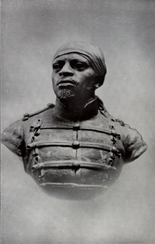
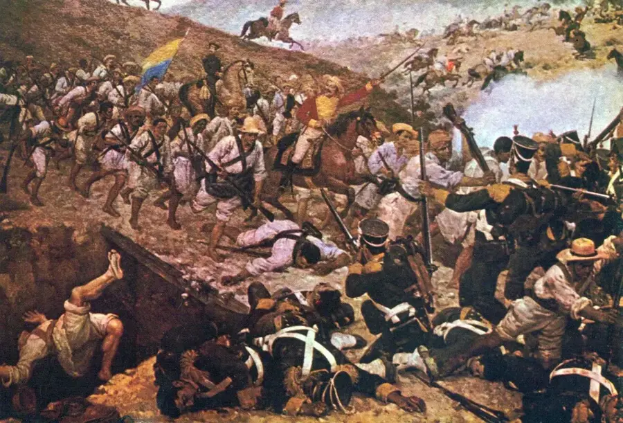
The Taguanes Battle Monument is located in Cojedes state and commemorates a decisive military success during the Admirable Campaign in 1813. On July 31 of that year, independence forces led by Simon Bolivar defeated the Spanish royalists under the command of Colonel Julián Izquierdo. This victory opened the path for the liberation of Caracas and marked the end of a six-month campaign. The monument consists of a tall obelisk and commemorative plaques describing the strategic maneuvers and the bravery of the soldiers involved. The battle is historically significant because Bolivar implemented modern cavalry tactics here, where infantrymen rode behind cavalrymen on the same horses to advance more quickly. Every year, ceremonies are held at the site to honor the legacy of the Liberator and the spirit of Venezuelan independence.
- Location: Venezuela
- Top sights: Antigua Iglesia Nuestra Señora del Socorro · Cerro Caja de Agua · Cerro Morrocoy
Best time to visit & climate
The most pleasant time to visit is Jan, Feb, Dec.
| Jan | Feb | Mar | Apr | May | Jun | Jul | Aug | Sep | Oct | Nov | Dec | |
|---|---|---|---|---|---|---|---|---|---|---|---|---|
| Avg °C | 25 | 25 | 26 | 26 | 26 | 25 | 25 | 25 | 25 | 25 | 25 | 25 |
| Rain mm | 18 | 8 | 15 | 54 | 100 | 98 | 110 | 105 | 86 | 99 | 71 | 38 |
📋 Practical info
Geography
Facts
- The battle took place on July 31, 1813.
- Spanish commander Julián Izquierdo died from his wounds after the battle.
- Simon Bolivar personally led the vanguard of the troops.
- The monument was erected for the centenary of the battle in 1913.
- The tactic of 'double riders' was crucial for the speed of the attack.
- It is located on the Troncal 5 highway between San Carlos and Valencia.
Explore nearby
Notable places around
Route planner — Car & Motorhome
Where do you start? We build the route here, with stops and country notes along the way.
© OpenStreetMap contributors · OpenRouteService
Sights in the town Taguanes Battle Monument (5)
Sights nearby
Frequently asked questions
What is the Batalla de Taguanes monument?
Is it worth traveling far to see the monument?
Is there parking nearby?
How is the weather?
Are there dining options nearby?
Taguanes Battle Monument: where is it located?
Taguanes Battle Monument: what is there to see?
Taguanes Battle Monument: when is the best time to visit?
Taguanes Battle Monument: why is it worth visiting?

Nearby cities
Nature
More places