Plizio Visual Lab
Serra da Gardunha South
The southern side of Serra da Gardunha stretches across the Castelo Branco district, creating a dramatic contrast with the Cova da Beira plain. The mountain consists of a prominent granite massif that erosion has sculpted into bizarre rock formations. Climatically sheltered, the southern slopes provide convenient conditions for fruit growing, particularly for the famous Fundão cherries, which are a hallmark of the region. The highest point reaches 1227 meters and serves as a vital watershed between the catchments of the Zêzere and Tagus rivers. Historically, Gardunha was a strategic observation point and now hosts numerous hiking trails passing through chestnut forests and quartzite ridges. Biodiversity is high, with rare plant species thriving uniquely in this microclimate. In the small villages at the foot of the mountain, traditions of sheep farming and the production of regional cheeses are still actively maintained.
- Location: Portugal
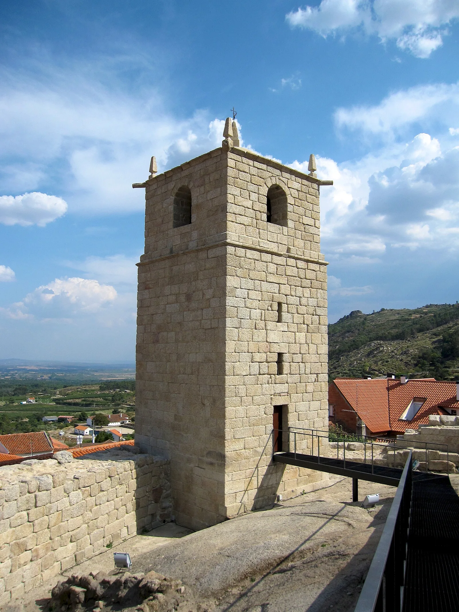
- Top sights: Torre de Menagem · Castelo de Castelo Novo · Lagareta de Castelo Novo
- Nearby: Fundão (6 km)
Best time to visit & climate
The most pleasant time to visit is Jun, Jul, Sep.
| Jan | Feb | Mar | Apr | May | Jun | Jul | Aug | Sep | Oct | Nov | Dec | |
|---|---|---|---|---|---|---|---|---|---|---|---|---|
| Avg °C | 6 | 7 | 10 | 13 | 16 | 21 | 25 | 25 | 22 | 16 | 10 | 7 |
| Rain mm | 109 | 88 | 104 | 88 | 53 | 24 | 9 | 13 | 43 | 133 | 128 | 109 |
📋 Practical info
Geography
Facts
- The highest peak of Gardunha reaches 1227 meters
- Main production area for the protected Fundão cherries
- Primarily composed of granite with notable quartzite inclusions
- Significant watershed between the Zêzere and Tagus rivers
- Major hub for nature tourism and paragliding activities
- Home to rare botanical species in protected ecological zones
Explore nearby
Notable places around
Route planner — Car & Motorhome
Where do you start? We build the route here, with stops and country notes along the way.
© OpenStreetMap contributors · OpenRouteService
Sights in the town Serra da Gardunha South (10)
Pelourinho de Castelo Novo
Historic pillory in Fundão, Portugal, carved from stone.
Cabeço da Forca
High relief carving of a skull with two crossed thigh bones.
Castelo Velho
Viewpoint on a hilltop overlooking the Serra da Gardunha region.
Bloco fracturado ou fendido
Cracked rock block in Serra da Gardunha, a natural geological feature.
Gardunha
Viewpoint on the ridge of Serra da Gardunha, offering distant views.
Paisagem Protegida Regional da Serra da Gardunha
Regional protected landscape area in Serra da Gardunha, Portugal.
Sights nearby
Frequently asked questions
What is Serra da Gardunha known for?
When do the cherries bloom?
What is 'Natura Glamping'?
Which town lies at the foot of the mountain?
Are there myths about UFOs there?
Serra da Gardunha South: where is it located?
Serra da Gardunha South: what is there to see?
Serra da Gardunha South: when is the best time to visit?
Serra da Gardunha South: why is it worth visiting?

Nearby cities


History & landmarks