Plizio Visual Lab
Guelta d'Eli
Weather…
Water temperature…
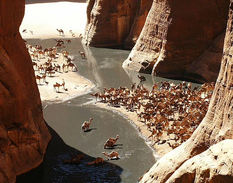
Guelta d'Eli is a vital natural sanctuary located within the rugged terrain of the Tagant Plateau. As a permanent water hole, a "guelta" in the local terminology, it consists of a deep rocky basin situated at the bottom of a steep canyon. Fed by hidden underground springs, it provides a dependable water source even during the height of the dry season, making it a critical lifeline for the region's wildlife. This isolated ecosystem supports a variety of species that would otherwise struggle to survive in the surrounding arid desert. For centuries, nomadic tribes have relied on Guelta d'Eli as a strategic stopover for watering their livestock during long treks across the Sahara. The striking contrast between the dark, still water and the towering reddish cliffs creates a scene of profound natural beauty. For those exploring the plateau, the guelta stands as a powerful symbol of endurance and a rare example of a stable aquatic habitat in one of the world's harshest climates.
- Location: Mauritania
- Nearby: Tidjikja (58 km)
📋 Practical info
Geography
Facts
- Located in the Adrar region
- Important ecological refuge
- Supports local livestock
- Situated within a rocky gorge
- Part of traditional nomad networks
- Water levels vary seasonally
Explore nearby
Notable places around
Route planner — Car & Motorhome
Where do you start? We build the route here, with stops and country notes along the way.
© OpenStreetMap contributors · OpenRouteService
Sights nearby
Frequently asked questions
What characterizes Guelta d'Eli?
Is it safe for tourists?
Do I need a lot of water?
Is the site well signposted?
Best time of day?
Guelta d'Eli: where is it located?
Guelta d'Eli: why is it worth visiting?

Nearby cities


