Plizio Visual Lab
Zagros Mountains

Weather…
Water temperature…
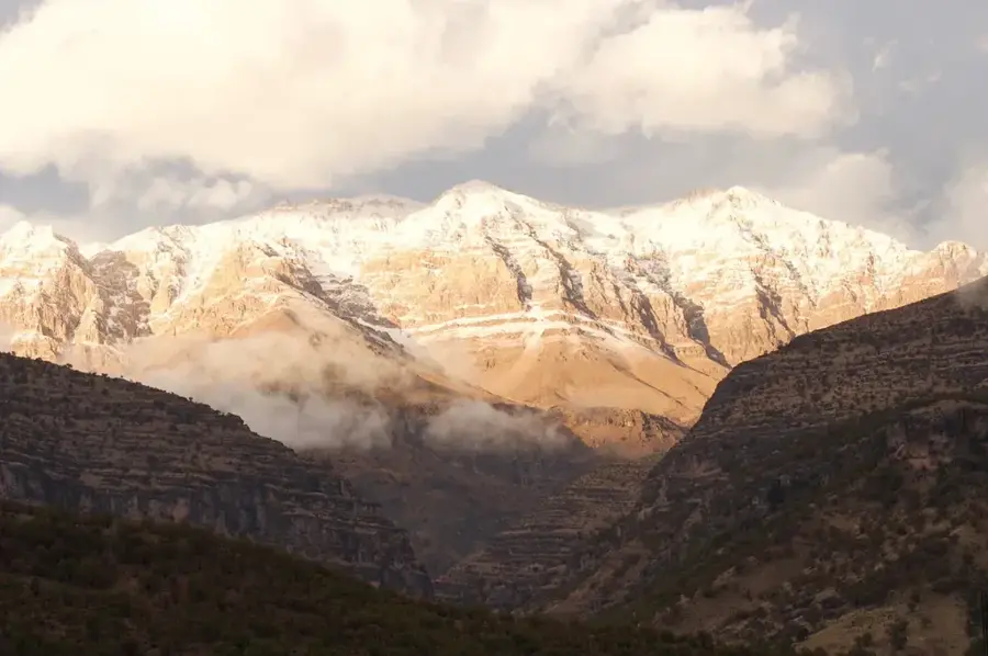
The Zagros Mountains form the most massive and extensive mountain range in Iran, serving as the topographical backbone of the country's western half, sweeping from the border with Turkey in the northwest down to the Strait of Hormuz in the south. This formidable fold-and-thrust belt was created over millions of years through the continuous and massive collision between the Arabian and Eurasian tectonic plates. The region's topography is defined by long ridges of parallel mountains separated by narrow, exceedingly deep valleys, which in antiquity constituted a formidable natural barrier against invasions. The protected and fertile valleys in the western sector of the range were the stage for some of humanity's earliest agricultural experiments and initial animal domestications. Today, the landscape is enriched by ancient oak forests, impressive wild gorges, and traditional nomadic encampments.
- Location: Iran
- Nearby: Gahar Lake (83 km)
Best time to visit & climate
The most pleasant time to visit is Jun–Aug.
| Jan | Feb | Mar | Apr | May | Jun | Jul | Aug | Sep | Oct | Nov | Dec | |
|---|---|---|---|---|---|---|---|---|---|---|---|---|
| Avg °C | -3 | -1 | 3 | 7 | 13 | 20 | 23 | 22 | 18 | 12 | 3 | -1 |
| Rain mm | 36 | 30 | 42 | 49 | 16 | 5 | 2 | 0 | 1 | 15 | 39 | 42 |
📋 Practical info
Geography
Facts
- The total length of the massive mountain range measures approximately 1,600 kilometers, crossing multiple provinces.
- The maximum width of the massif reaches dimensions of over 300 kilometers in certain central and southern sections.
- One of the highest and most imposing peaks of the mountain system is Zard-Kuh, standing at 4,221 meters.
- The intensive folding and formation of these mountains occurred predominantly during the Miocene and Pliocene geological epochs.
- The thick sedimentary basin of the Zagros Mountains holds a large portion of the world's greatest known oil and gas reserves.
- Archaeological traces left by Neanderthals, dating back 50,000 years, have been discovered in the area's karst cave systems.
Explore nearby
Notable places around
Route planner — Car & Motorhome
Where do you start? We build the route here, with stops and country notes along the way.
© OpenStreetMap contributors · OpenRouteService
Sights in the town Zagros Mountains (1)
Sights nearby
Frequently asked questions
How large are the Zagros Mountains?
Is it developed for tourism?
What activities are there?
Is it safe?
What is the best time to visit?
Zagros Mountains: where is it located?
Zagros Mountains: when is the best time to visit?
Zagros Mountains: why is it worth visiting?

Nearby cities
Nature

More places