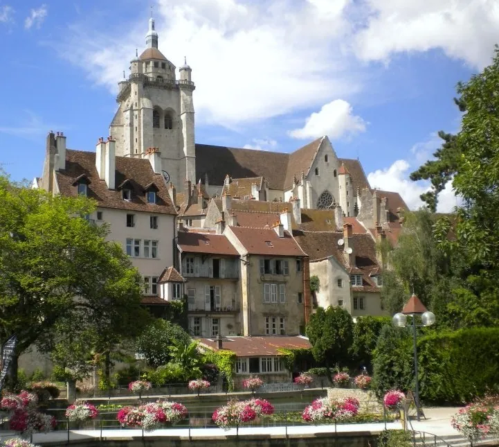
Montceau-les-Mines is a unique urban creation of the 19th century, legally established in 1856 to support the booming coal industry of the Blanzy basin. For over 140 years, the city was defined by the clatter of mining equipment and the heavy traffic on the Canal du Centre, which links the Loire and Saône rivers. This heritage is preserved at the Musée de la Mine, located on a former extraction site. The city's layout is linear, following the canal, and features two rare vertical-lift bridges that are central to its visual identity. Since the cessation of mining activities in 1992, Montceau has reinvented itself through ecological restoration, turning open-cast mines into lakes and parks like the Parc Maugrand. It remains a key component of the Creusot-Montceau urban community, balancing its deep working-class roots with a transition toward light industry and regional services.
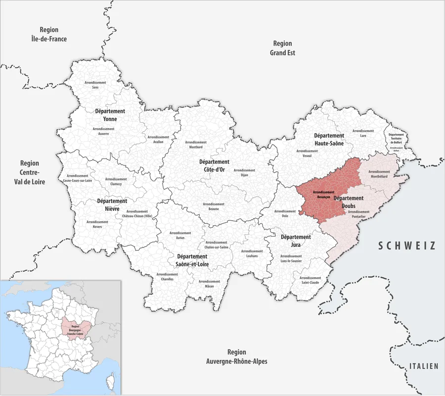
Location: Bourgogne-Franche-Comté, France
Top sights: Lavoir des Chavannes · Parc Maugrand · Church of Notre-Dame de l'Assomption
Nearby: Blanzy (4 km)
Population: ~19.210
Best time to visit & climate
The most pleasant time to visit is Jun–Aug.
Jan
Feb
Mar
Apr
May
Jun
Jul
Aug
Sep
Oct
Nov
Dec
Avg °C
2
2
6
10
14
18
21
20
16
11
6
2
Rain mm
56
44
55
62
80
66
69
73
53
78
77
68
Live webcam – Montceau-les-Mines
See what it looks like near Montceau-les-Mines right now.
Pouilloux › North-east: Montceau-les-Mines - Pouilloux Airport · 7.6 km · Open webcam on Windy · Webcams provided by Windy.com
Geography
Population
20,221
Coordinates
46.66690, 4.36890
Facts
Foundation: Created from parts of four neighboring communes in 1856.
Coal Basin: Part of the Blanzy basin, active since the 18th century.
Lift Bridges: The 'Pont levant' is a rare survivor of its type.
Post-Mining: The Lavoir des Chavannes is a massive coal-washing plant ruins.
Geography: Located in the heart of Burgundy (Bourgogne-Franche-Comté).
Labor History: Known for the 'Black Band' anarchist movements in the 1880s.
Pick weather + travel mode, get a concrete day plan.
09:00→15:255.2 km walk5 places0/5
Day budget: ≈ 16–22 €Entries 19€ · Transport 0€
Start your day exploring Montceau-les-Mines by discovering its civic heart and architectural landmarks. The morning reveals a quiet charm as you walk through historic squares and observe elegant civic structures.
By midday, immerse yourself in the rich religious heritage and beautiful sanctuaries. The atmosphere here offers a serene escape, letting you appreciate intricate local artisanship and peaceful surroundings.
In the afternoon, shift your focus to the vast green spaces and recreational areas. A long stroll through lush parks perfectly balances the earlier architectural highlights, providing fresh air and relaxation.
End your journey by the relaxing waterfront, soaking in the late afternoon glow. Whether enjoying the beach or modern aquatic facilities, the evening closes your vibrant day out with tranquil waterside views.
← swipe for more places →
📍
09:10 · 45'
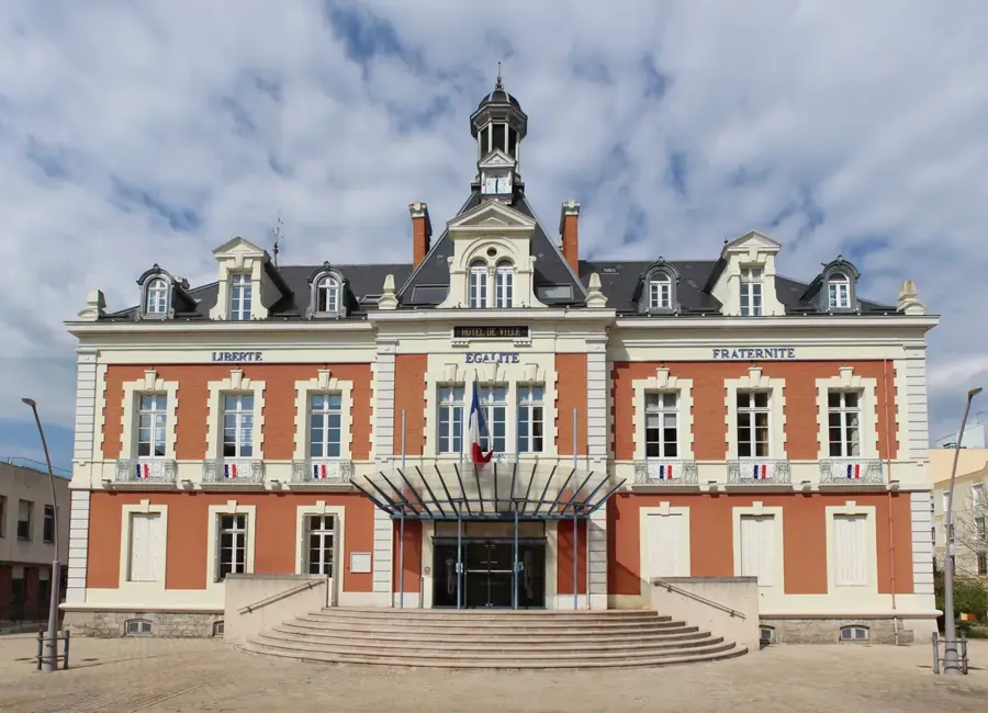
Mairie de Montceau-les-Mines
Admire the elegant architecture of the town hall located in the historic center, and visit early to avoid the bustling midday administrative crowds.
Take a refreshing stroll through this vast green space which provides scenic walking paths, and bring comfortable shoes for exploring its extensive trails.
Start your morning with an umbrella as you visit the town hall. By noon, the rain might intensify, so taking shelter in the grand church is ideal. In the afternoon, navigate the wet paths of Parc Maugrand carefully to avoid slipping. Finish your day at the indoor pools of the aquatic center, escaping the gloomy weather outside.
← swipe for more places →
📍
09:10 · 45'
Mairie de Montceau-les-Mines
Admire the Mairie's facade from beneath your umbrella; keep an eye out for nearby cafes if you need quick shelter from a sudden downpour.
Wrap up warm for a crisp morning walk to the town hall. Midday offers soft winter light perfectly illuminating the historic church. Afternoon shadows lengthen quickly in Parc Maugrand. By evening, as the sun sets early around 17:00, the indoor aquatic center provides a warm and relaxing finish to your chilly day.
← swipe for more places →
📍
09:10 · 45'
Mairie de Montceau-les-Mines
The town hall square can be quite frosty in winter. Wear a warm hat and scarf while taking in the architectural details of the facade.
Start your day exploring Montceau-les-Mines by discovering its civic heart and architectural landmarks. The morning reveals a quiet charm as you walk through historic squares and observe elegant civic structures.
By midday, immerse yourself in the rich religious heritage and beautiful sanctuaries. The atmosphere here offers a serene escape, letting you appreciate intricate local artisanship and peaceful surroundings.
In the afternoon, shift your focus to the vast green spaces and recreational areas. A long stroll through lush parks perfectly balances the earlier architectural highlights, providing fresh air and relaxation.
End your journey by the relaxing waterfront, soaking in the late afternoon glow. Whether enjoying the beach or modern aquatic facilities, the evening closes your vibrant day out with tranquil waterside views.
← swipe for more places →
🏛️
09:10 · 80'
Lavoir des Chavannes
Discover this monumental coal preparation plant that stands as a stark reminder of the region's mining heritage, best photographed in morning light.
Relax by the water at this lovely lakeside beach well-suited for family picnics, but remember to bring your own sun protection as shade is limited here.
Start your wet morning ride to the industrial ruins, ensuring your bike has good mudguards. By noon, navigate the slick city streets towards the center carefully. In the afternoon, the park's paths will be muddy, so always brake gently. End the ride safely before dusk, avoiding deep puddles.
← swipe for more places →
🏛️
09:10 · 80'
Lavoir des Chavannes
The industrial ruins look especially dramatic in the rain. Be careful when dismounting, as wet metal grates and stones are extremely slippery.
Use thermal gloves for the freezing morning ride to the historic sites. Midday sun offers slight warmth as you cycle towards the town hall. The park's crisp winter air is refreshing in the afternoon. Since sunset is around 17:00, ensure your bike lights are fully charged and turned on for the ride back.
← swipe for more places →
🏛️
09:10 · 80'
Lavoir des Chavannes
The massive industrial ruins look memorable covered in morning frost. Wear thick thermal gloves, as the wind chill is biting here.
Start your day exploring Montceau-les-Mines by discovering its civic heart and architectural landmarks. The morning reveals a quiet charm as you walk through historic squares and observe elegant civic structures.
By midday, immerse yourself in the rich religious heritage and beautiful sanctuaries. The atmosphere here offers a serene escape, letting you appreciate intricate local artisanship and peaceful surroundings.
In the afternoon, shift your focus to the vast green spaces and recreational areas. A long stroll through lush parks perfectly balances the earlier architectural highlights, providing fresh air and relaxation.
End your journey by the relaxing waterfront, soaking in the late afternoon glow. Whether enjoying the beach or modern aquatic facilities, the evening closes your vibrant day out with tranquil waterside views.
← swipe for more places →
⛪
09:10 · 50'
Église du Magny
Marvel at the unique local history attached to this quaint parish church, and take a moment to walk around the quiet surrounding residential streets.
Keep the wipers on for your morning drive between historic churches. Midday, you can admire the industrial ruins from the dry comfort of your car if the rain is heavy. In the afternoon, navigate the slick town roads cautiously. To stay perfectly dry, try parking as close to the entrances as possible and always carry an umbrella.
← swipe for more places →
⛪
09:10 · 50'
Église du Magny
Park close to the entrance. The historic church gives a remarkably peaceful and dry sanctuary on a gloomy, rainy morning.
Warm up the car early to thoroughly defrost the windows before your first stop. Midday brings bright but freezing winter sun as you drive through town. In the afternoon, the car's heater will be your best friend between short outdoor walks. Since sunset hits early around 17:00, expect a cozy twilight drive at the end.
← swipe for more places →
⛪
09:10 · 50'
Église du Magny
The morning frost looks absolutely beautiful on the stone walls. Blast the heater briefly so you return to a warm cabin from the crisp air.
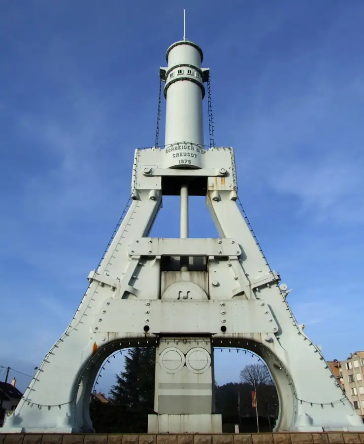
A massive industrial monument, once the largest coal washing plant in Europe, representing the town's mining past.
Parc Maugrand🎡 recreation
A large recreational park with a farm, playgrounds, and ponds, providing a green escape for families and nature lovers.
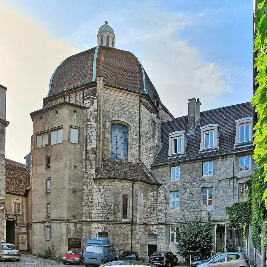
Church of Notre-Dame de l'Assomption⛪ religious
A 19th-century church built during the mining boom, serving as a landmark in the center of the industrial city.
Centre nautique👨👩👧 family
Nautical center in Montceau-les-Mines with various pools.
Mairie de Montceau-les-Mines📍 landmark
Mairie de Montceau-les-Mines serves as the town hall for the local administration.
🌐 montceaulesmines.fr🕒 Mo-Tu 08:30-12:00,13:30-17:30; We 08:30-17:30; Th-Fr 08:30-1♿
Église Saint-Joseph⛪ religious
Église Saint-Joseph is a religious place of worship located in Montceau-les-Mines.
Église du Magny⛪ religious
Église du Magny serves as a local church and place of worship in Montceau-les-Mines.
Plage Roger Lagrot🎡 recreation
Plage Roger Lagrot is a recreational beach area located in Montceau-les-Mines.
Frequently asked questions
What is the heritage of Montceau-les-Mines?
The city has a rich mining past, kept alive at the Mining Museum (Musée de la Mine).
Are there opportunities for water sports?
Yes, the Centre Nautique features pools and activities, and the Canal du Centre is good for boating.
What can you do in the city park?
Parc Maugrand provides walking trails, playgrounds, and even a small animal park for children.
Are there local markets?
The Tuesday morning market is one of the region's largest, offering fresh Burgundian produce.
How is the highway connection?
The city is located directly on the RCEA, making car access very easy.
Montceau-les-Mines: where is it located?
Montceau-les-Mines is located in Bourgogne-Franche-Comté, France.
Montceau-les-Mines: what is there to see?
Highlights include Lavoir des Chavannes, Parc Maugrand, Church of Notre-Dame de l'Assomption.
Montceau-les-Mines: when is the best time to visit?
The most pleasant time to visit is Jun, Aug.
Montceau-les-Mines: why is it worth visiting?
Montceau-les-Mines is a unique urban creation of the 19th century, legally established in 1856 to support the booming coal industry of the Blanzy basin.