Plizio Visual Lab
Adi Keyh
ℹ️Practical info — Adi Keyh
▾
🌤 Weather — 5 days
📍 Nearby
Sights nearby
💡 Tips
- Bring warm layers, as the high mountain altitude means evenings get quite cold.
- Cash is absolutely essential (Nakfa), as ATMs for international cards are practically non-existent.
- Power outages are frequent, so a high-capacity power bank is highly recommended.
- Arrange a local driver if you plan to visit the nearby historical ruins of Qohaito.
🍽 Food
A spicy meat stew served over injera, available at traditional local diners.
Enjoy a fantastic coffee, a lingering legacy of Italian influence, in cafes around the center.
Try this traditional homemade fermented beer at a local establishment.
🛍 Shopping · 🧘 Quiet spots
A great place to observe daily life and buy local highland produce.
Local tailors in town can create custom garments relatively quickly.
Walk to the edges of the town for dramatic, quiet views over the deep canyons.
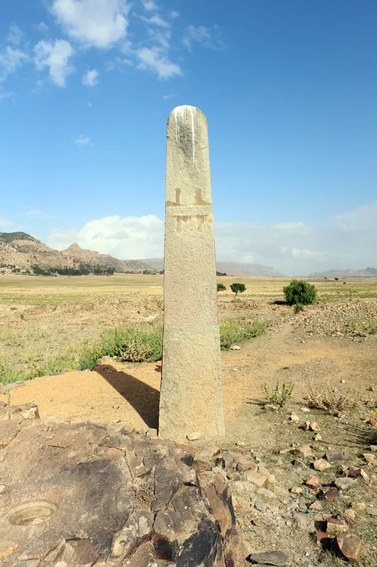
The expansive historical site outside the town provides a deeply peaceful atmosphere.
Water temperature…
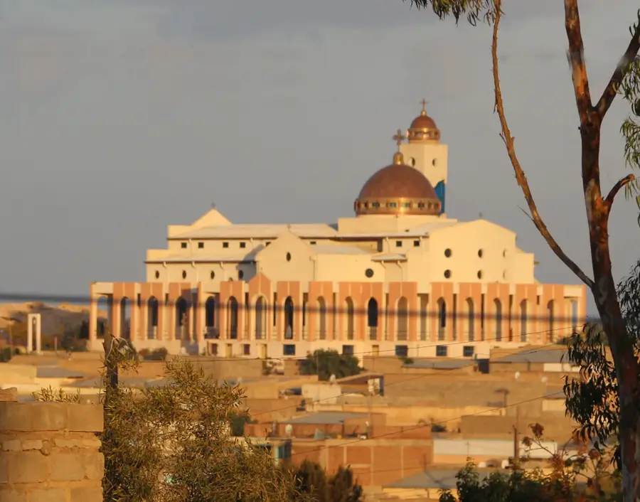
Adi Keyh, also known as Addi Caieh, is a historically significant town located in the Eritrean highlands, approximately 110 kilometers southeast of Asmara. Situated at an impressive elevation of about 2,400 meters above sea level, it is one of the highest urban settlements in the country, characterized by its brisk mountain climate and remarkable views of the surrounding plateaus. The town is most famous for its proximity to the ancient ruins of Qohaito, a pre-Aksumite and Aksumite trading hub that was a vital link on the trade route between the port of Adulis and the inland capital of Aksum. Adi Keyh's urban landscape features a blend of Italian colonial-era structures and traditional highland stone dwellings, reflecting its multi-layered history. Given its location on the main highway leading towards the southern border, it serves as an important commercial and transit center for the Debub region. The community is predominantly composed of the Tigrinya and Saho ethnic groups, maintaining a rich cultural heritage in one of the most scenic areas of the Eritrean highlands.
- Location: Eritrea
- Nearby: Mendefera (62 km)
- Population: ~13.061 (2021)
Best time to visit & climate
The most pleasant time to visit is Feb, Oct, Nov.
| Jan | Feb | Mar | Apr | May | Jun | Jul | Aug | Sep | Oct | Nov | Dec | |
|---|---|---|---|---|---|---|---|---|---|---|---|---|
| Avg °C | 19 | 21 | 22 | 24 | 26 | 26 | 25 | 24 | 24 | 22 | 21 | 19 |
| Rain mm | 12 | 15 | 15 | 39 | 20 | 14 | 65 | 78 | 23 | 12 | 12 | 13 |
Geography
Facts
- Adi Keyh stands at a notable elevation of 2,400 meters above sea level.
- The name Adi Keyh means 'Red Village' in the Tigrinya language.
- It is the main gateway to the archaeological plateau of Qohaito.
- The town is a significant cultural hub for the Saho and Tigrinya people.
- Adi Keyh houses the national College of Arts and Social Sciences.
- Ancient rock art sites are located in the mountains surrounding the town.
Explore nearby
Notable places around
Route planner — Car & Motorhome
Where do you start? We build the route here, with stops and country notes along the way.
© OpenStreetMap contributors · OpenRouteService
Sights in the town Adi Keyh (1)
Frequently asked questions
What is located near Adi Keih?
What is the altitude of Adi Keih?
What should one buy in Adi Keih?
What is the weather like?
Do you need a guide for Qohaito?
Adi Keyh: where is it located?
Adi Keyh: when is the best time to visit?
Adi Keyh: why is it worth visiting?

Nearby cities
History & landmarks

Nature
More places