Plizio Visual Lab
Upemba National Park

ℹ️Practical info — Upemba National Park
▾
🌤 Weather — 5 days
📍 Nearby
Sights nearby
Water temperature…
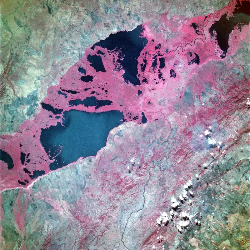
Upemba National Park, situated in the southeastern Katanga region of the Democratic Republic of Congo, is one of the country's most varied and geographically diverse conservation areas. Spanning over 11,000 square kilometers, the park is characterized by the majestic Kibara Plateau, deep valleys, and the Upemba Depression, a vast area of lakes and swamps sustained by the Lualaba River. This varied topography creates microclimates and habitats ranging from montane grasslands and woodlands to tropical marshes. Historically, Upemba was renowned for its immense herds of zebra, roan antelope, and elephants. While poaching has significantly impacted wildlife populations over the decades, intensive conservation efforts are aiding in the recovery of the ecosystem. Today, it remains a paradise for birdwatchers, harboring several endemic species, and is home to the rare Upemba lechwe and shoebill storks. The scenic beauty of the park, with its waterfalls and expansive vistas, is truly unparalleled. Tourism infrastructure in Upemba is minimal, appealing primarily to rugged, self-sufficient adventurers and dedicated conservation enthusiasts. Access is usually via the city of Lubumbashi, followed by a long and demanding 4x4 drive. The dry season, from May to September, is the most favorable time to explore the park, as the roads are passable and wildlife tends to congregate around the permanent water sources in the depression.
- Location: Congo - Kinshasa
- Nearby: Bukama (84 km)
Best time to visit & climate
The most pleasant time to visit is May–Jul.
| Jan | Feb | Mar | Apr | May | Jun | Jul | Aug | Sep | Oct | Nov | Dec | |
|---|---|---|---|---|---|---|---|---|---|---|---|---|
| Avg °C | 24 | 25 | 25 | 25 | 25 | 24 | 24 | 27 | 29 | 28 | 26 | 25 |
| Rain mm | 193 | 160 | 169 | 73 | 3 | 1 | 1 | 2 | 19 | 80 | 176 | 216 |
Geography
Facts
- Located in the Haut-Lomami province of southeastern DRC.
- Covers an extensive area of 11,730 square kilometers.
- Contains the Kibara Plateau and the Upemba Depression.
- Traversed by the Lualaba River (upper Congo River).
- Features several scenic waterfalls, including the Kayo Falls.
- Home to the endemic Upemba lechwe antelope.
- Considered a paradise for birdwatchers and ornithologists.
- Access is difficult, requiring expedition-level planning.
Explore nearby
Notable places around
Route planner — Car & Motorhome
Where do you start? We build the route here, with stops and country notes along the way.
© OpenStreetMap contributors · OpenRouteService
Frequently asked questions
Upemba National Park: where is it located?
Upemba National Park: when is the best time to visit?
Upemba National Park: why is it worth visiting?

Nearby cities


Nature
More places