Plizio Visual Lab
Trou du Prophète

Weather…
Water temperature…
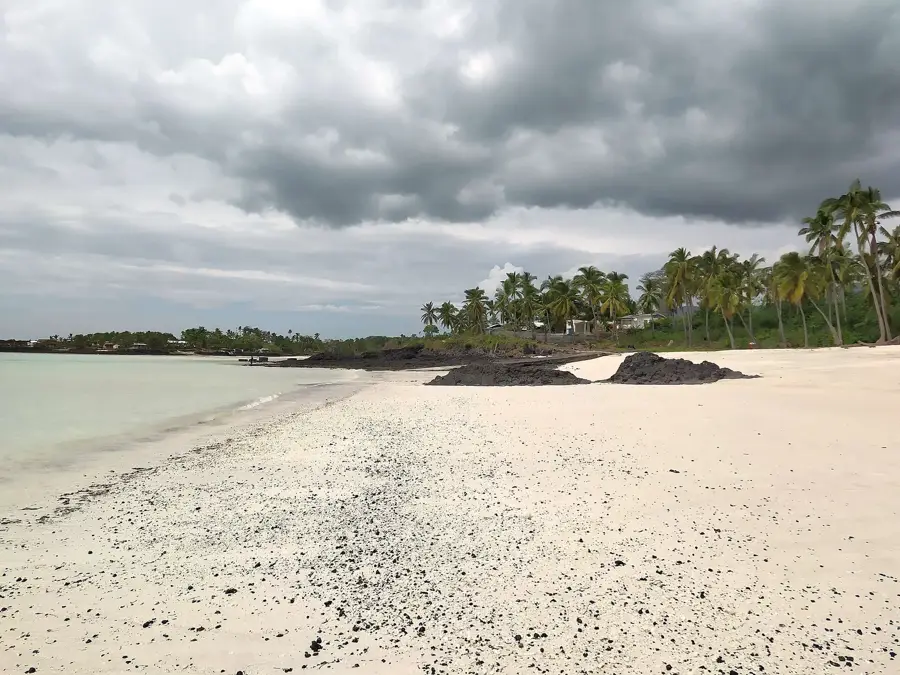
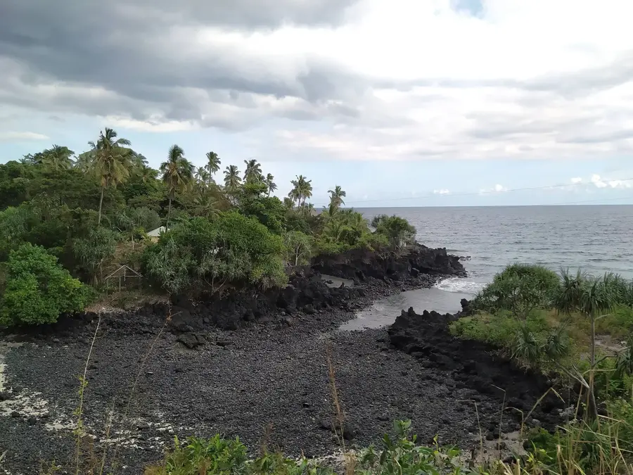
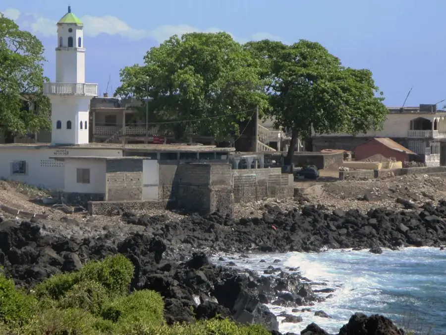
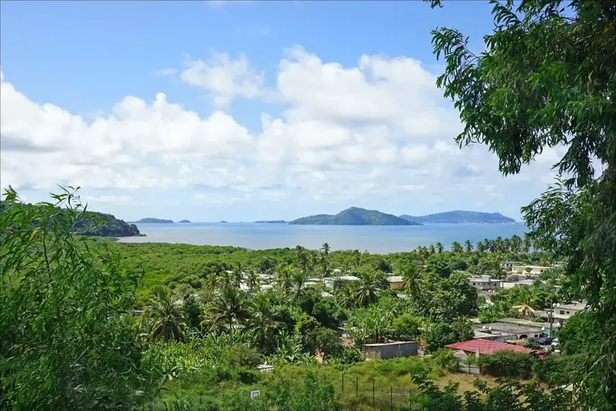
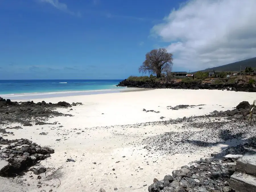
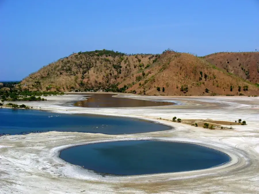
Trou du Prophète (The Prophet's Hole) is a prominent bay and natural landmark located in the northern region of Grande Comore Island (Ngazidja), near the town of Mitsamiouli. Geographically, the site is defined by its highly sheltered position, enclosed by jagged volcanic rock formations with a narrow entrance connecting it to the open ocean. The bay is steeped in local folklore, suggesting that a prophet once sought refuge here from pirates, which gave the location its distinctive name. The turquoise waters remain exceptionally calm and transparent, making the bay a good spot for swimming and a natural safe harbor for small vessels. The surrounding landscape is characterized by striking black basalt rocks that contrast sharply with the white sands and lively green palm trees. Ecologically, the area is noted for its healthy coral clusters situated close to the shore, supporting a diverse array of reef fish. Historically, the bay's concealed nature made it a strategic hideout for sailors throughout the centuries. Today, Trou du Prophète stands as one of the most photographed natural sites in the Comoros and a primary symbol of the archipelago's pristine aesthetic.
- Location: Comoros
- Top sights: Plage de Mitsamiouli shTy' mytsmywly · Marché de Mitsamiouli · Grand Baobab
- Nearby: Bandamadji (5 km)
Best time to visit & climate
The most pleasant time to visit is Jul–Sep.
| Jan | Feb | Mar | Apr | May | Jun | Jul | Aug | Sep | Oct | Nov | Dec | |
|---|---|---|---|---|---|---|---|---|---|---|---|---|
| Avg °C | 28 | 28 | 28 | 28 | 27 | 26 | 25 | 25 | 25 | 26 | 27 | 28 |
| Rain mm | 194 | 147 | 144 | 137 | 69 | 41 | 35 | 25 | 23 | 40 | 45 | 101 |
📋 Practical info
Geography
Facts
- Situated on the northern tip of Grande Comore near Mitsamiouli.
- The bay is almost entirely enclosed by a natural reef barrier.
- Historically served as a well-known hideout for pirate vessels in the 17th century.
- Offers some of the best conditions for beginner-level snorkeling on the island.
- The water depth within the bay is relatively shallow, often under 5 meters.
- The prominent basalt formations were shaped by prehistoric lava flows.
Explore nearby
Notable places around
Route planner — Car & Motorhome
Where do you start? We build the route here, with stops and country notes along the way.
© OpenStreetMap contributors · OpenRouteService
Sights in the town Trou du Prophète (3)
Sights nearby
Frequently asked questions
What does the name Trou du Prophète mean?
Where is this place located?
Is the water calm there?
Is food available on-site?
Can you see baobab trees there?
Trou du Prophète: where is it located?
Trou du Prophète: what is there to see?
Trou du Prophète: when is the best time to visit?
Trou du Prophète: why is it worth visiting?

Nearby cities


History & landmarks
Nature
More places