Plizio Visual Lab
Bahr Salamat
Weather…
Water temperature…
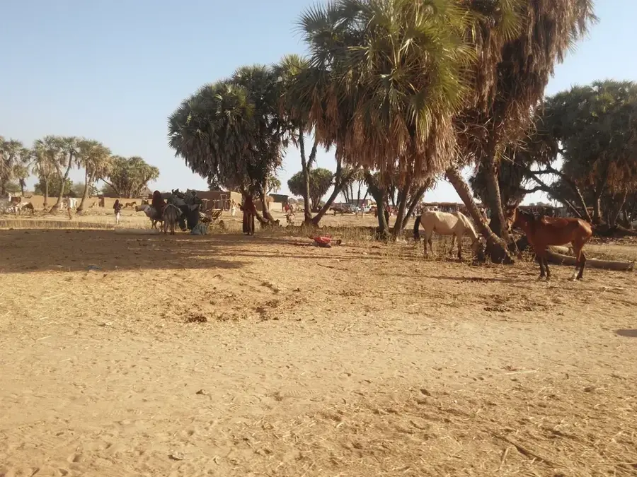
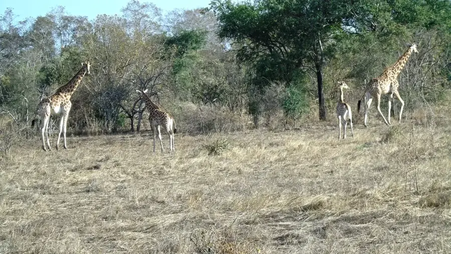
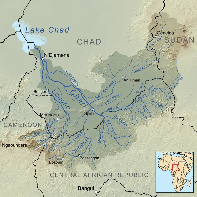
Bahr Salamat is a major seasonal river system that flows through southeastern Chad, eventually joining the Chari River. It originates in the highlands of the Darfur region in Sudan and the Central African Republic before traversing the vast plains of the Salamat Region. The river is the primary hydrological artery for the Zakouma National Park, providing the water necessary to sustain one of Africa's most successful wildlife recoveries. During the rainy season, the Bahr Salamat overflows its banks, creating extensive floodplains that are rich in nutrients and support high levels of biodiversity. These seasonal wetlands are critical for the reproduction of various fish species and provide breeding grounds for numerous waterbirds. In the dry season, the river ceases to flow, leaving behind a series of permanent pools that become magnets for elephants, giraffes, and lions. The local human populations also depend on the river's cycle for recession agriculture and livestock watering. The management of the Bahr Salamat's water resources is essential for both the ecological health of the region and the livelihoods of thousands of people.
Best time to visit & climate
The most pleasant time to visit is Feb, Mar, Nov.
| Jan | Feb | Mar | Apr | May | Jun | Jul | Aug | Sep | Oct | Nov | Dec | |
|---|---|---|---|---|---|---|---|---|---|---|---|---|
| Avg °C | 15 | 18 | 23 | 29 | 32 | 34 | 34 | 34 | 32 | 28 | 22 | 16 |
| Rain mm | 0 | 0 | 0 | 1 | 2 | 2 | 1 | 3 | 1 | 0 | 0 | 0 |
📋 Practical info
Geography
Facts
- Serves as a vital water source for the Zakouma National Park.
- Joins the Chari River at the end of its course.
- Creates vast, nutrient-rich floodplains during the wet season.
- Important migration corridor for the African elephant population.
- Originates in the mountainous regions of Sudan and the CAR.
- The riverbed dries up seasonally, leaving only isolated pools.
Explore nearby
Notable places around
Route planner — Car & Motorhome
Where do you start? We build the route here, with stops and country notes along the way.
© OpenStreetMap contributors · OpenRouteService
Sights nearby
Frequently asked questions
Is Bahr Salamat a river all year round?
Can you go boating there?
Are there riverside paths for hiking?
What is the best time to visit?
Is it a dangerous region?
Bahr Salamat: where is it located?
Bahr Salamat: when is the best time to visit?
Bahr Salamat: why is it worth visiting?