Plizio Visual Lab
Abou-Deïa
ℹ️Practical info — Abou-Deïa
▾
🌤 Weather — 5 days
📍 Nearby
Sights nearby
💡 Tips
- This is a very remote region; travel with a robust 4x4, an experienced local guide, and spare tires.
- Only attempt to visit during the dry season, as roads become completely impassable during the rains.
- Stock up on all necessary supplies, including water, fuel, and first-aid, before leaving major towns.
- Dress conservatively and respect the local Islamic traditions of the Salamat region.
🍽 Food
The staple food of the region, served with a savory sauce made from dried vegetables or meat.
A delicacy often prepared for special occasions or found at local market days.
Sharing strong, sweet tea is a crucial part of local hospitality; never decline a cup if offered.
🛍 Shopping · 🧘 Quiet spots
The central trading hub where nomadic herders bring livestock and buy basic goods.
Nomadic artisans occasionally sell practical, hand-crafted leather items at the market.
The vast, flat landscape gives incredible, uninterrupted views of the sun dipping below the horizon.
During the dry season, these sandy channels are peaceful places to walk, shadowed by large acacia trees.
Water temperature…
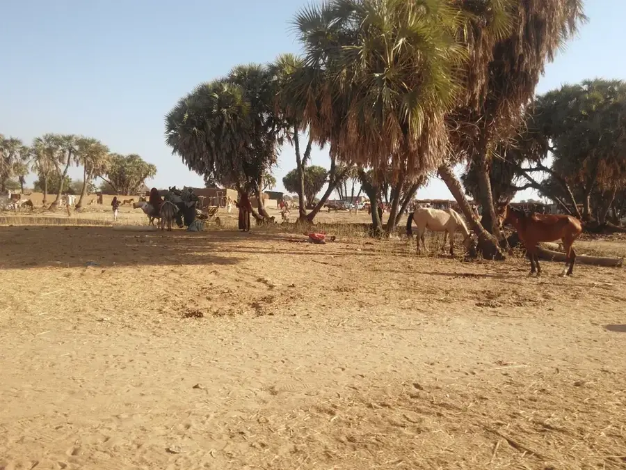
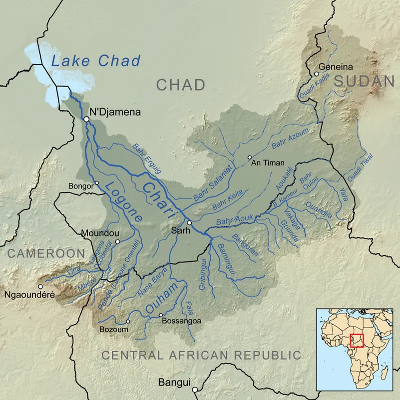
Abou-Deïa is a strategically significant town in southeastern Chad, located within the Salamat Region near the world-renowned Zakouma National Park. Serving as the administrative headquarters of the Abou-Deïa Department, the settlement acts as a vital commercial hub for the surrounding agrarian and pastoral communities. The regional geography is defined by vast savanna landscapes that transform into fertile grounds for millet and sorghum cultivation during the rainy season. Historically, the town evolved as a key transit point and resting place for livestock herders and traders navigating the route between Mongo and Am Timan. The local economy is primarily sustained by extensive cattle ranching and seasonal crop production, with the town's spirited markets playing a central role in regional food security. In the modern era, Abou-Deïa is increasingly recognized as a logistical gateway for ecotourism and conservation initiatives within the greater Salamat Basin.
- Location: Chad
- Nearby: Bitkine (84 km)
- Population: ~10.749 (2023)
Best time to visit & climate
The most pleasant time to visit is Jan, Nov, Dec.
| Jan | Feb | Mar | Apr | May | Jun | Jul | Aug | Sep | Oct | Nov | Dec | |
|---|---|---|---|---|---|---|---|---|---|---|---|---|
| Avg °C | 26 | 29 | 32 | 34 | 33 | 30 | 27 | 26 | 26 | 27 | 27 | 25 |
| Rain mm | 0 | 0 | 1 | 10 | 39 | 92 | 185 | 256 | 142 | 48 | 1 | 0 |
Geography
Facts
- Located in the Salamat Region of southeastern Chad.
- Administrative capital of the Abou-Deïa Department.
- Major trading center for millet and sorghum crops.
- Strategically located about 100 km from Zakouma National Park.
- Key transit point on the highway linking Mongo and Am Timan.
- Local economy is driven by livestock and subsistence farming.
Explore nearby
Notable places around
Route planner — Car & Motorhome
Where do you start? We build the route here, with stops and country notes along the way.
© OpenStreetMap contributors · OpenRouteService
Frequently asked questions
Where is Abou-Deïa located?
How can one get to Abou-Deïa?
What is there to see?
When is the best time to travel?
Are there tourist facilities?
Abou-Deïa: where is it located?
Abou-Deïa: when is the best time to visit?
Abou-Deïa: why is it worth visiting?