Plizio Visual Lab
Mandara Mountains
Weather…
Water temperature…
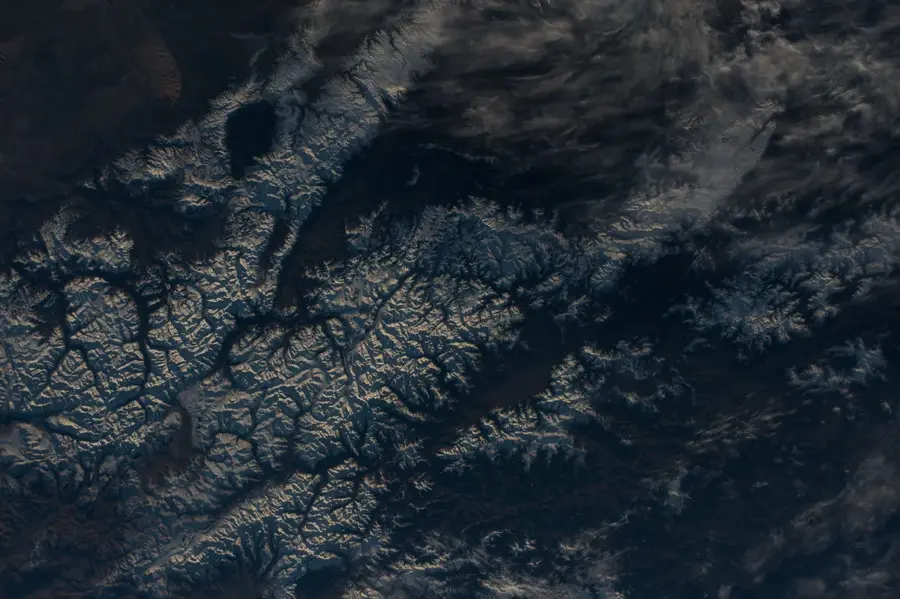
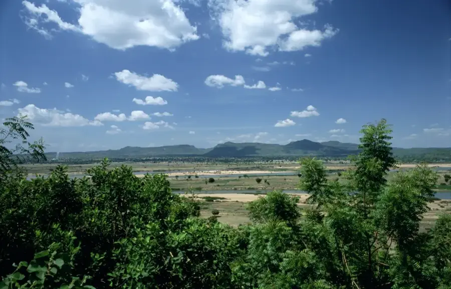
The Mandara Mountains stretch for about 200 kilometers along the border between northern Cameroon and northeastern Nigeria, with foothills extending into Chad. This volcanic range was formed millions of years ago and is now famous for its surreal rock spires and deeply eroded valleys. The region is home to numerous ethnic groups, including the Kapsiki people, who are renowned for their impressive terrace farming techniques used to cultivate the steep hillsides. The highest point in the range is Mount Oupay, reaching an elevation of 1,494 meters. The landscape is dominated by striking volcanic plugs, such as the famous Rhumsiki Peak, which is widely regarded as one of Cameroon's most iconic landmarks. Despite the long dry season, the mountains boast lush vegetation during the rains and serve as a vital watershed for the surrounding plains. The Mandara Mountains are not only geologically significant but also represent a major cultural sanctuary where traditional lifestyles and religious practices have been preserved for centuries.
Best time to visit & climate
The most pleasant time to visit is Jan, Feb, Dec.
| Jan | Feb | Mar | Apr | May | Jun | Jul | Aug | Sep | Oct | Nov | Dec | |
|---|---|---|---|---|---|---|---|---|---|---|---|---|
| Avg °C | 20 | 24 | 28 | 32 | 34 | 34 | 31 | 28 | 29 | 29 | 25 | 21 |
| Rain mm | 0 | 0 | 0 | 1 | 8 | 37 | 94 | 155 | 50 | 7 | 0 | 0 |
📋 Practical info
Geography
Facts
- Length: approx. 200 km
- Highest peak: Mount Oupay (1,494 m)
- Location: Cameroon/Nigeria border
- Geology: Volcanic plugs and spires
- Iconic spot: Rhumsiki Peak
- Agriculture: Famous for hillside terracing
Explore nearby
Notable places around
Route planner — Car & Motorhome
Where do you start? We build the route here, with stops and country notes along the way.
© OpenStreetMap contributors · OpenRouteService
Sights nearby
Frequently asked questions
How difficult is hiking in the Mandara Mountains?
What is the best season for the Mandara Mountains?
Are there parking facilities at the Mandara Mountains?
Are there toilets or restaurants available?
Is there a weather risk in the mountains?
Mandara Mountains: where is it located?
Mandara Mountains: when is the best time to visit?
Mandara Mountains: why is it worth visiting?

Nearby cities


Nature

More places