Plizio Visual Lab
Ndjoukou
ℹ️Practical info — Ndjoukou
▾
🌤 Weather — 5 days
📍 Nearby
Sights nearby
💡 Tips
- River transport is the most reliable way to reach the town.
- Electricity may be intermittent; bring a high-capacity power bank or solar charger.
- Learn a few basic phrases in Sango to easily connect with the locals.
- Expect very limited internet connectivity throughout the entire area.
🍽 Food
Occasionally offered by local hunters; ensure it is thoroughly cooked if you decide to try it.
🛍 Shopping · 🧘 Quiet spots
Buy supplies directly from boats and traders arriving along the Ubangi River.
Find a quiet spot along the banks to watch the slow movement of river traffic.
Water temperature…
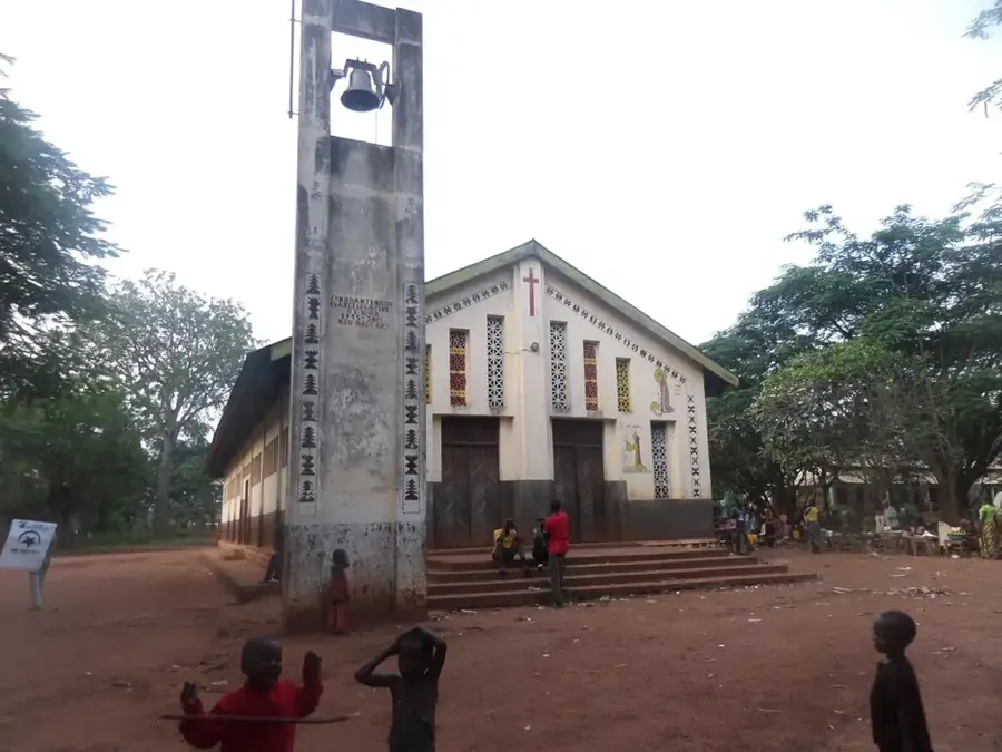
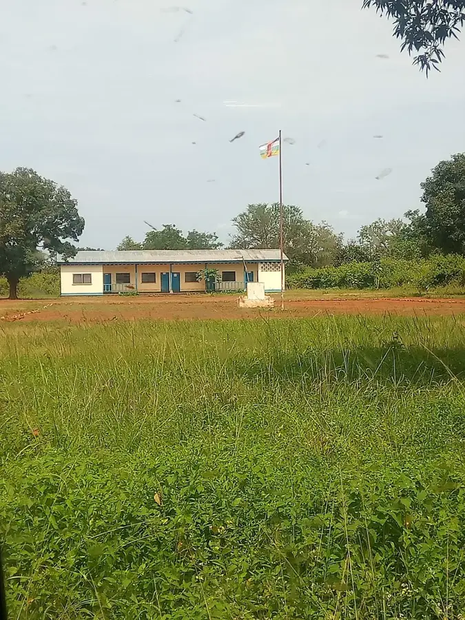
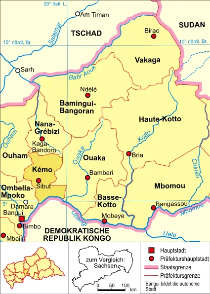
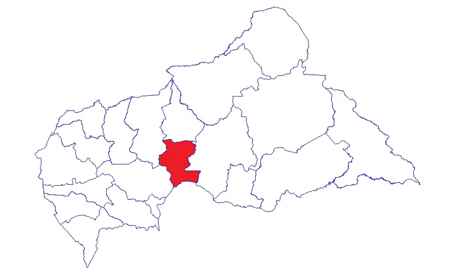
Ndjoukou is a strategically located port town on the banks of the Oubangui River in the Kémo prefecture of the Central African Republic. The town is situated directly across the border from the Democratic Republic of the Congo, serving as a significant border post and transshipment point for river traffic. Geographically, Ndjoukou is defined by the vast expanse of the Oubangui and the adjacent fertile banks, which support intensive fishing and agriculture. The history of the settlement is inseparable from river trade, with Ndjoukou long serving as a key point for transporting goods between Bangui and upriver territories. Its economy relies on cross-border small-scale trade, timber transport, and the production of local food staples like bananas and cassava. Due to its location on the border river, Ndjoukou possesses a multicultural atmosphere where influences from both Congos meet. Despite often difficult logistical conditions, Ndjoukou remains a vital hub for regional connectivity along the Oubangui.
- Location: Central African Republic
- Nearby: Mala (61 km)
Best time to visit & climate
The most pleasant time to visit is Jan, Nov, Dec.
| Jan | Feb | Mar | Apr | May | Jun | Jul | Aug | Sep | Oct | Nov | Dec | |
|---|---|---|---|---|---|---|---|---|---|---|---|---|
| Avg °C | 28 | 29 | 28 | 27 | 27 | 26 | 25 | 25 | 25 | 25 | 26 | 26 |
| Rain mm | 9 | 44 | 102 | 112 | 125 | 146 | 181 | 196 | 196 | 201 | 68 | 7 |
Geography
Facts
- Ndjoukou is located on the right bank of the Oubangui border river.
- The town belongs to the Kémo prefecture in the south of the country.
- It serves as a significant port for regional goods traffic.
- Ndjoukou is the administrative seat of its namesake sub-prefecture.
- Fishing is the primary livelihood alongside agriculture.
- The town is situated southeast of the prefectural capital, Sibut.
Explore nearby
Notable places around
Route planner — Car & Motorhome
Where do you start? We build the route here, with stops and country notes along the way.
© OpenStreetMap contributors · OpenRouteService
Sights in the town Ndjoukou (1)
Frequently asked questions
Where is Ndjoukou located?
How to travel there?
What is the main activity?
What is the vegetation like?
Is there drinking water there?
Ndjoukou: where is it located?
Ndjoukou: when is the best time to visit?
Ndjoukou: why is it worth visiting?

Nearby cities