Plizio Visual Lab
Mala
ℹ️Practical info — Mala
▾
🌤 Weather — 5 days
📍 Nearby
Sights nearby
💡 Tips
- Road conditions can be challenging, especially during the rainy season; travel with a 4x4 if possible.
- Infrastructure is very basic, so pack all essential medical supplies and snacks.
- Engage with village chiefs or local elders with respect when visiting communities.
- Photography of people should only be done with explicit permission.
🍽 Food
A staple meal in the region, often served at simple local food stalls.
🛍 Shopping · 🧘 Quiet spots
The best place to find local agricultural goods and simple handmade items.
Enjoy the natural surroundings and quiet trails just outside the main settlement.
Water temperature…
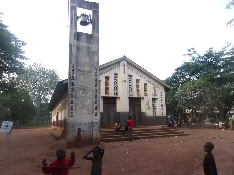
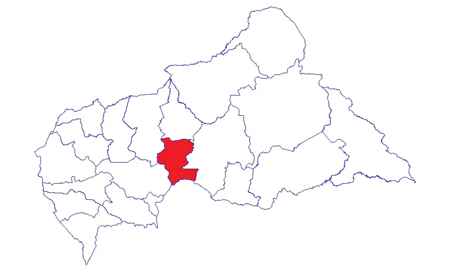
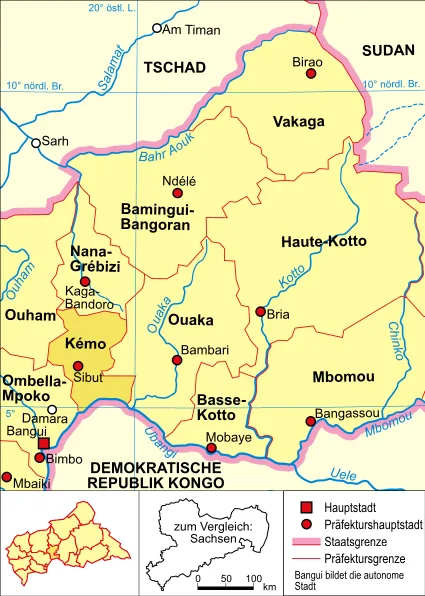
Mala is a rural settlement in the Kémo prefecture of the Central African Republic, located north of Sibut. The region is characterized by vast savannas that transition into wooded zones, providing the local population with diverse resources for farming and hunting. Economically, Mala primarily relies on cotton cultivation, which in the past was a major export product of the region, alongside food crops like cassava and peanuts. The town serves as a local trading hub for the surrounding small villages and is connected via land routes to the larger centers of the prefecture. Historically, the area around Mala is a traditional settlement territory of the Mandjia ethnic groups, whose cultural heritage continues to shape the social structure of the place today. The tranquil atmosphere of Mala exemplifies rural life in Central Africa, where community and the seasonal agricultural cycle dictate daily life. Despite limited modern infrastructure, the settlement maintains its importance for local identity and regional food supply.
- Location: Central African Republic
- Nearby: Sibut (52 km)
Best time to visit & climate
The most pleasant time to visit is Jan, Nov, Dec.
| Jan | Feb | Mar | Apr | May | Jun | Jul | Aug | Sep | Oct | Nov | Dec | |
|---|---|---|---|---|---|---|---|---|---|---|---|---|
| Avg °C | 27 | 29 | 28 | 27 | 27 | 26 | 25 | 25 | 25 | 25 | 26 | 26 |
| Rain mm | 5 | 33 | 100 | 107 | 123 | 149 | 200 | 190 | 214 | 209 | 57 | 4 |
Geography
Facts
- Mala is located in the Kémo prefecture in the central part of the country.
- The settlement is situated north of the regional town of Sibut.
- Cotton farming was historically the primary source of income for the region.
- The area is predominantly inhabited by the Mandjia ethnic group.
- Mala serves as a supply hub for surrounding agricultural communities.
- The climate features distinct rainy and dry seasons.
Explore nearby
Notable places around
Route planner — Car & Motorhome
Where do you start? We build the route here, with stops and country notes along the way.
© OpenStreetMap contributors · OpenRouteService
Frequently asked questions
What is Mala?
Are there attractions there?
How to reach Mala?
What is produced there?
Is there cell signal there?
Mala: where is it located?
Mala: when is the best time to visit?
Mala: why is it worth visiting?