Plizio Visual Lab
Kahlenberg
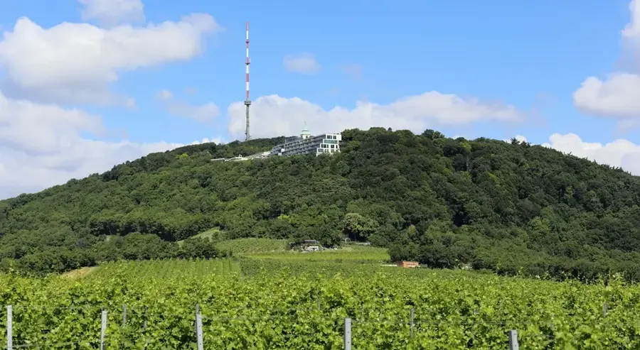
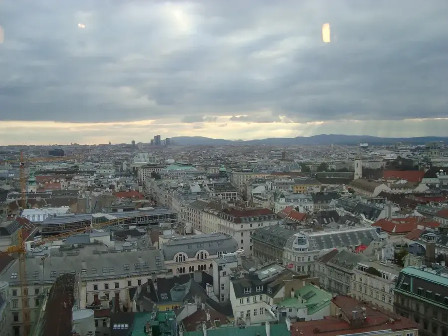
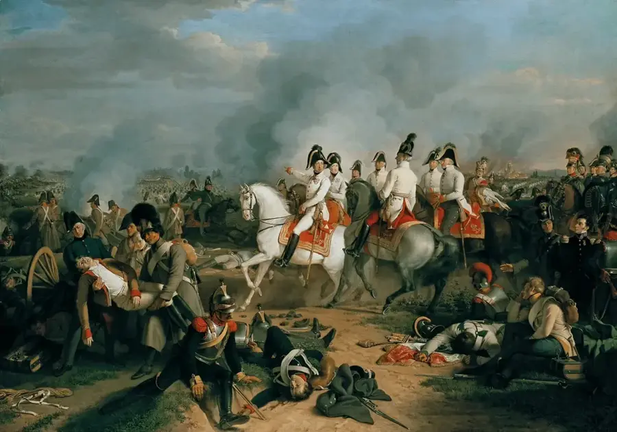
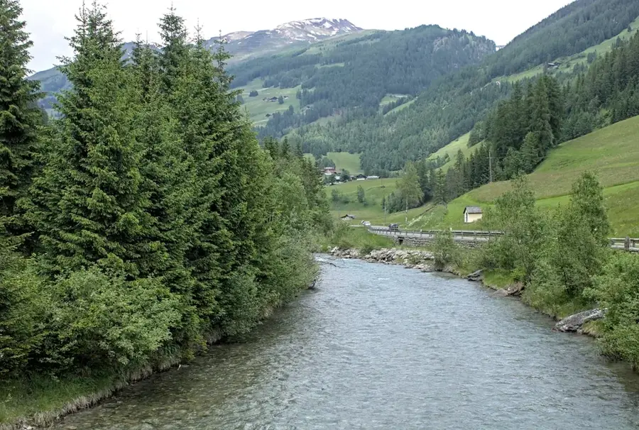
The Kahlenberg is a 484-meter-high hill in the Vienna Woods and is regarded as the most famous viewpoint overlooking the Austrian capital, Vienna. Historically, it gained global significance through the Battle of Kahlenberg in 1683, when the relief army under Polish King Jan Sobieski launched the decisive attack from here against the Ottoman forces besieging Vienna. At the summit lies the Baroque St. Joseph's Church, which today serves as an important memorial for the events of 1683. Beyond its historical relevance, the Kahlenberg is a popular recreational area for the Viennese population and tourists, accessible via hiking trails and the scenic Höhenstraße road. From the observation plateau, one enjoys an expansive view of the Vienna Basin, the Danube, and on clear days, as far as the Little Carpathians and the Schneeberg mountain. The Kahlenberg also houses the Kahlenberg transmitter, a private university, and gastronomic establishments frequently used for events.
- Location: Austria, Austria
- Top sights: Vogelsangberg · Handleinsberg · Biosphärenpark Wienerwald Kernzone Latisberg
- Nearby: Langenzersdorf (5 km)
Best time to visit & climate
The most pleasant time to visit is Jun–Aug.
| Jan | Feb | Mar | Apr | May | Jun | Jul | Aug | Sep | Oct | Nov | Dec | |
|---|---|---|---|---|---|---|---|---|---|---|---|---|
| Avg °C | -2 | 0 | 4 | 10 | 15 | 19 | 21 | 21 | 15 | 10 | 5 | 0 |
| Rain mm | 41 | 34 | 42 | 37 | 77 | 80 | 78 | 76 | 70 | 47 | 40 | 39 |
📋 Practical info
Geography
Facts
- The Battle of Kahlenberg took place on September 12, 1683.
- The summit is located at an altitude of 484 meters above sea level.
- The Kahlenbergbahn operated as a rack railway to the summit from 1874 to 1922.
- St. Joseph's Church was originally constructed in the year 1629.
- The transmission mast on the Kahlenberg stands 165 meters tall.
- The Höhenstraße scenic road to the Kahlenberg was completed in the 1930s.
Explore nearby
Notable places around
Route planner — Car & Motorhome
Where do you start? We build the route here, with stops and country notes along the way.
© OpenStreetMap contributors · OpenRouteService
Sights in the town Kahlenberg (10)
Latisberg
Mountain in Austria, located in the Vienna Woods.
Kinderbauernhof - Landgut Wien Cobenzl
Children's farm with animals and play areas on the Cobenzl hill.
Schloss Cobenzl🏰 castle
Historic building on Cobenzl hill, now a restaurant and excursion spot.
Cobenzl
Viewpoint overlooking Vienna, a popular excursion destination.
Habsburgwarte
Observation tower in Döbling, Vienna, built in 1888.
Biosphärenpark Wienerwald Kernzone Pfaffenberg
Core zone of the Vienna Woods Biosphere Reserve, protecting forest ecosystems.
Sisi-Kapelle
Artwork or chapel named after Empress Elisabeth of Austria.
Sights nearby
Frequently asked questions
What is the best way to get to Kahlenberg?
Is entry to the viewing platform free?
What is the historical significance of Kahlenberg?
Are there restaurants at the top?
Can you hike from Kahlenberg?
Kahlenberg: where is it located?
Kahlenberg: what is there to see?
Kahlenberg: when is the best time to visit?
Kahlenberg: why is it worth visiting?

History & landmarks


Nature
More places