Plizio Visual Lab
Damba
ℹ️Practical info — Damba
▾
🌤 Weather — 5 days
📍 Nearby
Sights nearby
💡 Tips
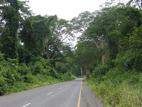
- Travel between May and October during the dry season, as rural roads in the Uíge province can become impassable in the rain.
- Learn a few basic phrases in Portuguese or Kikongo, as English is rarely understood here.
- Bring enough Angolan Kwanzas in cash from major cities, as local ATMs may be out of service or completely empty.
- Always ask for permission and show respect to the local chief (Soba) if visiting surrounding rural villages.
🍽 Food
A staple cassava flour porridge usually served with rich stews, available at any local diner.
A savory chicken stew made with palm oil and garlic; ask for it at local guesthouses.
Buy locally grown bananas, mangoes, and papayas straight from the vendors at the town center.
🛍 Shopping · 🧘 Quiet spots
The central hub of commerce in the town where you can find fresh produce and everyday items.
Look for traditional handmade baskets sold by regional artisans along the main road.
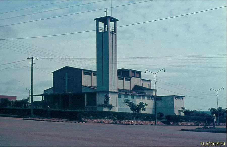
The historic mission area gives a peaceful environment and interesting colonial-era architecture.
Take a short walk toward the surrounding hills for expansive and tranquil views of the Angolan landscape.
Water temperature…
Damba is a strategically located town and municipality in the Uíge Province of northern Angola, situated approximately 190 kilometers from the provincial capital. The settlement lies on a plateau at an elevation of around 1,200 meters above sea level and is historically tied to the Bakongo people. During the Portuguese colonial era, Damba emerged as a significant hub for coffee production, which formed the economic foundation of the region. The climate is tropical and humid, featuring distinct rainy and dry seasons that support various agricultural activities. Today, the area is primarily focused on growing cassava, sweet potatoes, and peanuts, as infrastructure continues to be rebuilt following the civil war. The town functions as the administrative center for the municipality of the same name, which spans an area of over 6,000 square kilometers.
- Location: Angola
- Nearby: Maquela do Zombo (70 km)
- Population: ~12.000 (2023)
Best time to visit & climate
The most pleasant time to visit is Jun–Aug.
| Jan | Feb | Mar | Apr | May | Jun | Jul | Aug | Sep | Oct | Nov | Dec | |
|---|---|---|---|---|---|---|---|---|---|---|---|---|
| Avg °C | 23 | 23 | 23 | 23 | 23 | 22 | 22 | 23 | 24 | 24 | 23 | 23 |
| Rain mm | 150 | 143 | 183 | 187 | 90 | 8 | 2 | 15 | 54 | 146 | 218 | 189 |
Geography
Facts
- The town is situated at an elevation of approximately 1,200 meters.
- Damba is located within the Uíge Province in northern Angola.
- The surrounding municipality covers an area of about 6,915 square kilometers.
- Coffee was historically the region's primary export commodity.
- The area is predominantly inhabited by the Bakongo ethnic group.
- The settlement lies roughly 450 kilometers northeast of Luanda.
Explore nearby
Notable places around
Route planner — Car & Motorhome
Where do you start? We build the route here, with stops and country notes along the way.
© OpenStreetMap contributors · OpenRouteService
Frequently asked questions
How many days do you need for Damba?
When is the best time to visit Damba?
What is the easiest way to get to Damba?
What food is typical in Damba?
Is Damba family-friendly?
Damba: where is it located?
Damba: when is the best time to visit?
Damba: why is it worth visiting?