Plizio Visual Lab
M'Sila
ℹ️Practical info — M'Sila
▾
🌤 Weather — 5 days
📍 Nearby
Sights nearby
💡 Tips
- Visit the University of M'Sila area for an animated, student-friendly atmosphere with numerous affordable cafes.
- Transport around the city center is best done by local taxis. Ensure you have cash, as card payments are rare outside large establishments.
- The nearby ruins of Al Qal'a of Beni Hammad are, ideally in the early morning to avoid the heat.
- Dress modestly out of respect for local customs, particularly when outside the immediate university district.
🍽 Food
A hearty traditional dish of torn flatbread and meat stew, easily found in traditional eateries near the center.
Traditional Algerian flatbread, get it fresh from local bakeries in the morning.
Enjoy a sweet mint tea at any of the lively cafes near the university district.
🛍 Shopping · 🧘 Quiet spots
Bustling area for fresh produce, local spices, and everyday items.
Look for small shops in the older parts of town selling local fabrics and garments.
Stroll through the green spaces of the university for a peaceful break.
A dry riverbed area outside the immediate center offering quiet walks during the cooler months.
Water temperature…
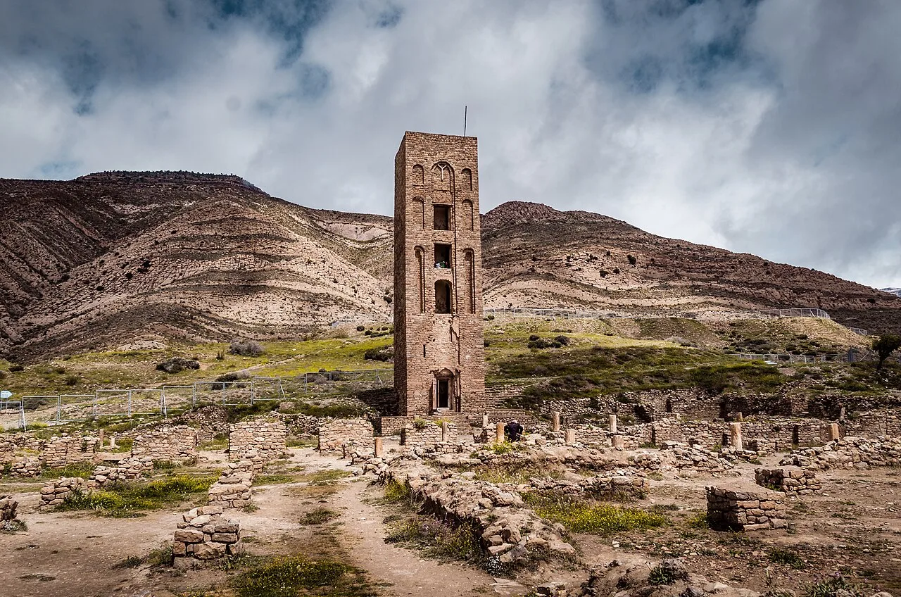
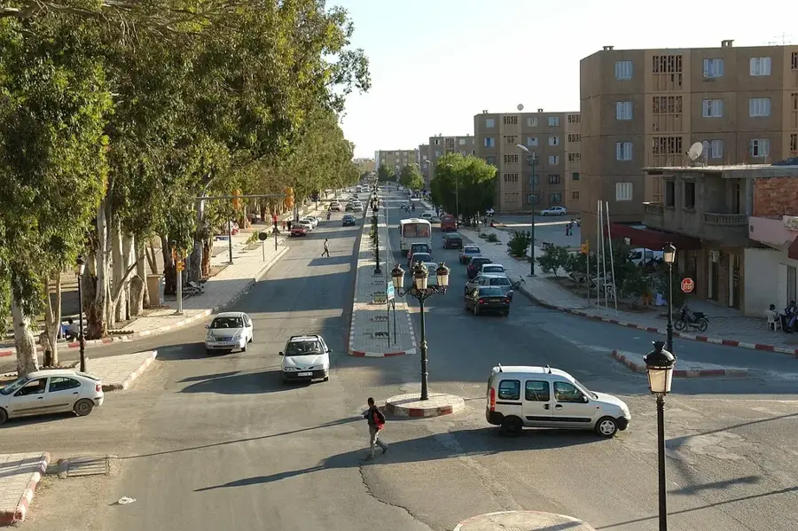
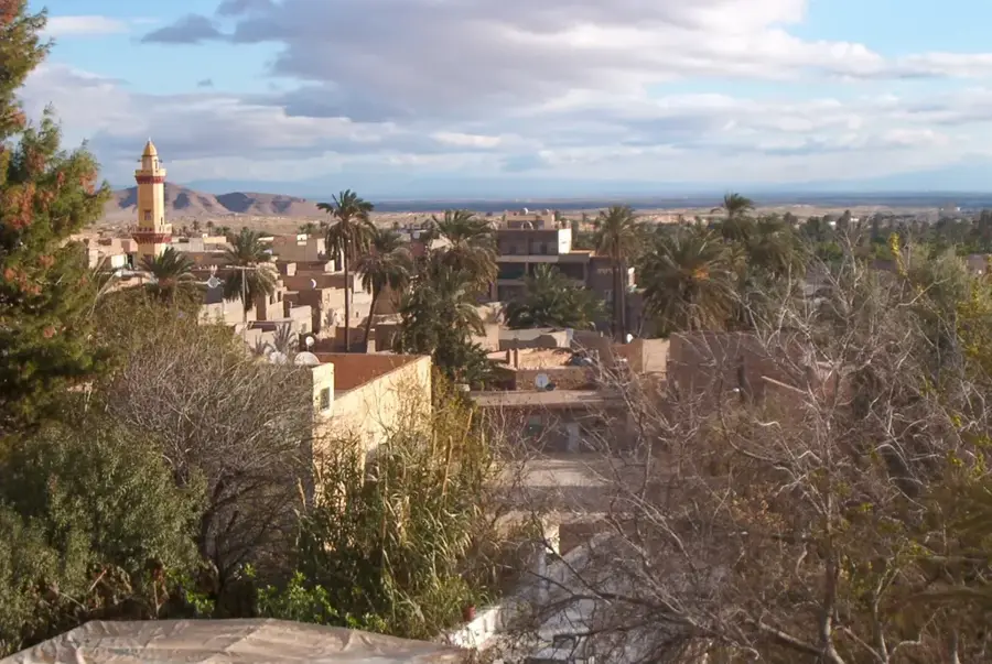
M'Sila, located in the Hodna region of north-central Algeria, is a city with deep historical roots dating back to the Fatimid era. Founded in 925 AD by the Fatimids, it originally served as a strategic military outpost to control the surrounding region. Nearby lie the ruins of Al-Qal'a of Beni Hammad, the first capital of the Hammadid dynasty and a significant UNESCO World Heritage site. Geographically, M'Sila is defined by the vast plains of the Hodna basin, known for its salt lakes and intensive grain cultivation. In modern times, the city has evolved into a vital administrative and educational center, notably through the establishment of Mohamed Boudiaf University. The local economy is primarily based on agriculture, particularly sheep farming and cereal production, alongside emerging industries in construction materials. M'Sila serves as a major transportation hub connecting the northern coast with the high plateau regions. Despite the semi-arid climate, modern irrigation projects have significantly bolstered the agricultural productivity of the surrounding plains.
- Location: Algeria
- Top sights: This · Elmodjahid museum
- Nearby: Bordj Bou Arréridj (45 km)
- Population: ~132.975 (2026)
Best time to visit & climate
The most pleasant time to visit is May, Sep, Oct.
| Jan | Feb | Mar | Apr | May | Jun | Jul | Aug | Sep | Oct | Nov | Dec | |
|---|---|---|---|---|---|---|---|---|---|---|---|---|
| Avg °C | 7 | 8 | 12 | 16 | 21 | 26 | 31 | 30 | 25 | 20 | 12 | 8 |
| Rain mm | 35 | 25 | 32 | 44 | 35 | 13 | 5 | 14 | 32 | 30 | 32 | 31 |
Geography
Facts
- Founded in 925 AD by the Fatimid Caliphate.
- Located near the UNESCO World Heritage site of Al-Qal'a of Beni Hammad.
- Center of the Hodna region on the edge of a large salt lake.
- Major producer of aluminum and construction materials.
- Mohamed Boudiaf University was established here in 1985.
- Renowned for the traditional sheep farming prevalent in the region.
Explore nearby
Notable places around
Route planner — Car & Motorhome
Where do you start? We build the route here, with stops and country notes along the way.
© OpenStreetMap contributors · OpenRouteService
Sights in the town M'Sila (2)
Frequently asked questions
What is the main attraction near M'Sila?
How is the climate?
Are there natural attractions?
What is typically eaten here?
How many days to plan?
M'Sila: where is it located?
M'Sila: what is there to see?
M'Sila: when is the best time to visit?
M'Sila: why is it worth visiting?

Nearby cities
Nature
More places