Plizio Visual Lab
Tarinkot
ℹ️Practical info — Tarinkot
▾
🌤 Weather — 5 days
📍 Nearby
Sights nearby
💡 Tips
- Security is the primary concern; always check current travel advisories and rely on trusted local guides.
- The city is remote and surrounded by mountains; road travel can be arduous and unpredictable.
- Electricity and modern amenities are limited; bring power banks and essential supplies with you.
- Pashtunwali (the traditional code of honor) strongly influences local culture; hospitality is immense but comes with strict social rules.
🍽 Food
Seek out local guesthouses (chaikhanas) that prepare this hearty rice dish with lamb, carrots, and raisins.
Buy warm, freshly baked flatbread directly from traditional tandoor bakeries in the bazaar.
Look for these meat-stuffed dumplings topped with yogurt in small, family-style eateries.
🛍 Shopping · 🧘 Quiet spots
The central market has basic everyday goods, local produce, and regional textiles.
Uruzgan province is known for its almonds and dried fruits; buy them directly from market stalls.
The river flowing near the city provides a natural contrast to the arid mountain landscape.
Find a secure, slightly elevated spot on the edge of town to admire the rugged foothills of the Hindu Kush.
Water temperature…
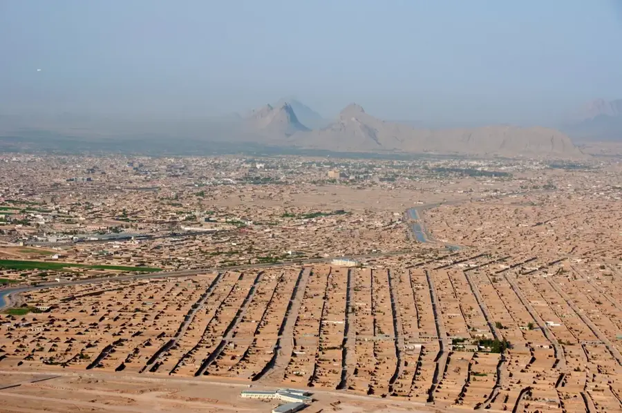
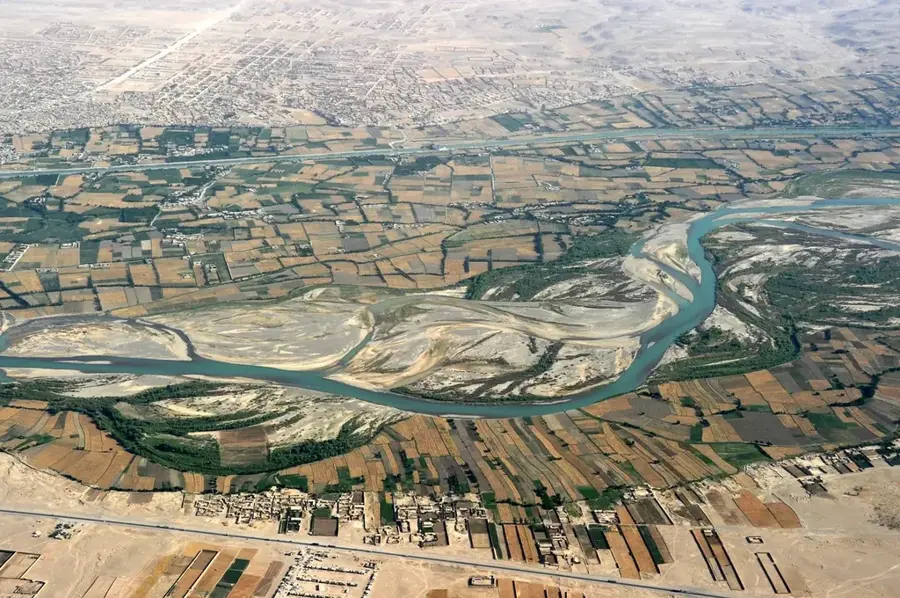
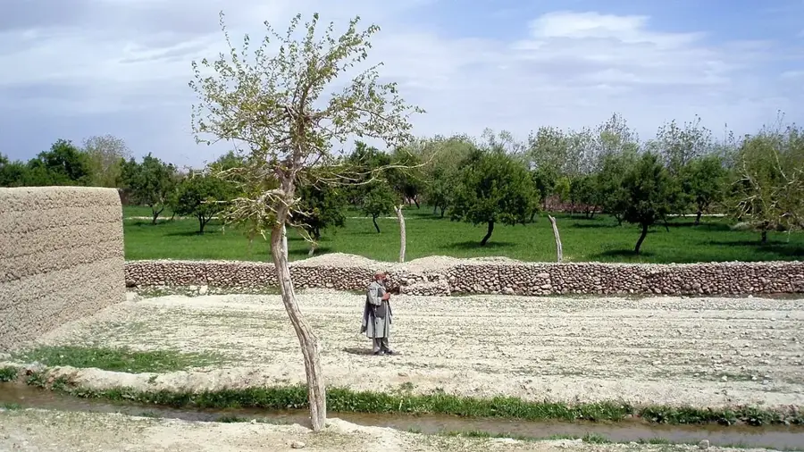
Tarinkot serves as the provincial capital of Uruzgan in southern Afghanistan, situated in a remote mountain valley at an elevation of 1,317 meters. Its geographic isolation, surrounded by the rugged peaks of the central highlands, has historically defined its role as a secluded tribal bastion. The city is the ancestral heartland of several prominent Pashtun tribes, including the Popalzai and Achakzai, whose leadership has often played a significant role in national Afghan politics. Agriculture is the mainstay of the local economy, supported by the waters of the Tarin River and ancient underground irrigation channels known as karez. The region is widely celebrated for its high-quality almond orchards, pomegranates, and dried fruits, which are staples of the local market and export trade. In contemporary history, Tarinkot gained strategic prominence in 2001 when it became the starting point for Hamid Karzai’s resistance movement against the Taliban, leading to a pivotal battle that shifted the tide of the conflict. The city’s infrastructure is concentrated around a central bazaar and a domestic airport that provides essential links to Kabul and Kandahar. A single primary road connects Tarinkot to the south, serving as a critical lifeline for supplies and commerce despite persistent security challenges. The urban fabric is predominantly traditional, featuring mud-brick compounds designed to withstand the region's semi-arid climate. Summers in Tarinkot are characterized by intense heat and dust, while winters bring freezing temperatures and occasional snow in the surrounding highlands. As an administrative hub, the city hosts the provincial government offices and basic healthcare facilities, serving a population that remains deeply rooted in traditional Afghan customs and tribal law. Its resilience in the face of ongoing regional instability underscores its importance as a center of stability and governance in the volatile heart of the southern provinces.
- Location: Afghanistan
- Top sights: Battle of Tarinkot (2016) · Multi National Base Tarin Kot · July 2005 Afghan captive incident
- Population: ~10.000 (2026)
Best time to visit & climate
The most pleasant time to visit is May, Jun, Sep.
| Jan | Feb | Mar | Apr | May | Jun | Jul | Aug | Sep | Oct | Nov | Dec | |
|---|---|---|---|---|---|---|---|---|---|---|---|---|
| Avg °C | 1 | 3 | 8 | 14 | 20 | 24 | 26 | 24 | 20 | 14 | 7 | 3 |
| Rain mm | 25 | 35 | 37 | 29 | 11 | 11 | 10 | 11 | 8 | 11 | 17 | 16 |
Geography
Facts
- Tarinkot sits at an elevation of 1,317 meters above sea level.
- It is the administrative and political capital of Uruzgan Province.
- The city was the site of a major tribal uprising in November 2001.
- Almonds and pomegranates are the primary agricultural exports of the region.
- A domestic airport serves as a critical link for the remote provincial capital.
- The population is almost entirely composed of Pashtun tribal groups.
- Karez irrigation systems are essential for sustaining local agriculture.
- The city's main land connection is the highway leading south to Kandahar.
Explore nearby
Notable places around
Route planner — Car & Motorhome
Where do you start? We build the route here, with stops and country notes along the way.
© OpenStreetMap contributors · OpenRouteService
Sights in the town Tarinkot (3)
Frequently asked questions
What is Tarin Kowt?
What is the access like?
Is it touristy?
What should be considered?
What characterizes the area?
Tarinkot: where is it located?
Tarinkot: what is there to see?
Tarinkot: when is the best time to visit?
Tarinkot: why is it worth visiting?