Plizio Visual Lab
Mubende
ℹ️Practical info — Mubende
▾
🌤 Weather — 5 days
📍 Nearby
Sights nearby
💡 Tips
- Mubende is a key transit stop between Kampala and Fort Portal; it’s worth staying for more than a quick break.
- Visit the Nakayima Tree shrine in the late afternoon for the best photography light and cooler air.
- The town is hilly; wear comfortable shoes if you plan to walk to the historic sites.
- Morning is the best time for the central market to find the freshest local produce.
- Ask for a local guide at the Nakayima shrine to fully appreciate the complex Bachwezi history.
🍽 Food
A top pick for travelers on the Fort Portal road, famous for its authentic Luwombo.
A local favorite for high-quality grilled meats (muchomo) and quick service.
Gives a more refined dining experience with a mix of Ugandan and continental dishes.
🛍 Shopping · 🧘 Quiet spots
The heart of the town's trade; great for fresh tropical fruits and textiles.
Look for unique handmade clay pots and baskets sold by artisans along the main highway.
Provides wide panoramic views of the agricultural highlands and a spiritual calm.
Located 20km away; massive rock formations historically used by kings, now a quiet retreat.
Water temperature…
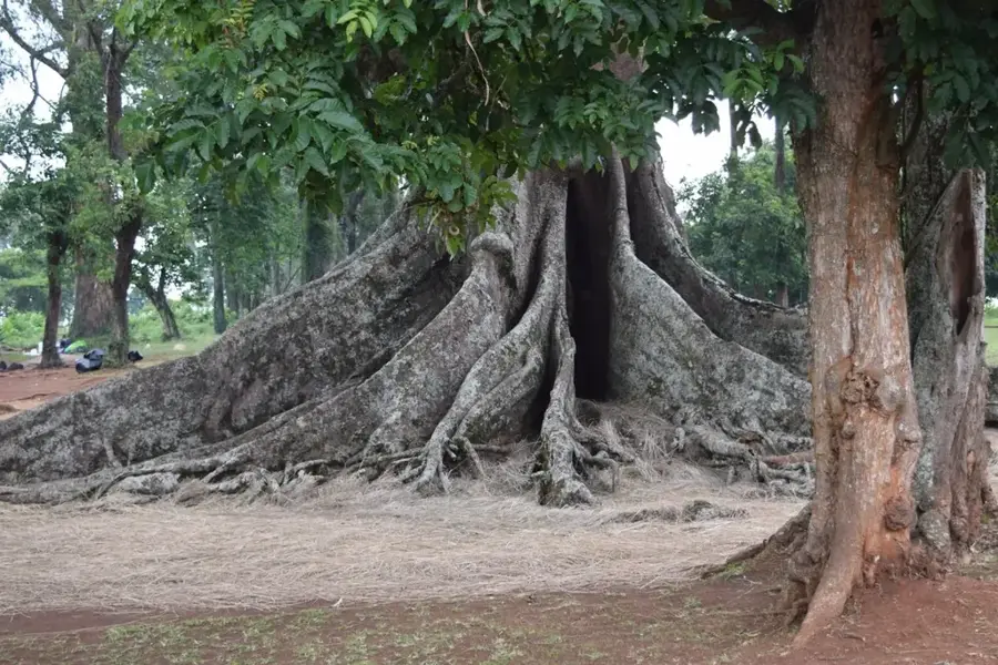
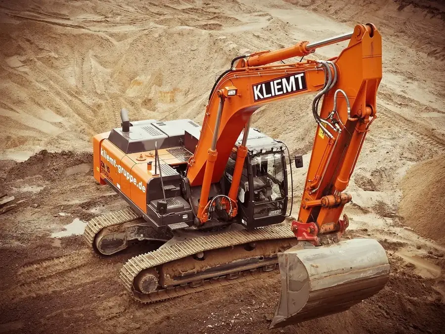
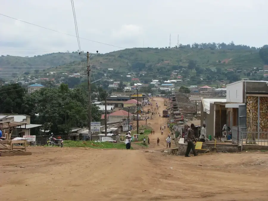
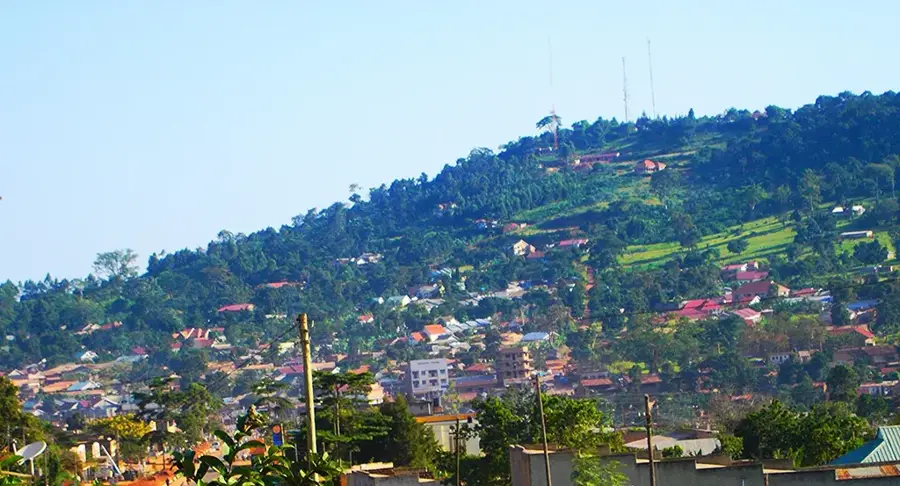
Mubende is a historically significant town located in the Central Region of Uganda, approximately 170 kilometers west of Kampala. The town is globally recognized for the Nakayima Tree, an ancient site estimated to be over 400 years old, which serves as a spiritual shrine tied to the pre-colonial Bacwezi Empire. Geographically, Mubende sits on a high plateau at an elevation of about 1,500 meters, granting the area a cooler climate compared to the surrounding lowlands. It functions as a vital commercial hub along the main highway connecting the capital to Fort Portal in the west. Economically, Mubende is heavily reliant on agriculture, with maize, beans, and coffee being the primary crops. In recent years, the discovery of gold deposits in the vicinity has driven significant economic activity and population growth. Additionally, the town is home to a major training wing of the Uganda People's Defence Force (UPDF). Mubende thus represents a unique intersection of ancient tradition and contemporary economic development.
- Location: Uganda
- Nearby: Mityana (72 km)
- Population: ~121.600 (2024)
Best time to visit & climate
The most pleasant time to visit is Jan, Jun, Jul.
| Jan | Feb | Mar | Apr | May | Jun | Jul | Aug | Sep | Oct | Nov | Dec | |
|---|---|---|---|---|---|---|---|---|---|---|---|---|
| Avg °C | 22 | 23 | 23 | 21 | 21 | 20 | 21 | 21 | 21 | 21 | 21 | 21 |
| Rain mm | 52 | 57 | 118 | 146 | 136 | 59 | 58 | 94 | 129 | 159 | 148 | 95 |
Geography
Facts
- The Nakayima Tree is a sacred site over 400 years old in Mubende.
- Mubende is located at an elevation of approximately 1,500 meters.
- It is a major transit point on the Kampala-Fort Portal highway.
- The surrounding district is known for recent gold mining activities.
- The town hosts a significant training installation for the UPDF.
- Mubende was established as a colonial administrative district in 1905.
Explore nearby
Notable places around
Route planner — Car & Motorhome
Where do you start? We build the route here, with stops and country notes along the way.
© OpenStreetMap contributors · OpenRouteService
Frequently asked questions
What are the main attractions in Mubende?
What is the climate like in Mubende?
Do I need a car to explore Mubende?
Are there accommodation options there?
What is the region around Mubende known for?
Mubende: where is it located?
Mubende: when is the best time to visit?
Mubende: why is it worth visiting?

Nearby cities
History & landmarks

Nature
More places