Plizio Visual Lab
Tyresta Plateau
Weather…
Water temperature…
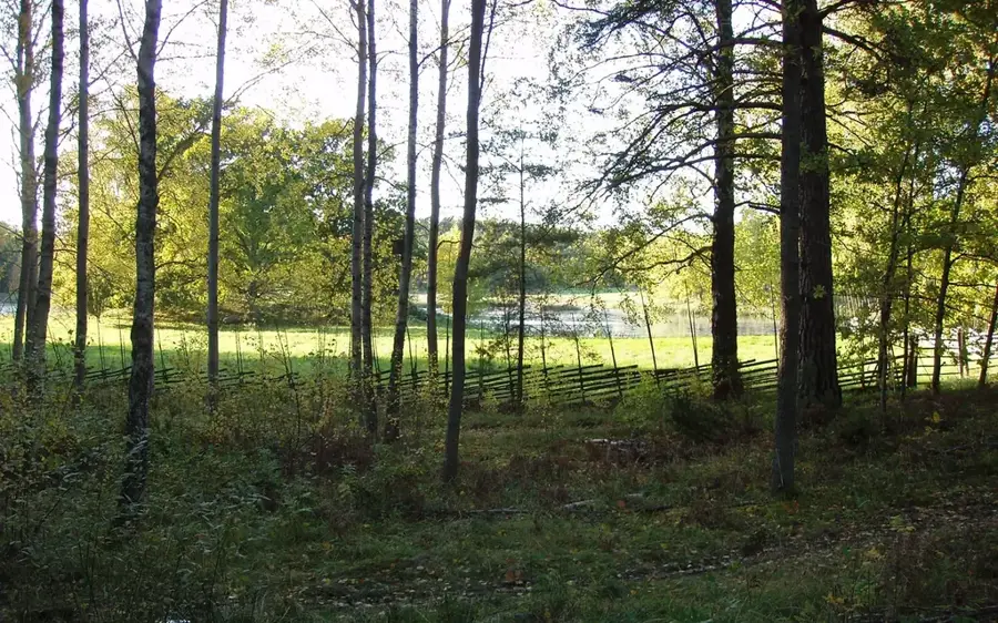
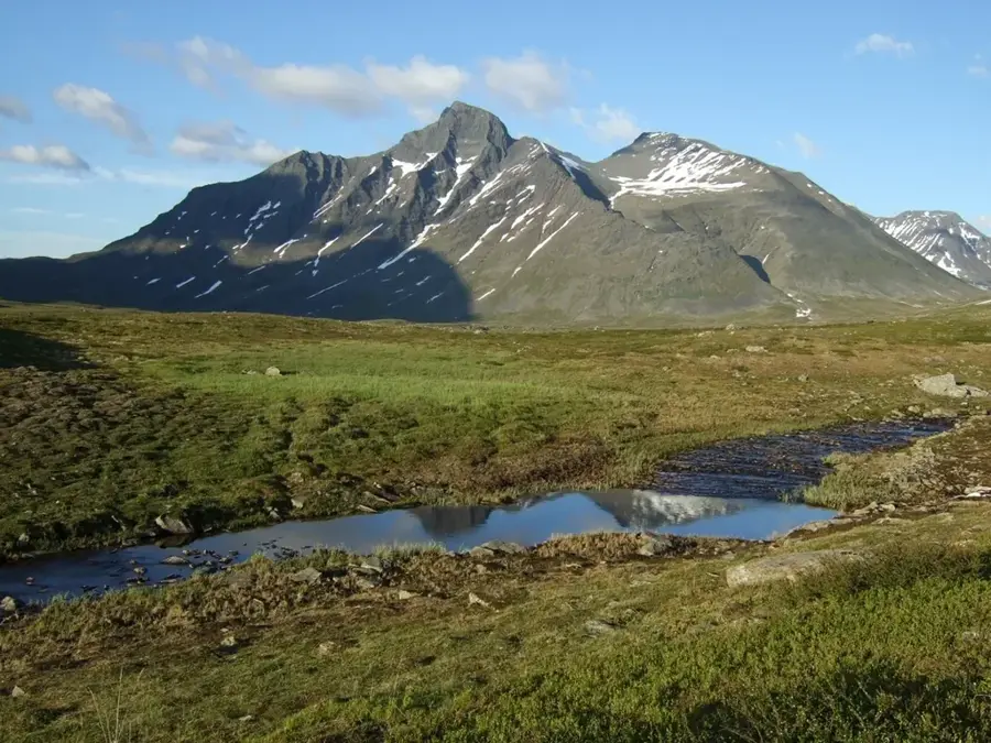
The Tyresta Plateau is located south of Stockholm and forms the heart of Tyresta National Park, which protects one of Sweden's best-preserved old-growth forest landscapes. Geologically, it is a Precambrian rift block that attained its current form through tectonic uplift and subsequent glacial erosion. The plateau is characterized by a mosaic of barren rocky ridges, moss-covered hollows, and small lakes such as Bylsjön. A defining event in its recent history was the massive forest fire in 1999, which destroyed approximately 450 hectares of woodland. Today, this burned area serves as an important open-air laboratory for studying natural forest regeneration and the survival of specialized insect species. The vegetation on the plateau is dominated by centuries-old Scots pines, many of which exceed 400 years of age. Due to its proximity to the Swedish capital, the area functions as an ecological lung and a crucial recreational zone for the metropolitan region.
- Location: Sweden
- Top sights: Runsten · Fornborg · Skolmuseet i Svartbäcken
- Nearby: Årsta havsbad (7 km)
Best time to visit & climate
The most pleasant time to visit is Jun–Aug.
| Jan | Feb | Mar | Apr | May | Jun | Jul | Aug | Sep | Oct | Nov | Dec | |
|---|---|---|---|---|---|---|---|---|---|---|---|---|
| Avg °C | -1 | -1 | 1 | 5 | 10 | 14 | 18 | 18 | 14 | 8 | 4 | 1 |
| Rain mm | 47 | 41 | 38 | 36 | 45 | 66 | 64 | 69 | 54 | 64 | 63 | 56 |
📋 Practical info
Geography
Facts
- Tyresta National Park was officially inaugurated in 1993.
- In August 1999, a devastating forest fire affected approximately 10% of the park's area.
- Some of the pine trees on the Tyresta Plateau are verified to be over 450 years old.
- The region is home to more than 8,000 documented species of beetles and other insects.
- The plateau ranges in elevation from 30 to 80 meters above sea level.
- Tyresta is part of a rift valley system that originated about 2 billion years ago.
Explore nearby
Notable places around
Route planner — Car & Motorhome
Where do you start? We build the route here, with stops and country notes along the way.
© OpenStreetMap contributors · OpenRouteService
Sights in the town Tyresta Plateau (5)
Bird tower
Birdwatching tower in Tyresta National Park.
Naturum Nationalparkernas hus🏛 museum
Visitor center and museum about Swedish national parks.
Sights nearby
Frequently asked questions
How close is Tyresta to Stockholm?
What can be seen after the 1999 fire?
Is there food available?
Are dogs allowed?
What is the Naturum?
Tyresta Plateau: where is it located?
Tyresta Plateau: what is there to see?
Tyresta Plateau: when is the best time to visit?
Tyresta Plateau: why is it worth visiting?

Nearby cities