Plizio Visual Lab
Nazca Lines
Weather…
Water temperature…
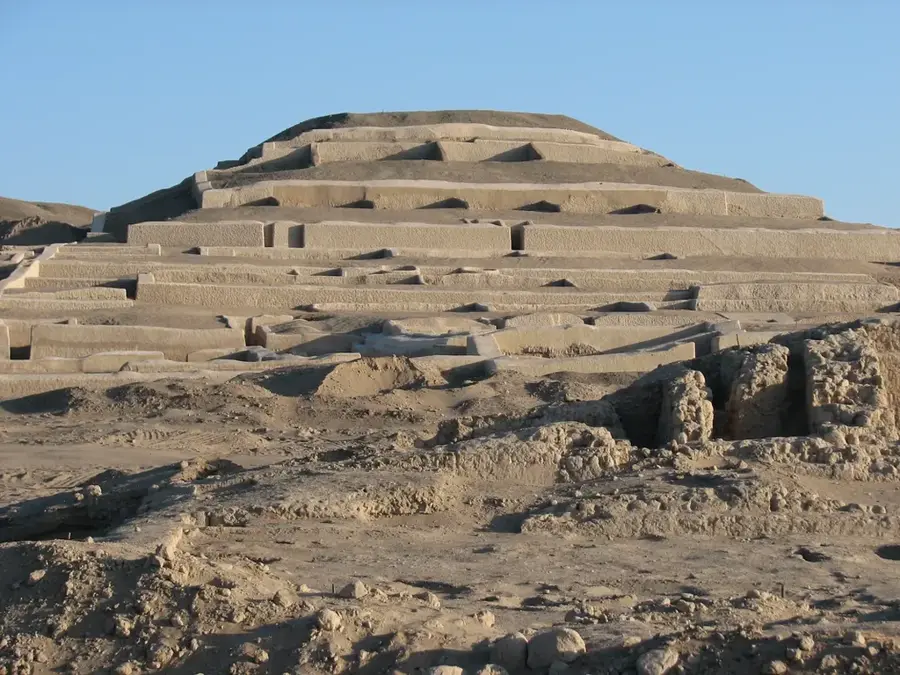
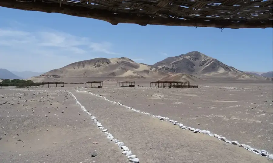
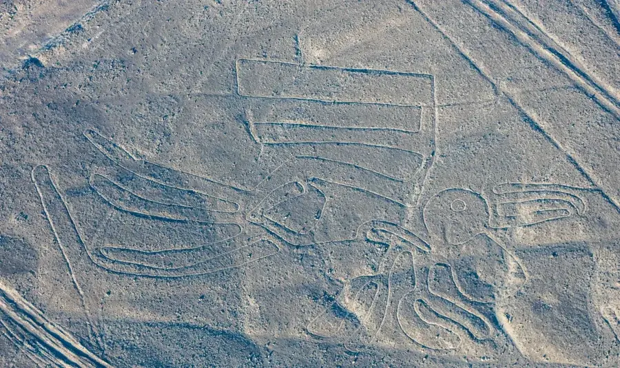
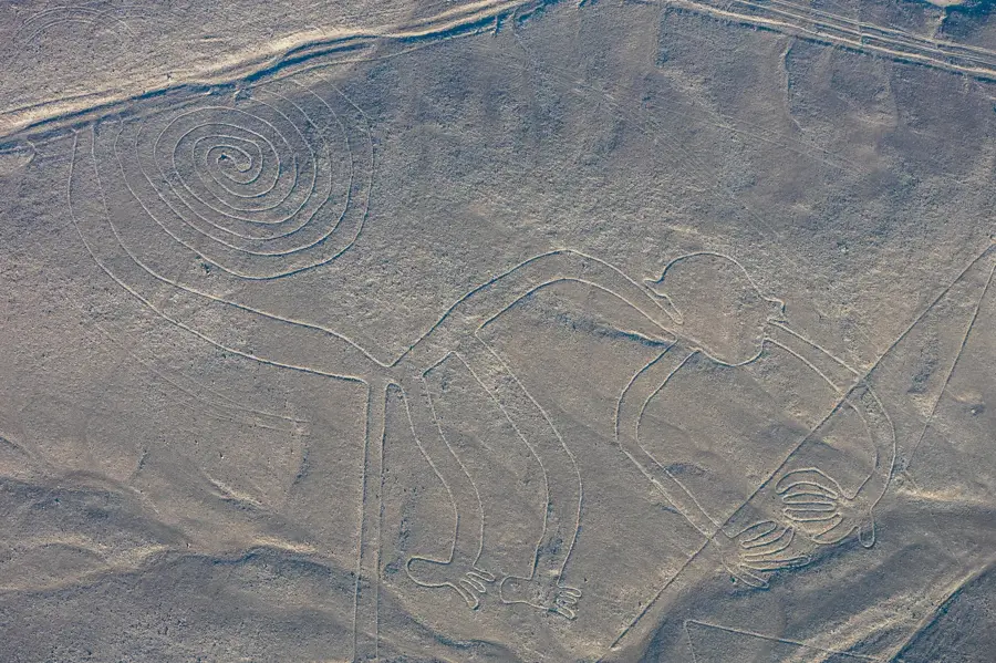
The Nazca Lines are a series of enormous geoglyphs etched into the soil of the Nazca Desert in southern Peru, created by the Nazca culture between 500 BC and 500 AD. Spanning an area of roughly 450 square kilometers, the site features hundreds of individual figures, ranging from simple geometric lines to complex zoomorphic shapes like a monkey, hummingbird, and spider. The lines were formed by removing the dark, iron-oxide coated pebbles from the desert surface to reveal the lighter-colored clay and lime subsoil underneath. Because of the hyper-arid, windless climate of the region, these fragile structures have remained remarkably preserved for over 1,500 years. Maria Reiche, a German mathematician, dedicated most of her life to documenting and protecting the lines, theorizing they served as an astronomical calendar. Since 1994, the Nazca Lines have been a UNESCO World Heritage site, and new figures continue to be discovered using modern satellite imaging and drones.
- Location: Peru
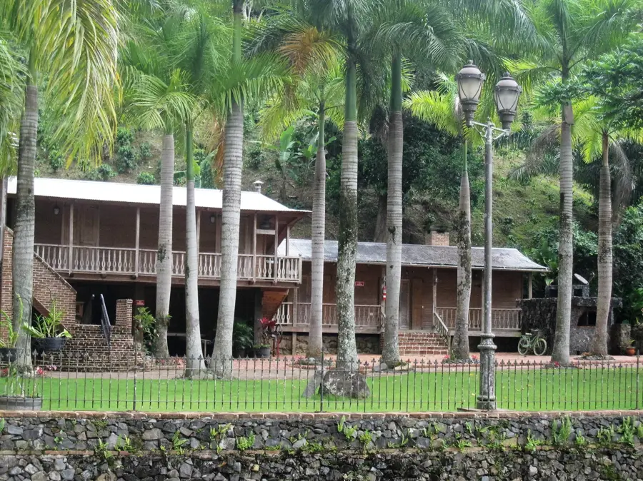
- Top sights: Monolítico · Serpiente Grande · Giant
- Nearby: Ica (69 km)
Best time to visit & climate
The most pleasant time to visit is Mar, Apr, Sep.
| Jan | Feb | Mar | Apr | May | Jun | Jul | Aug | Sep | Oct | Nov | Dec | |
|---|---|---|---|---|---|---|---|---|---|---|---|---|
| Avg °C | 19 | 19 | 19 | 19 | 18 | 18 | 17 | 18 | 18 | 18 | 18 | 18 |
| Rain mm | 23 | 22 | 19 | 5 | 6 | 1 | 3 | 2 | 4 | 8 | 12 | 21 |
📋 Practical info
Geography
Facts
- The geoglyphs cover an area of approximately 450 square kilometers.
- Some of the largest animal figures measure over 200 meters in length.
- They were created by the Nazca people between 500 BC and 500 AD.
- Maria Reiche studied and protected the site from 1940 until 1998.
- Over 300 distinct figures and thousands of lines have been identified so far.
- The Nazca Lines were designated a UNESCO World Heritage site in 1994.
Explore nearby
Notable places around
Route planner — Car & Motorhome
Where do you start? We build the route here, with stops and country notes along the way.
© OpenStreetMap contributors · OpenRouteService
Sights in the town Nazca Lines (5)
Sights nearby
Frequently asked questions
How to best see the Nazca lines?
Are the flights suitable for everyone?
Can you see the lines from the ground?
When is the best time to fly?
What is the best season?
Nazca Lines: where is it located?
Nazca Lines: what is there to see?
Nazca Lines: when is the best time to visit?
Nazca Lines: why is it worth visiting?

Nearby cities
History & landmarks

Nature
More places