Plizio Visual Lab
Rangrim Mountains

Weather…
Water temperature…
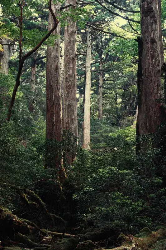
The Rangrim Mountains form the central backbone of the northern part of the Korean Peninsula, extending from the border with China down into South Hamgyong Province. This massive mountain range serves as a primary watershed, dividing the rivers that flow west into the Yellow Sea from those that flow east into the Sea of Japan. The highest peak in the range is Mount Rangrim, which reaches an elevation of 2,262 meters, and it is surrounded by several other summits exceeding 2,000 meters. The terrain is exceptionally rugged, characterized by steep slopes, deep valleys, and dense coniferous forests that harbor a variety of wildlife, including the endangered Siberian tiger and Himalayan black bear. Historically, the Rangrim Mountains served as a natural barrier and a strategic location for guerrilla activities during the Japanese colonial period and the Korean War. The region is rich in mineral resources, including timber, coal, and various ores, which are vital for North Korea's heavy industry. Due to its remote and difficult terrain, much of the range remains relatively untouched, serving as an important ecological corridor and a site for forestry research and conservation efforts.
- Location: North Korea
- Nearby: Kanggye (46 km)
Best time to visit & climate
The most pleasant time to visit is Jun, Aug, Sep.
| Jan | Feb | Mar | Apr | May | Jun | Jul | Aug | Sep | Oct | Nov | Dec | |
|---|---|---|---|---|---|---|---|---|---|---|---|---|
| Avg °C | -15 | -12 | -5 | 4 | 11 | 16 | 19 | 19 | 13 | 5 | -4 | -13 |
| Rain mm | 8 | 15 | 21 | 44 | 73 | 95 | 209 | 171 | 74 | 39 | 35 | 13 |
📋 Practical info
Geography
Facts
- Mount Rangrim is the highest peak, reaching 2,262 meters.
- The range acts as the main watershed divide of the peninsula.
- It is a habitat for endangered Siberian tigers and black bears.
- The mountains are rich in timber and various mineral ores.
- The area was a strategic site for guerrillas during World War II.
- The region is known for its harsh alpine climate and deep snow.
Explore nearby
Notable places around
Route planner — Car & Motorhome
Where do you start? We build the route here, with stops and country notes along the way.
© OpenStreetMap contributors · OpenRouteService
Sights nearby
Frequently asked questions
Where are the Rangrim Mountains located?
Are the mountains developed for tourism?
How high are the peaks?
What wildlife is found in the Rangrim Mountains?
What is the climate like there?
Rangrim Mountains: where is it located?
Rangrim Mountains: when is the best time to visit?
Rangrim Mountains: why is it worth visiting?

Nearby cities

Nature
More places