Plizio Visual Lab
Zambezi River
Weather…
Water temperature…
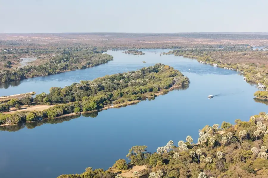
The Zambezi is the mightiest river in Southern Africa and shapes Mozambique's natural landscape over a distance of approximately 820 kilometers within national borders. It originates in Zambia and flows through Angola, Namibia, Botswana, and Zimbabwe before reaching Mozambique and discharging into the Indian Ocean. In Tete Province, the river is impounded by the Cahora Bassa Dam, which, with a surface area of 2,700 square kilometers, is one of the continent's largest reservoirs. The floodplains are of critical ecological importance, hosting elephants, hippopotamuses, and over 400 bird species. The Zambezi Delta is renowned for its extensive mangrove forests and serves as a nursery for shrimp and numerous fish species. Historically, the river was the lifeblood for the Monomotapa Empire and later a significant route for European expeditions. Today, the river is indispensable for power generation, transport, and large-scale agricultural irrigation. Its seasonally varying water levels directly influence the biodiversity in the surrounding national parks.
Best time to visit & climate
The most pleasant time to visit is Jun–Aug.
| Jan | Feb | Mar | Apr | May | Jun | Jul | Aug | Sep | Oct | Nov | Dec | |
|---|---|---|---|---|---|---|---|---|---|---|---|---|
| Avg °C | 27 | 27 | 26 | 25 | 23 | 22 | 21 | 23 | 26 | 28 | 29 | 28 |
| Rain mm | 257 | 174 | 184 | 80 | 30 | 33 | 53 | 9 | 16 | 37 | 74 | 225 |
📋 Practical info
Geography
Facts
- Total length of the Zambezi: approx. 2,574 km
- Surface area of Cahora Bassa Reservoir: 2,700 km²
- Fourth-longest river in Africa after the Nile, Congo, and Niger
- The delta stretches 100 km along the coast
- Primary power source for South Africa and Mozambique
- Home to the Zambezi shark (bull shark)
Explore nearby
Notable places around
Route planner — Car & Motorhome
Where do you start? We build the route here, with stops and country notes along the way.
© OpenStreetMap contributors · OpenRouteService
Sights nearby
Frequently asked questions
When is the best time to visit the Zambezi?
Can you boat on the Zambezi?
Are there crocodiles in the river?
Is swimming in the river safe?
Is a visa required for boat trips?
Zambezi River: where is it located?
Zambezi River: when is the best time to visit?
Zambezi River: why is it worth visiting?
