Plizio Visual Lab
Banhine National Park

Weather…
Water temperature…
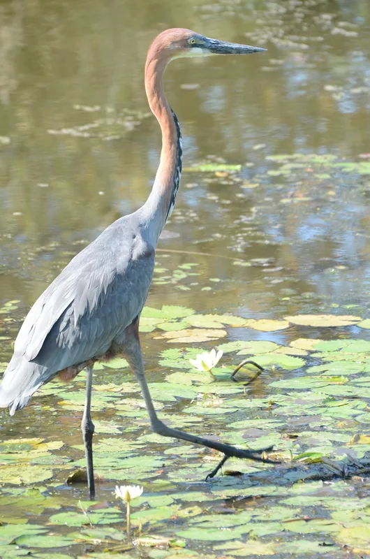
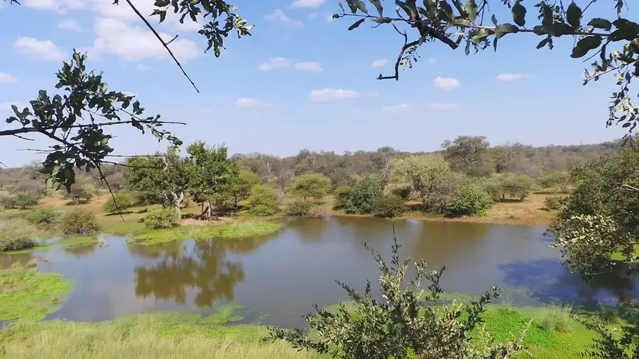
Banhine National Park is located in the northern part of Gaza Province in southern Mozambique, encompassing an area of approximately 7,000 square kilometers. Established on June 26, 1973, it is a critical component of the Great Limpopo Transfrontier Park ecosystem, serving as a biological bridge between Kruger and Gonarezhou national parks. The park's primary geographical feature is its extensive system of seasonal wetlands within the Banhine Basin, which trap and store rainwater for several months during the dry season. These wetlands provide a lifeline for a variety of wildlife, including ostriches, kudus, and reedbucks, and serve as a vital stopover for migratory birds. The vegetation is characterized by vast mopane woodlands and open grasslands adapted to the semi-arid climate. Although remote and less visited than other parks, Banhine's role in maintaining regional biodiversity is immense, particularly in regulating water cycles in the Limpopo drainage system. Conservation efforts are currently focused on protecting these unique hydrological features and monitoring animal populations to ensure long-term ecological stability.
Best time to visit & climate
The most pleasant time to visit is Jun–Aug.
| Jan | Feb | Mar | Apr | May | Jun | Jul | Aug | Sep | Oct | Nov | Dec | |
|---|---|---|---|---|---|---|---|---|---|---|---|---|
| Avg °C | 29 | 29 | 28 | 26 | 23 | 21 | 20 | 22 | 25 | 28 | 29 | 29 |
| Rain mm | 122 | 86 | 74 | 39 | 11 | 16 | 9 | 5 | 9 | 26 | 61 | 139 |
📋 Practical info
Geography
Facts
- Established as a national park on June 26, 1973.
- Spans an area of approximately 7,000 square kilometers.
- Features seasonal wetlands vital for dry-season survival.
- Component of the Great Limpopo Transfrontier Park.
- Important sanctuary for the African ostrich.
- Acts as a key hydrological reservoir for Gaza Province.
Explore nearby
Notable places around
Route planner — Car & Motorhome
Where do you start? We build the route here, with stops and country notes along the way.
© OpenStreetMap contributors · OpenRouteService
Sights nearby
Frequently asked questions
What characterizes Banhine?
Is the park suitable for beginners?
Is there a water supply?
How is the infrastructure?
What should I have with me?
Banhine National Park: where is it located?
Banhine National Park: when is the best time to visit?
Banhine National Park: why is it worth visiting?