Plizio Visual Lab
Barkéol
ℹ️Practical info — Barkéol
▾
🌤 Weather — 5 days
📍 Nearby
Sights nearby
💡 Tips
- Infrastructure is basic, so be prepared for a rustic experience in rural Mauritania.
- Carry plenty of water with you; the Sahelian climate is very dry and hot.
- The best way to get around town is on foot or by hiring local 4x4 vehicles.
- Greet locals with "Salaam Alaikum" and take time to sit for traditional mint tea.
- Bring your own basic medical supplies, as local healthcare facilities are limited.
🍽 Food
Found in small, family-run eateries.
Bought directly from vendors in the local market.
Served everywhere in three rounds, a key social ritual.
🛍 Shopping · 🧘 Quiet spots
A fascinating place to watch the trade of sheep, goats, and cattle.
Basic food supplies and regional agricultural produce.
Good for quiet nature observation, especially during the rainy season.
The shady spots where locals gather for tea and conversation.
Water temperature…
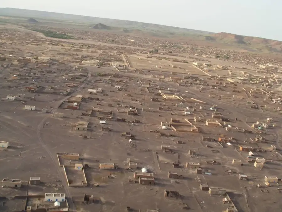
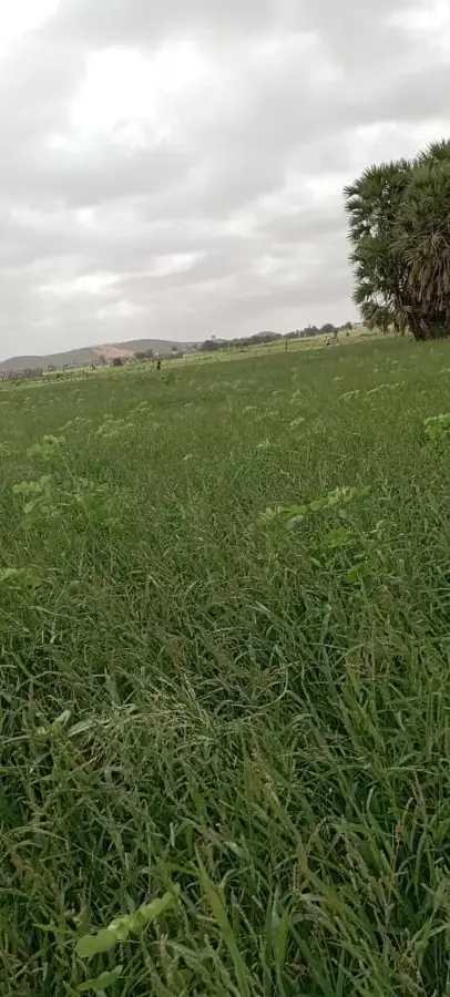
Barkéol is a key regional hub in the Assaba region of southern Mauritania. Unlike the mining centers of the north, life in Barkéol is deeply connected to the seasonal rhythms of agriculture and traditional livestock farming. The town is situated in a transitional zone that turns green during the rainy season, providing essential grazing lands for herds of cattle, sheep, and goats, which form the basis of the local economy. Barkéol serves as a vital market town for the surrounding rural communities, where grains such as millet and sorghum are traded alongside livestock products. The town's architecture reflects the traditional Sahelian style, featuring mud-brick buildings designed to mitigate the extreme heat. For visitors, Barkéol has an authentic glimpse into rural Mauritanian life, characterized by the enduring traditions of its semi-nomadic population and their resilience in an ecologically sensitive environment where the desert meets the savannah.
- Location: Mauritania
- Nearby: Kiffa-Nord (35 km)
Best time to visit & climate
The most pleasant time to visit is Jan, Feb, Dec.
| Jan | Feb | Mar | Apr | May | Jun | Jul | Aug | Sep | Oct | Nov | Dec | |
|---|---|---|---|---|---|---|---|---|---|---|---|---|
| Avg °C | 22 | 25 | 29 | 32 | 35 | 35 | 32 | 30 | 30 | 30 | 27 | 23 |
| Rain mm | 1 | 1 | 1 | 0 | 4 | 24 | 90 | 142 | 90 | 17 | 1 | 0 |
Geography
Facts
- Population: approximately 12,000.
- Elevation: 100 m above sea level.
- Annual rainfall: 450 mm.
- Distance from Kiffa: 60 km.
- Agricultural crops: millet and sorghum.
- Founded in the early 1900s.
Explore nearby
Notable places around
Route planner — Car & Motorhome
Where do you start? We build the route here, with stops and country notes along the way.
© OpenStreetMap contributors · OpenRouteService
Frequently asked questions
What kind of place is Barkéol?
How is the infrastructure?
When should I travel?
Are there accommodations?
What can be seen nearby?
Barkéol: where is it located?
Barkéol: when is the best time to visit?
Barkéol: why is it worth visiting?

Nearby cities