Plizio Visual Lab
Pic Boby
Weather…
Water temperature…
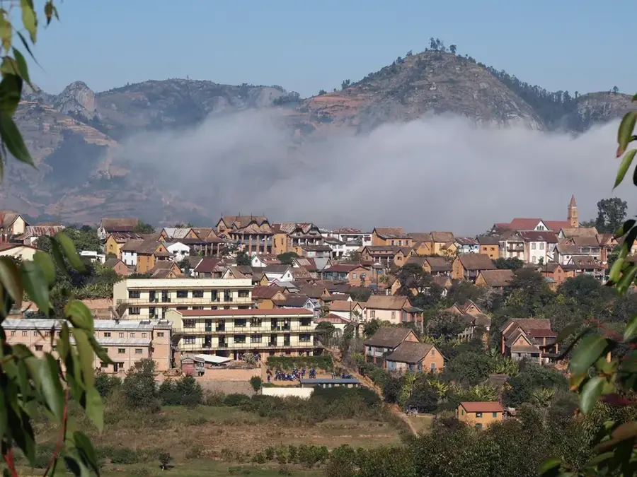
Pic Boby, officially known as Imarivolanitra, is the highest peak in the Andringitra Massif at 2,658 meters and the highest accessible hiking point in Madagascar. Located in the heart of Andringitra National Park, it gives some of the most memorable mountain scenery on the island. The summit consists of massive granite that has been sculpted into bizarre shapes by erosion over millions of years. The name 'Pic Boby' dates back to a French expedition in 1920, when the team's dog, named Boby, was reportedly the first to reach the summit. It was later renamed Imarivolanitra, which means 'close to the sky'. The ascent takes hikers through a surreal landscape of mountain heaths and succulent aloes, often shrouded in mist. On clear nights, the views from the summit are panoramic, though temperatures can drop significantly. Pic Boby stands as a symbol of Madagascar's pristine wilderness and is a premier destination for ecotourism, requiring good physical fitness for the trek.
- Location: Madagascar
- Top sights: Riandahy Falls · Rianbavy Falls
- Nearby: Ambalavao (23 km)
Best time to visit & climate
The most pleasant time to visit is Aug–Oct.
| Jan | Feb | Mar | Apr | May | Jun | Jul | Aug | Sep | Oct | Nov | Dec | |
|---|---|---|---|---|---|---|---|---|---|---|---|---|
| Avg °C | 21 | 21 | 20 | 19 | 17 | 15 | 14 | 15 | 17 | 19 | 21 | 22 |
| Rain mm | 367 | 296 | 250 | 113 | 87 | 73 | 73 | 40 | 35 | 84 | 170 | 256 |
📋 Practical info
Geography
Facts
- Highest hikeable peak at 2,658 meters
- Originally named after an expedition dog
- Granite formations are over 150 million years old
- Habitat for the rare Aloe andringitrensis
- Night temperatures can drop as low as -7°C
- Part of the world's second largest granite massif
Explore nearby
Notable places around
Route planner — Car & Motorhome
Where do you start? We build the route here, with stops and country notes along the way.
© OpenStreetMap contributors · OpenRouteService
Sights in the town Pic Boby (2)
Sights nearby
Frequently asked questions
Is Pic Boby easy to climb?
How long is the ascent?
What should I know about the view?
Is there accommodation at the base?
Is a guide mandatory?
Pic Boby: where is it located?
Pic Boby: what is there to see?
Pic Boby: when is the best time to visit?
Pic Boby: why is it worth visiting?

Nearby cities
History & landmarks
More places