Plizio Visual Lab
Tibesti Foothills
Weather…
Water temperature…
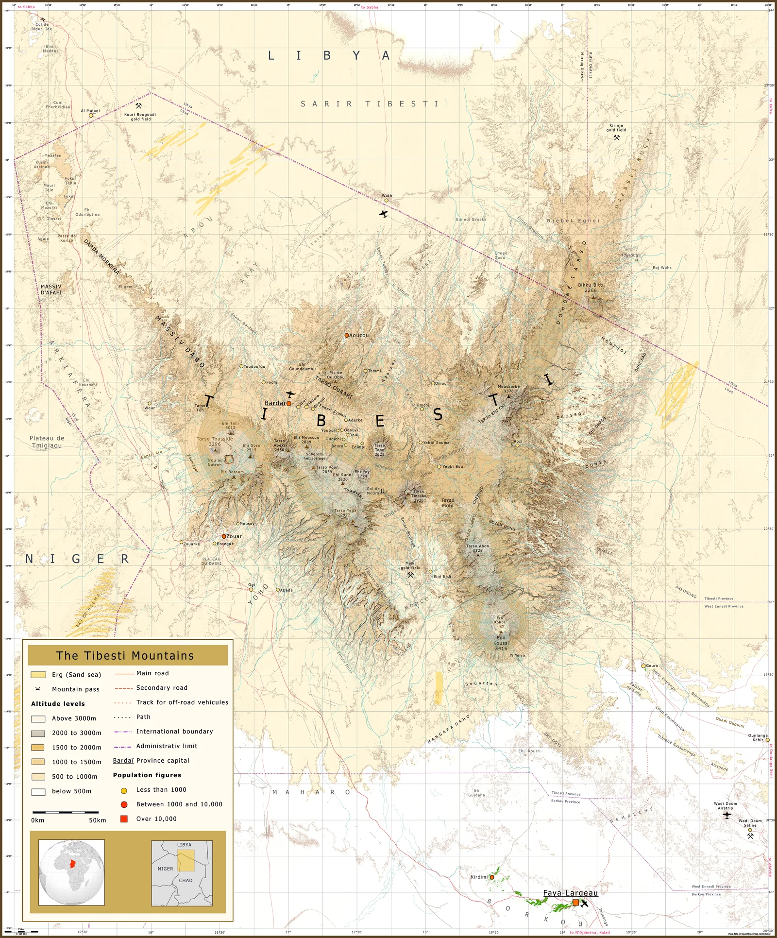
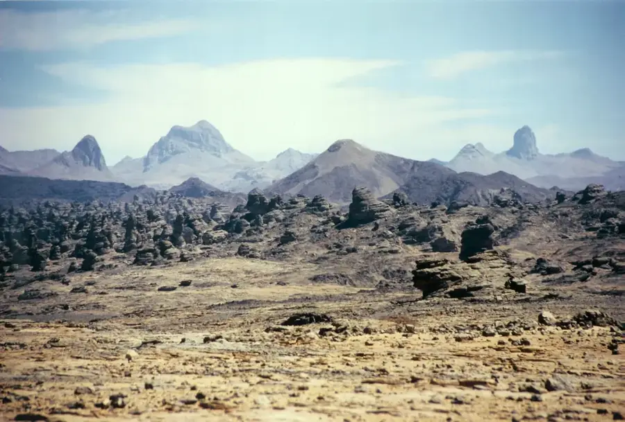
The Tibesti Foothills form the northern extension of the massive Tibesti Mountains, stretching deep into southern Libya across the Saharan landscape. This region is characterized by a dramatic scenery of rugged sandstone formations and volcanic remains, testifying to the turbulent geological past of North Africa and ancient tectonic activity. In this sparsely populated desert territory, significant prehistoric rock art has been discovered, proving that during the African Humid Period, the area supported a much more diverse flora and fauna. Current climatic conditions are extremely arid, with temperatures fluctuating between scorching daytime heat and freezing nights. Geomorphologically, the foothills are marked by deep wadis and broad plateaus shaped by rare but intense rainfall over thousands of years. For researchers, the Tibesti Foothills provide valuable insights into paleoclimatology and the migration patterns of early human populations across the Sahara. The strategic location near the border with Chad adds a geopolitical dimension to the region, while the physical geography continues to pose a significant challenge for modern scientific expeditions.
Best time to visit & climate
The most pleasant time to visit is Mar, Oct, Nov.
| Jan | Feb | Mar | Apr | May | Jun | Jul | Aug | Sep | Oct | Nov | Dec | |
|---|---|---|---|---|---|---|---|---|---|---|---|---|
| Avg °C | 14 | 17 | 21 | 26 | 30 | 31 | 31 | 31 | 29 | 25 | 20 | 15 |
| Rain mm | 0 | 0 | 1 | 0 | 2 | 1 | 0 | 5 | 0 | 0 | 0 | 0 |
📋 Practical info
Geography
Facts
- The foothills belong to the Tibesti Massif, which contains the highest peak in the Sahara.
- The area features basaltic plateaus and craters from extinct volcanic activity.
- Prehistoric rock engravings in the region date back to 8,000–5,000 BCE.
- Elevation in the Libyan portion typically ranges between 1,000 and 2,000 meters.
- The region is home to rare desert-adapted species such as the dorcas gazelle.
- Geologically, the area is composed of Precambrian crystalline rocks and Paleozoic sandstones.
Explore nearby
Notable places around
Route planner — Car & Motorhome
Where do you start? We build the route here, with stops and country notes along the way.
© OpenStreetMap contributors · OpenRouteService
Sights nearby
Frequently asked questions
How can you reach the Tibesti foothills?
When is the best time to visit?
What makes the landscape special?
Are there water sources available?
Is the region safe for tourists?
Tibesti Foothills: where is it located?
Tibesti Foothills: when is the best time to visit?
Tibesti Foothills: why is it worth visiting?