Plizio Visual Lab
Al-Haruj

Weather…
Water temperature…
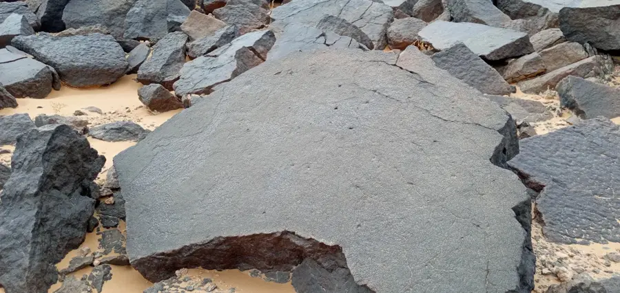
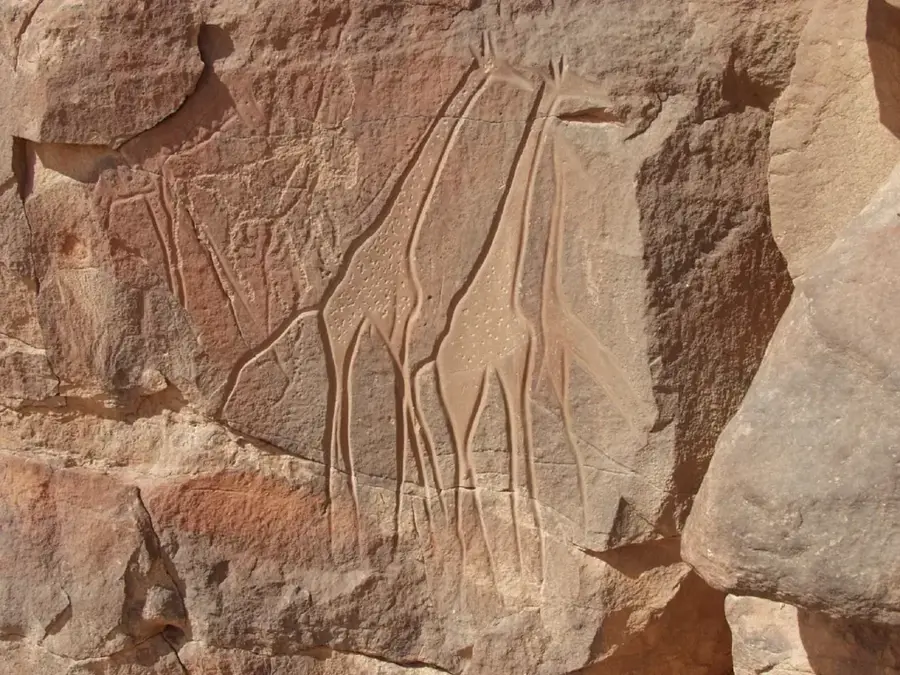
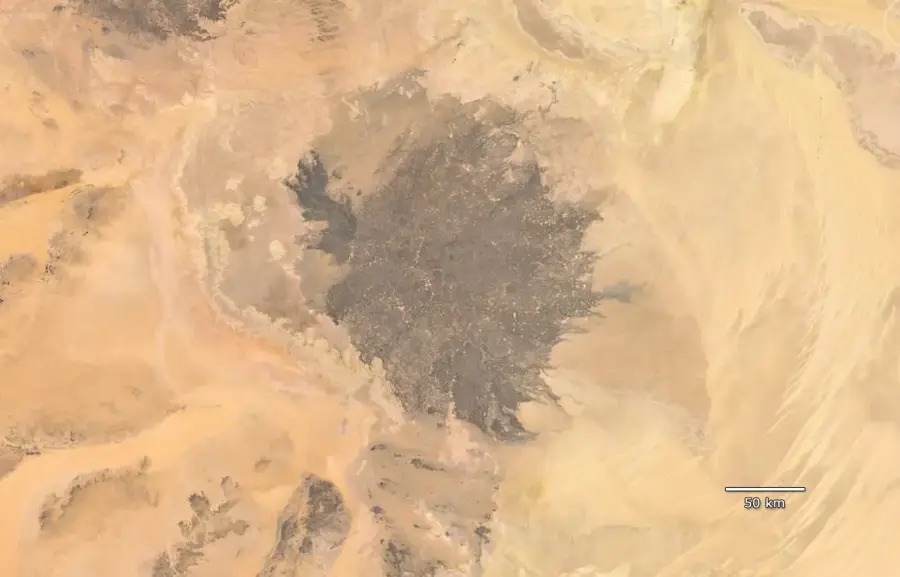
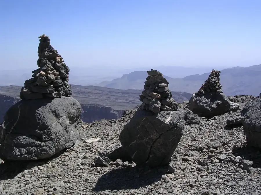
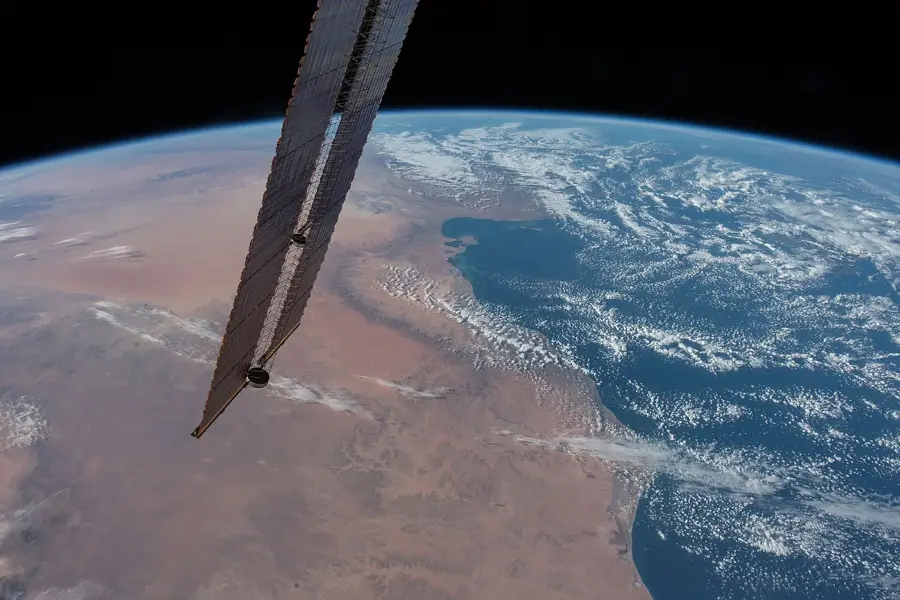
Al-Haruj is a massive volcanic field located in central Libya, striking for its vast expanse of black basalt rocks amidst the light-colored desert landscape. Covering an area of approximately 45,000 square kilometers, it ranks as one of the largest volcanic provinces in North Africa. The formation of this region is attributed to volcanic activity during the Tertiary and Quaternary periods, with the most recent eruptions occurring only a few thousand years ago. The landscape is dotted with hundreds of well-preserved volcanic cones, craters, and solidified lava flows that absorb sunlight, giving the region its characteristic name 'Haruj al-Aswad' (the Black Haruj). Geomorphologically, the plateau has a fascinating variety of volcanic forms, including shield volcanoes and scoria cones. Due to extreme aridity and the intense heat buildup on the dark rock, the area is almost entirely devoid of life and uninhabited. Nevertheless, it provides geologists with a unique opportunity to study intraplate tectonic processes and the magmatic evolution of the African continent. Archaeological finds at the margins of the field suggest the region was intermittently traversed by hunter-gatherers in earlier times.
Best time to visit & climate
The most pleasant time to visit is Mar, Apr, Oct.
| Jan | Feb | Mar | Apr | May | Jun | Jul | Aug | Sep | Oct | Nov | Dec | |
|---|---|---|---|---|---|---|---|---|---|---|---|---|
| Avg °C | 10 | 13 | 17 | 22 | 26 | 29 | 30 | 30 | 28 | 23 | 17 | 12 |
| Rain mm | 8 | 5 | 3 | 2 | 4 | 1 | 0 | 1 | 9 | 5 | 5 | 8 |
📋 Practical info
Geography
Facts
- The field comprises approximately 150 individual volcanic and scoria cones.
- It is the largest basaltic plateau in North Africa, covering 45,000 km².
- The highest elevation is Jebel al-Qatrun, reaching 1,200 meters.
- Some lava flows extend for hundreds of kilometers across the desert.
- Radiometric dating indicates some lava flows are only about 3,000 years old.
- The basalt's dark color causes ground temperatures to rise above 60°C.
Route planner — Car & Motorhome
Where do you start? We build the route here, with stops and country notes along the way.
© OpenStreetMap contributors · OpenRouteService
Sights nearby
Frequently asked questions
What is Al-Haruj?
When was the last volcanic eruption?
What does the landscape look like?
Can the area be visited?
Where is it located?
Al-Haruj: where is it located?
Al-Haruj: when is the best time to visit?
Al-Haruj: why is it worth visiting?