Plizio Visual Lab
Cavalla River Valley

Weather…
Water temperature…
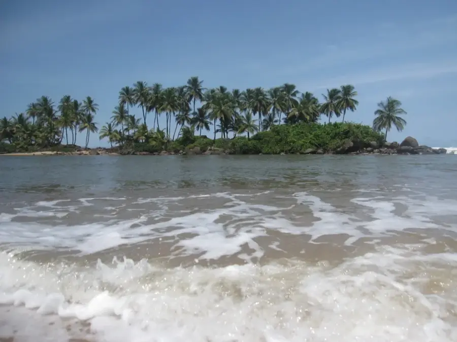
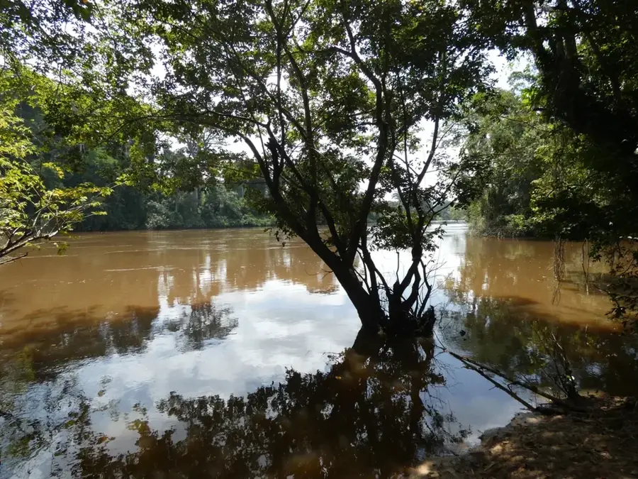
The Cavalla River Valley is defined by the winding course of the Cavalla River, which at 515 kilometers is the longest river in Liberia. It marks the sovereign border between Liberia and neighboring Ivory Coast, functioning as both a geographical barrier and a cultural bridge. The valley's terrain is predominantly low-lying and covered with fertile alluvial deposits, which have fostered the growth of massive rubber, coffee, and cocoa plantations. Historically, the river was the primary artery for trade in the southeastern provinces, with large canoes and small vessels transporting goods to the coast. The valley's ecosystem is exceptionally rich, comprising primary rainforest and seasonal wetlands that support diverse bird species and aquatic life. Cultural heritage remains strong in the valley, with indigenous Kru and Grebo communities maintaining traditional fishing practices and spiritual connections to the river. Navigation can be complex due to seasonal water level fluctuations, yet the river remains an essential lifeline for transport and commerce in this remote part of West Africa.
- Location: Liberia
- Nearby: Pleebo Trading Post (20 km)
Best time to visit & climate
The most pleasant time to visit is Jan, Aug, Dec.
| Jan | Feb | Mar | Apr | May | Jun | Jul | Aug | Sep | Oct | Nov | Dec | |
|---|---|---|---|---|---|---|---|---|---|---|---|---|
| Avg °C | 26 | 27 | 27 | 27 | 27 | 26 | 25 | 24 | 25 | 26 | 26 | 26 |
| Rain mm | 59 | 87 | 125 | 139 | 242 | 389 | 173 | 127 | 199 | 201 | 116 | 67 |
📋 Practical info
Geography
Facts
- The Cavalla River is 515 km long.
- The valley extends 200 km in length.
- Valley width is 10-30 km.
- Elevation ranges from 100 to 400 m.
- Annual rainfall is 2,000 mm.
- Gold reserves estimated at 50,000 ounces.
Explore nearby
Notable places around
Route planner — Car & Motorhome
Where do you start? We build the route here, with stops and country notes along the way.
© OpenStreetMap contributors · OpenRouteService
Sights nearby
Frequently asked questions
What is the Cavalla Valley?
What is the valley known for?
Can you travel by boat on the river in the valley?
How is the climate in the valley?
Are there border crossings in the valley?
Cavalla River Valley: where is it located?
Cavalla River Valley: when is the best time to visit?
Cavalla River Valley: why is it worth visiting?

Nearby cities


History & landmarks

Nature
More places