Plizio Visual Lab
Aksu
ℹ️Practical info — Aksu
▾
🌤 Weather — 5 days
📍 Nearby
Sights nearby
💡 Tips
- Expect a heavily industrial atmosphere and variable air quality.
- Use taxis as the most convenient way to get around the city.
- Dress in very warm layers during winter, as temperatures can drop drastically.
- Take a trip to the nearby Irtysh River to escape the factory scenery.
🍽 Food
Try the Kazakh national dish in traditional restaurants located in the city center.
You can find freshly grilled meat skewers at small stands near the local markets.
Buy this fried dough from local bakeries while it's still fresh and warm.
🛍 Shopping · 🧘 Quiet spots
This is the place to buy fresh fruits, vegetables, and Central Asian spices.
For daily necessities and imported goods, larger supermarkets are your best bet.
Take a walk along the river to enjoy some nature away from the factories.
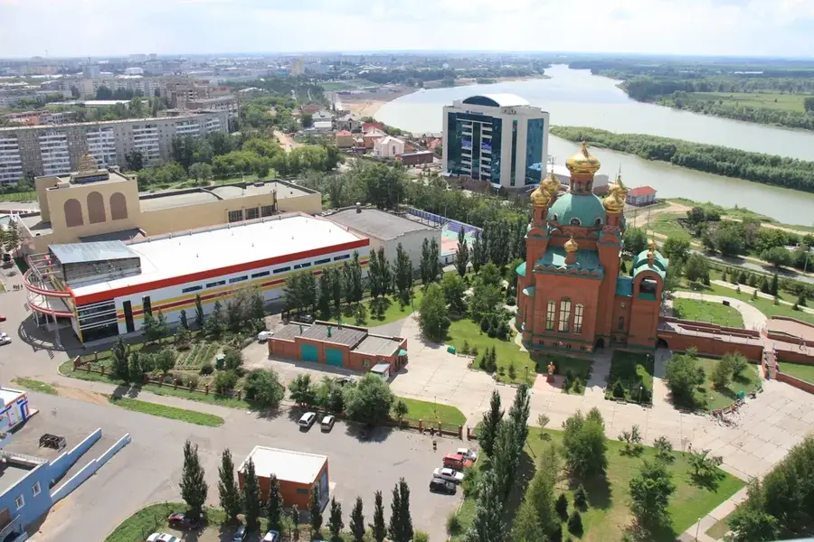
A green sanctuary in the middle of this heavily industrial town.
Water temperature…
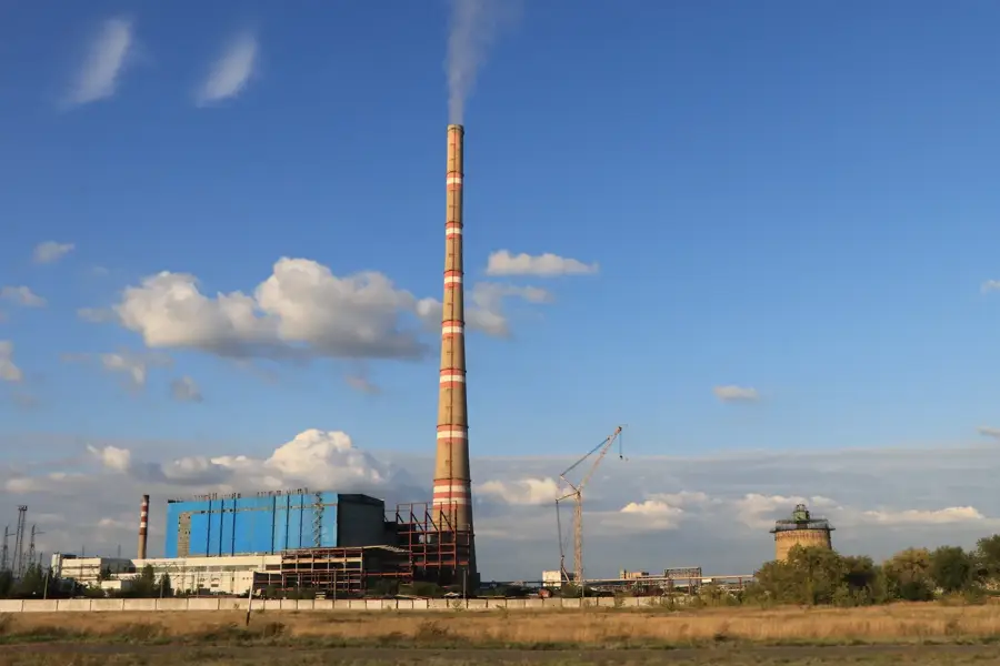
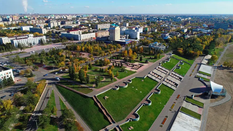
Aksu is an industrial city in the Pavlodar Region of northeastern Kazakhstan, situated on the left bank of the Irtysh River. Founded in 1897 as the settlement of Glinka, it was known as Yermak from 1961 until 1993, when it was renamed Aksu, meaning 'white water' in Kazakh. During the latter half of the 20th century, Aksu emerged as a prominent center of heavy industry, largely due to the Aksu Ferroalloy Plant, which remains one of the largest facilities of its kind globally. Another critical economic pillar is the Aksu Power Station, a key energy provider for the entire northern region of Kazakhstan. The city serves as a strategic infrastructure hub, as it marks the starting point of the Irtysh, Karaganda Canal, which supplies water to the central steppe regions. Geographically, Aksu is located in a flat steppe landscape characterized by an extreme continental climate with hot summers and frigid winters. In recent years, significant efforts have been made to modernize the city and enhance the quality of life through new parks and social amenities.
- Location: Kazakhstan
- Top sights: Zhertvam politicheskikh repressii · Satpaev K.I. · Myachik
- Nearby: Pavlodar (7 km)
- Population: ~44.808 (2022)
Best time to visit & climate
The most pleasant time to visit is Jun–Aug.
| Jan | Feb | Mar | Apr | May | Jun | Jul | Aug | Sep | Oct | Nov | Dec | |
|---|---|---|---|---|---|---|---|---|---|---|---|---|
| Avg °C | -18 | -15 | -5 | 7 | 15 | 21 | 22 | 20 | 13 | 4 | -5 | -14 |
| Rain mm | 15 | 14 | 21 | 21 | 25 | 39 | 48 | 32 | 21 | 26 | 24 | 21 |
Geography
Facts
- The city was officially known as Yermak from 1961 to 1993.
- The Aksu Ferroalloy Plant produces more than one million tons annually.
- The 450 km long Irtysh–Karaganda Canal originates in Aksu.
- The city is located approximately 50 kilometers south of Pavlodar.
- The Aksu Power Station is one of the most powerful in Kazakhstan.
- The settlement was originally established by migrants from Ukraine.
Explore nearby
Notable places around
Route planner — Car & Motorhome
Where do you start? We build the route here, with stops and country notes along the way.
© OpenStreetMap contributors · OpenRouteService
Sights in the town Aksu (6)
Frequently asked questions
Where is Aksu located?
What is the most important industry in Aksu?
What was the former name of the city?
Are there natural sights nearby?
How to reach Aksu?
Aksu: where is it located?
Aksu: what is there to see?
Aksu: when is the best time to visit?
Aksu: why is it worth visiting?