Plizio Visual Lab
Grindavík Port

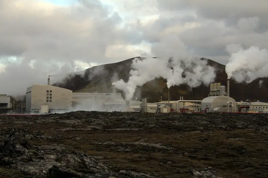
Grindavík Port, located on the southern coast of the Reykjanes Peninsula, is historically one of Iceland's most productive and vital fishing hubs. It plays a pivotal role in the national economy, handling a significant portion of the country's total fish catch, particularly Atlantic cod, which is processed in local facilities. The town and its harbor are closely integrated with the nearby Svartsengi Power Station, utilizing geothermal heat for industrial fish drying and processing. In 2023 and 2024, the port faced unprecedented challenges due to intense volcanic activity, where earthquakes and lava flows threatened infrastructure and led to the evacuation of the community. Despite these geological disruptions, the harbor remains a symbol of resilience, with ongoing efforts to maintain operations and secure the facilities. The port area includes specialized shipyards for vessel maintenance and state-of-the-art export logistics centers. Its strategic proximity to rich North Atlantic fishing grounds ensures Grindavík remains a key contributor to the global seafood market. Current reconstruction and protection projects are focused on stabilizing the quays and restoring critical transport links to ensure future economic viability.
- Location: Iceland
- Top sights: Sundlaug Grindavíkur · Reykjanes awakens · Kvikan
- Nearby: Blue Lagoon (Grindavík) (4 km)
Best time to visit & climate
The most pleasant time to visit is Jun–Aug.
| Jan | Feb | Mar | Apr | May | Jun | Jul | Aug | Sep | Oct | Nov | Dec | |
|---|---|---|---|---|---|---|---|---|---|---|---|---|
| Avg °C | 1 | 1 | 2 | 4 | 6 | 9 | 11 | 11 | 8 | 5 | 3 | 2 |
| Rain mm | 154 | 136 | 138 | 106 | 83 | 72 | 85 | 109 | 161 | 131 | 137 | 154 |
📋 Practical info
Geography
Facts
- Grindavík accounts for approximately 5% of Iceland's total annual fish catch.
- The port is a leading center for the production and export of salted fish.
- Lava flows directly threatened the eastern docks during the 2024 eruptions.
- The harbor infrastructure was significantly damaged by seismic activity in 2023.
- Grindavík was an early adopter of electronic fish auction systems in Iceland.
- The harbor is located just 5 kilometers from the world-famous Blue Lagoon.
Explore nearby
Notable places around
Route planner — Car & Motorhome
Where do you start? We build the route here, with stops and country notes along the way.
© OpenStreetMap contributors · OpenRouteService
Sights in the town Grindavík Port (6)
Hópsnes
Lighthouse in Iceland.
Þorbjörn
Mountain in Iceland.
Sights nearby
Frequently asked questions
What is the significance of Grindavík Port?
Is the Blue Lagoon near the port?
Can you buy fresh fish there?
Is the port accessible to tourists?
What is the current situation regarding volcanic eruptions?
Grindavík Port: where is it located?
Grindavík Port: what is there to see?
Grindavík Port: when is the best time to visit?
Grindavík Port: why is it worth visiting?

Nearby cities