Plizio Visual Lab
East Mani
ℹ️Practical info — East Mani
▾
🌤 Weather — 5 days
📍 Nearby
Sights nearby
💡 Tips
- The summer sun is fierce and shade is rare; always pack extra water and a strong hat.
- Rent a small car, as the village roads winding between the stone tower houses are extremely narrow.
- Visit the nearly abandoned tower village of Vathia at golden hour for dramatic photography.
- Carry cash, as some of the more remote coastal tavernas might not have reliable card machines.
🍽 Food
A local Mani specialty that you must try in the traditional tavernas in Areopoli.
Crispy fried dough loops, a well-suited walking snack picked up from local bakeries.
Enjoy the fresh catch of the day at the welcoming coastal tavernas in Limeni or Gythio.
🛍 Shopping · 🧘 Quiet spots
The region is famous for its oil; buy it direct from local producers or at markets in Gythio.
Harvested directly from the rocky coast, available in specialty local product shops in Areopoli.
Take a quiet hike down to the southernmost lighthouse of mainland Europe.
Enjoy the peaceful waters early in the morning before the tour buses arrive for the caves.
Water temperature…
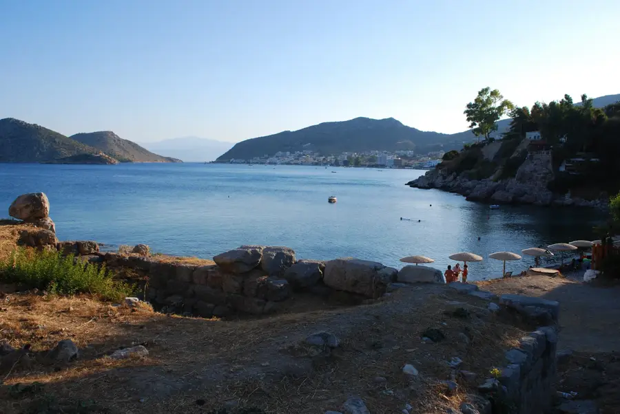
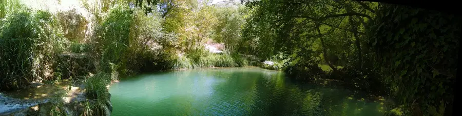
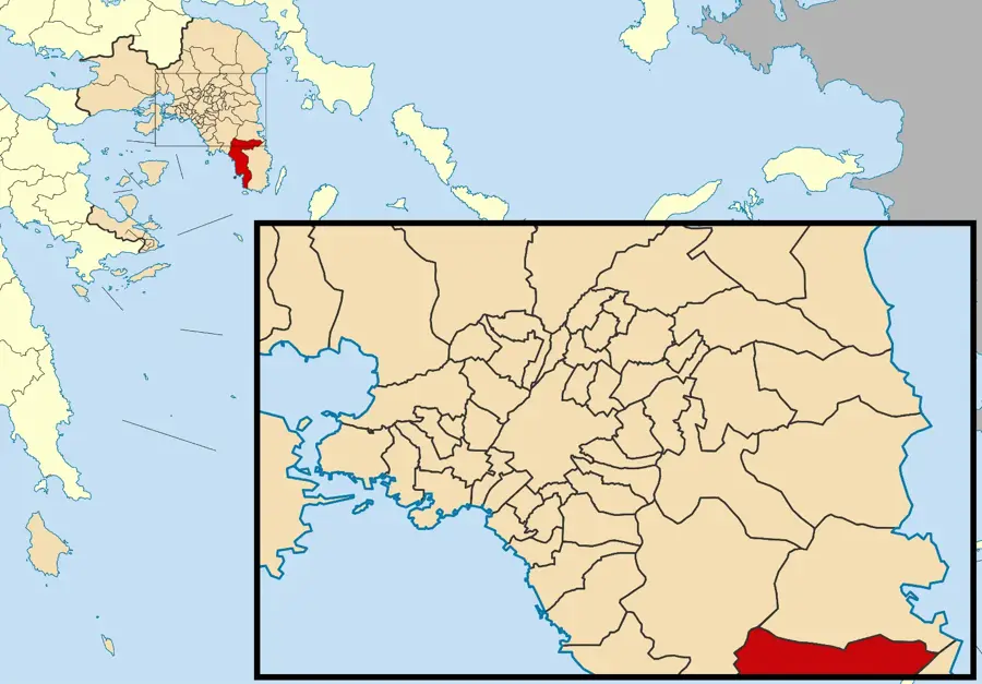
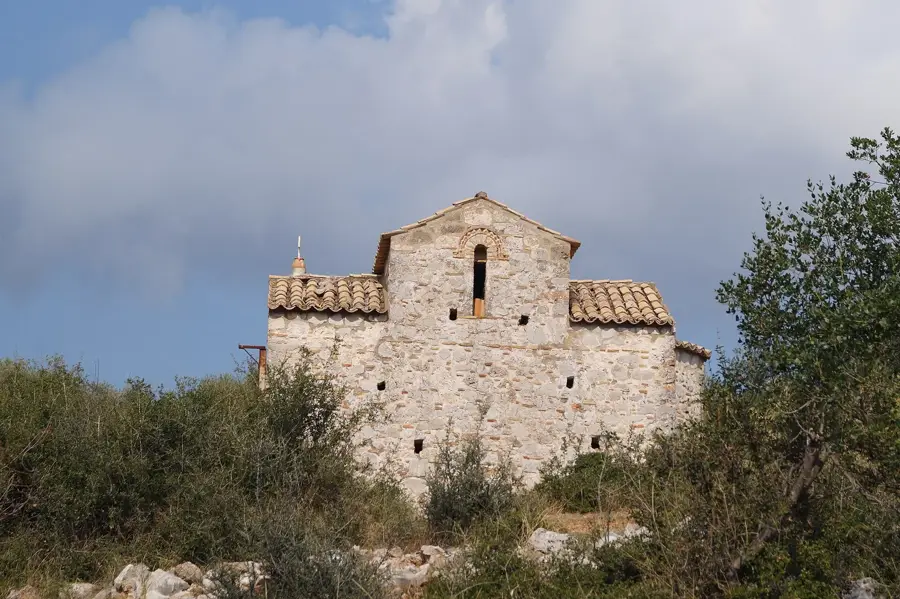
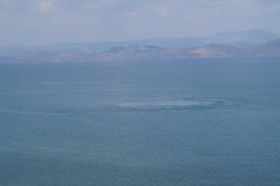
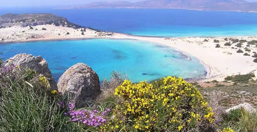
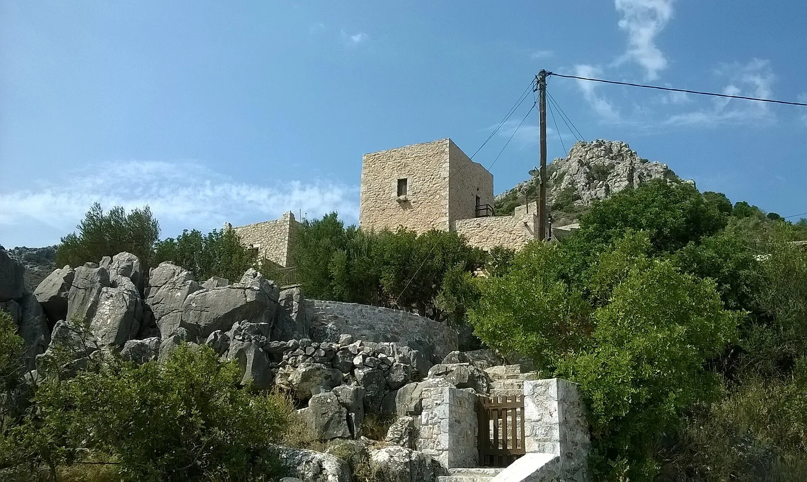
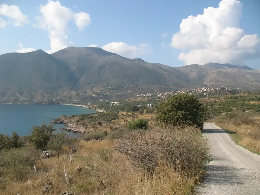
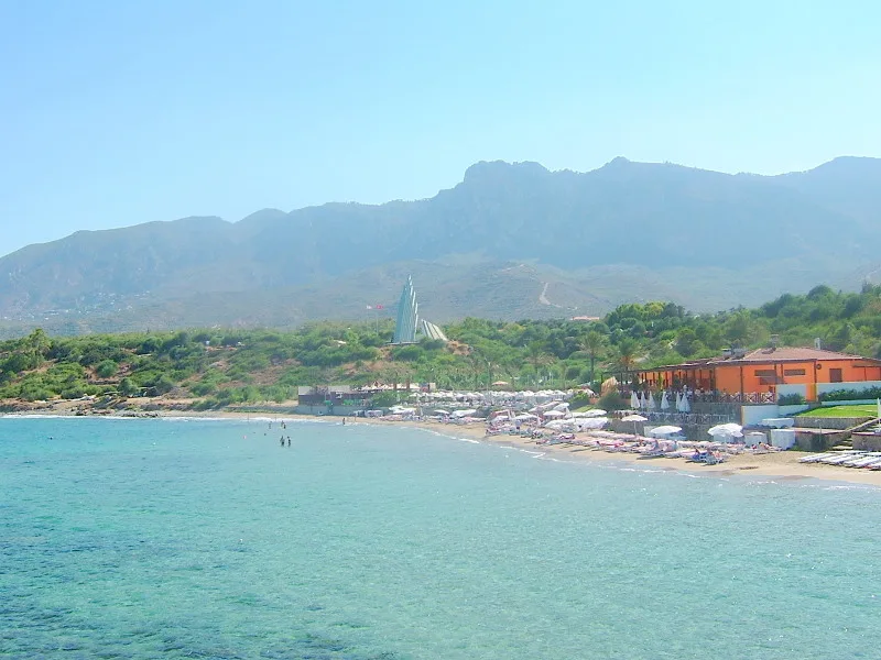
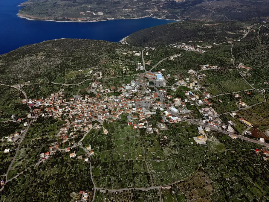
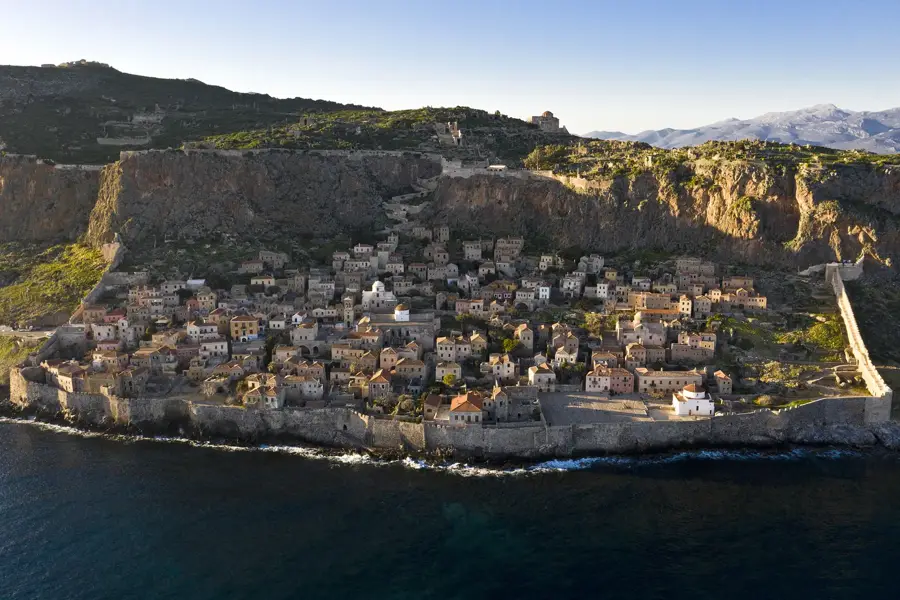
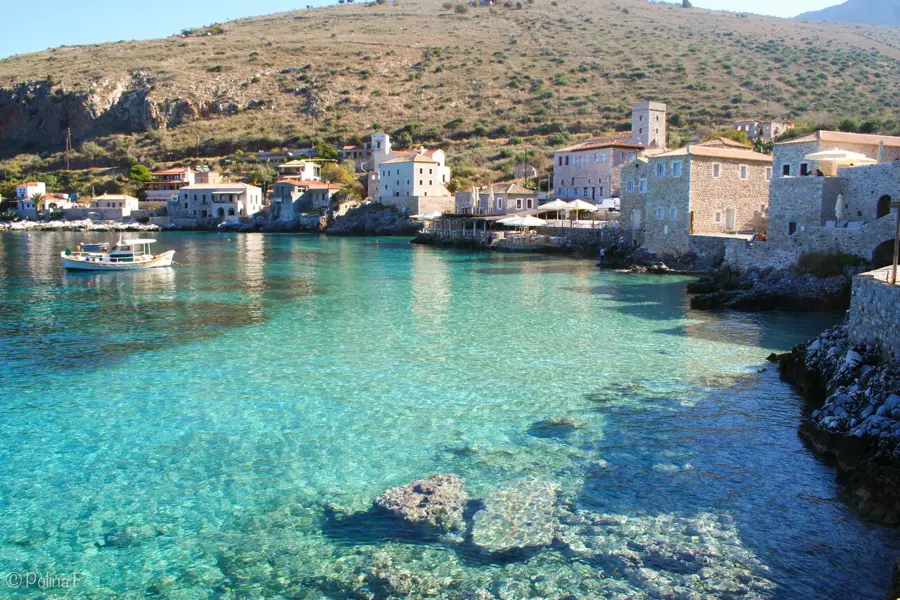
East Mani spans the sun-baked, rocky eastern coastline of the Mani Peninsula, extending down to the southernmost tip of mainland Greece at Cape Matapan. This is a region defined by its austere beauty, where imposing stone tower houses stand as monuments to a clan-based historical society. The dramatic plunge of the Taygetos mountains into the Laconian Gulf creates a coastline of spectacular coves and deep waters. The beaches here are often unorganized and ruggedly beautiful. Visitors can seek out the deep bay of Porto Kagio near the peninsula's end, or relax on the sands of Marmari. The eastern shores offer excellent swimming spots like Kotronas beach, Chalikia Vata, Skopa, and the tranquil Romaiki Paralia. Beaches such as Agia Barbara and Androgyalos provide solitary escapes surrounded by sun-drenched scrubland and ancient olives. The local culinary scene is heavily influenced by the harsh yet bountiful land, featuring robust olive oil, wild herbs, and simple, high-quality seafood caught fresh daily. Exploring East Mani means driving along winding coastal roads, discovering tiny fishing hamlets, and experiencing a side of Greece that feels entirely untouched by mass tourism.
- Location: Greece
- Top sights: Romaike Paralia · Purgos Gregorake · Skourka
- Nearby: Exo Nymfio (16 km)
- Population: ~19
Geography
Facts
- Located on the Mani Peninsula
- Part of the Peloponnese region
- Famous for traditional stone tower houses
- Reaches the southernmost point of mainland Greece
- Porto Kagio is a well-sheltered natural bay
- Features arid, mountainous coastal terrain
- Historically known for an independent, warrior society
- Kotronas is the largest coastal settlement on the east side
Explore nearby
Notable places around
Route planner — Car & Motorhome
Where do you start? We build the route here, with stops and country notes along the way.
© OpenStreetMap contributors · OpenRouteService
Start your morning at the very edge of the continent, exploring the ancient ruins of Tainaron and the nearby archaeological museum. By midday, walk to the mythical Cave of Hades, soaking in the eerie but fascinating history of the area. The afternoon is reserved for true relaxation as you hike over to the secluded Romaike Paralia. End the day walking up to Skourka for a magnificent sunset view.
Ancient Tainaron
Archeological Museum of ancient Tainaron
Entrance to Hades
Romaike Paralia
Skourka
A rainy morning at Cape Tainaron. We start among ancient ruins where slippery stones demand careful steps and waterproof boots. At noon, the museum provides a dry sanctuary. The afternoon leads us toward the cave and beach, watching the crashing waves. The day ends quietly with the steady rhythm of rain falling over the rugged cliffs of the Mani peninsula.
Ancient Tainaron
Archeological Museum of ancient Tainaron
Entrance to Hades
Romaike Paralia
Skourka
A crisp breeze at the southernmost tip. The morning starts fresh at the ruins, which glow golden in the winter light. At noon, we warm up inside the museum. The afternoon walk to the cave is windy, but the clear air is refreshing. By 17:00, the sun sets quickly, and we conclude our trek at Skourka in the peaceful silence of the off-season.
Ancient Tainaron
Archeological Museum of ancient Tainaron
Entrance to Hades
Romaike Paralia
Skourka
Begin your cycling trip amidst the rugged natural beauty of Skourka, taking in the morning breeze. Ride south to Marmari to enjoy its golden sands and clear waters for a midday break. In the afternoon, pedal past the historic stone towers of Purgos Gregorake toward the coastal charm of Porto Kagio. Conclude your active day by cycling up to the impressive Castle of Porto Kayio overlooking the bay.
Skourka
Marmari
Purgos Gregorake
Porto Kagio
Castle of Porto Kayio
Cycling through the Mani rain. The day starts at Skourka with gusty winds making pedaling challenging. By noon, we reach Marmari, taking a break under cover. The ride to Porto Kagio involves wet asphalt, requiring extra caution. The day ends at the castle, where mist swirls mystically around the ancient stone walls.
Skourka
Marmari
Purgos Gregorake
Porto Kagio
Castle of Porto Kayio
A winter cycling adventure. The morning at Skourka is freezing, but the clear visibility lets you spot the distant Cyclades. By midday, Marmari is quiet and peaceful. The ride to Porto Kagio benefits from the mild noon sun. At 15:00, we climb to the castle for the golden lights before finishing the tour before the early sunset.
Skourka
Marmari
Purgos Gregorake
Porto Kagio
Castle of Porto Kayio
Drive to the southernmost point to explore the Archeological Museum and Ancient Tainaron in the fresh morning air. For midday, head up the coast to Marmari for a swim in the turquoise bay. The afternoon drive takes you to the picturesque harbor of Porto Kagio for a seaside stroll and up to its commanding castle ruins. Finally, enjoy a peaceful evening at the quiet natural spot of Purgos.
Archeological Museum of ancient Tainaron
Ancient Tainaron
Marmari
Porto Kagio
Castle of Porto Kayio
Purgos
A car tour through the Mani rain. The vehicle provides the perfect refuge. We start at the museum while rain drums on the windows. At noon, we drive to Cape Tainaron, admiring the dramatic coastline from the dry interior. Via Marmari, we head to Porto Kagio. The day ends safely in the glow of headlights near Purgos.
Archeological Museum of ancient Tainaron
Ancient Tainaron
Marmari
Porto Kagio
Castle of Porto Kayio
Purgos
A winter road trip through Mani. We explore remote locations in the comfort of a heated car. The morning at the museum is educational and warm. At noon, we head to Cape Tainaron, where the winter sun bathes the ruins in soft light. Passing through Marmari, we reach Porto Kagio. The highlight is the early sunset at Purgos around 17:00.
Archeological Museum of ancient Tainaron
Ancient Tainaron
Marmari
Porto Kagio
Castle of Porto Kayio
Purgos
Sights in the town East Mani (10)
Frequently asked questions
What is special about Mani?
Which cave is famous?
What is the southernmost point?
Are there beaches there?
What is the capital of East Mani?
East Mani: where is it located?
East Mani: what is there to see?
East Mani: why is it worth visiting?

Nearby cities