Plizio Visual Lab
Kahler Asten
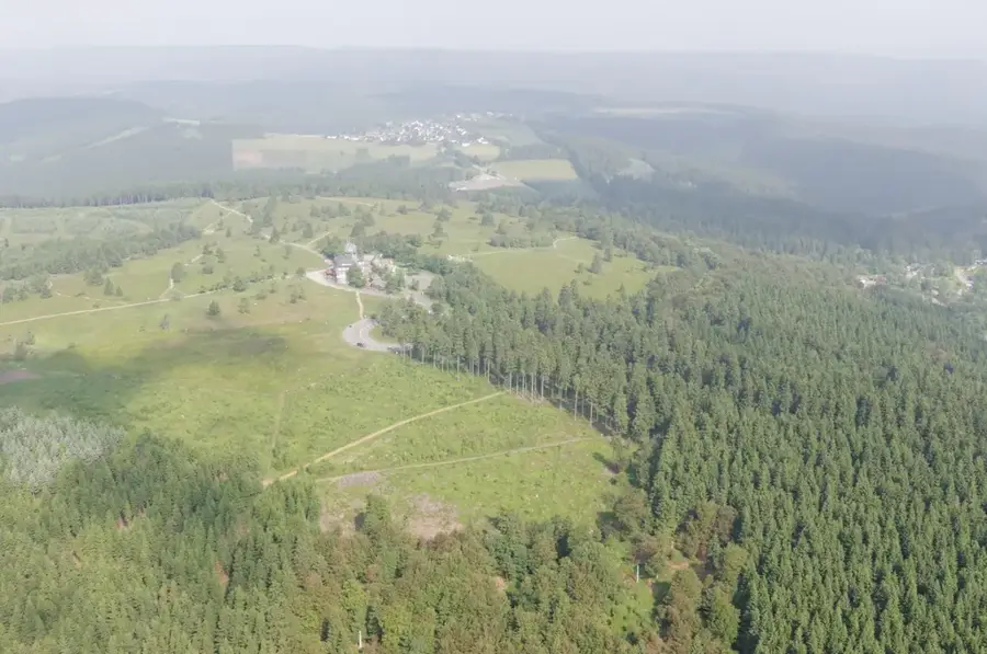
The Kahler Asten, standing at 841.9 meters, is the most renowned peak in the Rothaargebirge, situated in the Hochsauerland region of North Rhine-Westphalia. Although frequently cited as the state's highest mountain, it is slightly exceeded in height by the Langenberg. The summit area is defined by an extensive highland heath, designated as a nature reserve of European significance, hosting rare species such as dwarf shrubs and bilberries. Geologically, the mountain is composed of graywacke and clay shale dating back to the Devonian period, roughly 400 million years ago. At the peak stands the Astenturm, an integrated facility containing an observation tower, a weather station, and a restaurant, with its foundation stone laid in 1884. The Kahler Asten also serves as a critical watershed, being the source of several rivers including the Lenne, which later flows into the Ruhr. The climate is harsh, characterized by high precipitation levels and an average snow cover of over 70 days per year.
- Location: North Rhine-Westphalia, Germany
- Top sights: Kahler Asten · Blutstein · Astenturm
- Nearby: Schmallenberg (15 km)
Best time to visit & climate
The most pleasant time to visit is Jun–Aug.
| Jan | Feb | Mar | Apr | May | Jun | Jul | Aug | Sep | Oct | Nov | Dec | |
|---|---|---|---|---|---|---|---|---|---|---|---|---|
| Avg °C | -1 | 0 | 3 | 8 | 12 | 16 | 18 | 18 | 13 | 9 | 4 | 0 |
| Rain mm | 69 | 52 | 54 | 47 | 74 | 70 | 82 | 74 | 60 | 59 | 66 | 72 |
📋 Practical info
Geography
Facts
- Elevation of 841.9 meters above sea level.
- The foundation stone of the Astenturm was laid in 1884.
- The Kahler Asten nature reserve covers 48 hectares.
- The Lenne river rises here at an altitude of 820 meters.
- The weather station on the peak has operated since 1918.
- The average annual temperature is only 5.0 degrees Celsius.
Explore nearby
Notable places around
Route planner — Car & Motorhome
Where do you start? We build the route here, with stops and country notes along the way.
© OpenStreetMap contributors · OpenRouteService
Sights in the town Kahler Asten (10)
Astenturm🗼 tower
The Astenturm is an observation tower near Winterberg.
LWL-Museum für Naturkunde Außenstelle Kahler Asten Winterberg🏛 museum
An external branch of the LWL Museum of Natural History on the Kahler Asten.
Lennequelle
The Lenne Spring has a low flow rate.
Landwehr Winterberger Schanze
An archaeological site in Winterberg.
Bremberg
Bremberg is a mountain.
Heidmecke
Heidmecke is a nature reserve.
Sommerrodelbahn Winterberg
A summer toboggan run in Winterberg.
Kappe
Kappe is a mountain.
Sights nearby
Frequently asked questions
Where is the Kahler Asten located?
What is special about this mountain?
Are there any catering facilities?
Does a well-known river originate here?
Is the mountain snow-sure in winter?
Kahler Asten: where is it located?
Kahler Asten: what is there to see?
Kahler Asten: when is the best time to visit?
Kahler Asten: why is it worth visiting?

Nearby cities