Plizio Visual Lab
Le Rove
ℹ️Practical info — Le Rove
▾
🌤 Weather — 5 days
📍 Nearby
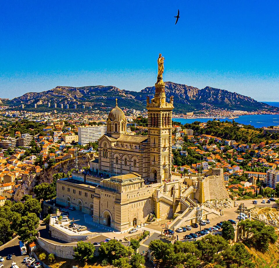
Sights nearby
💡 Tips
- Take the "Train de la Côte Bleue" from Marseille for scenic views and to avoid tricky parking.
- Arrive at Calanque de Niolon early in the morning during summer to beat the crowds.
- The coastal trail gives spectacular views but requires sturdy shoes.
- Be prepared for the strong Mistral wind; check weather conditions before heading to the coastal cliffs.
🍽 Food
Buy this fresh goat cheese in cylindrical cones directly from local farms.
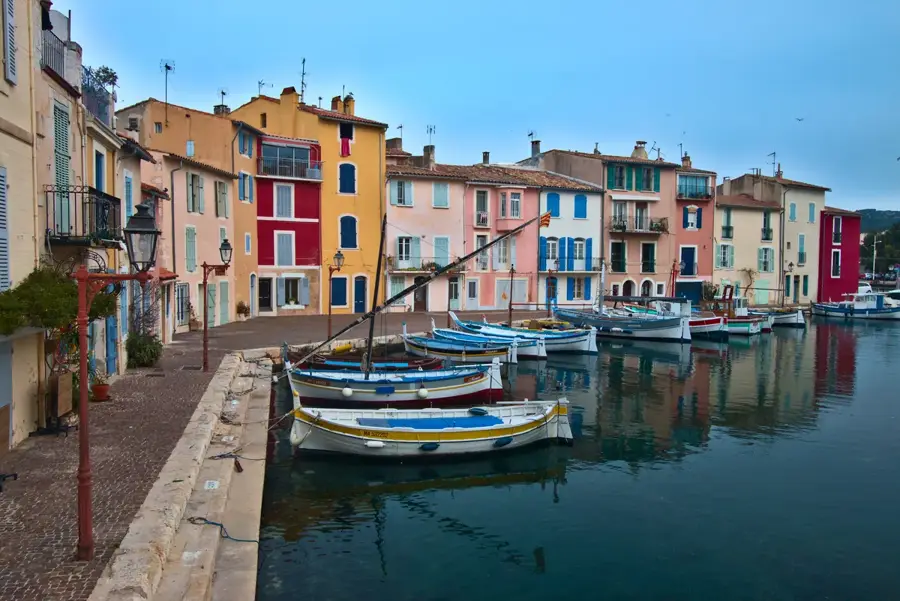
Enjoy the daily catch at the small harbor-side restaurants in Niolon or La Vesse.
Try these chickpea fries as a typical regional snack for aperitif near the coast.
🛍 Shopping · 🧘 Quiet spots
Convenient for buying authentic Brousse cheese directly from the producers in the hills.
Visit the weekly markets in neighboring villages for Provencal herbs and olive oil.
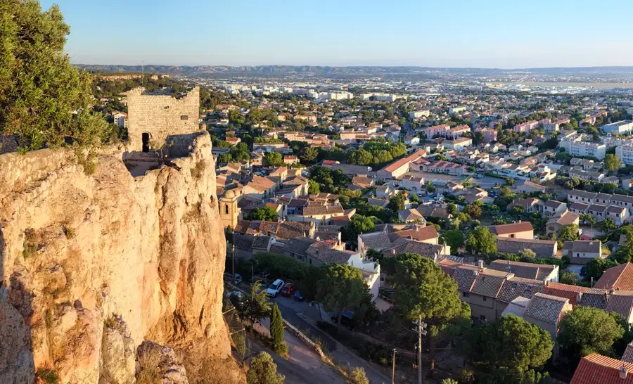
Hike to this abandoned fort for a peaceful panoramic view over the Bay of Marseille.
A secluded pebble beach accessible only via the coastal walking trail.
Water temperature…
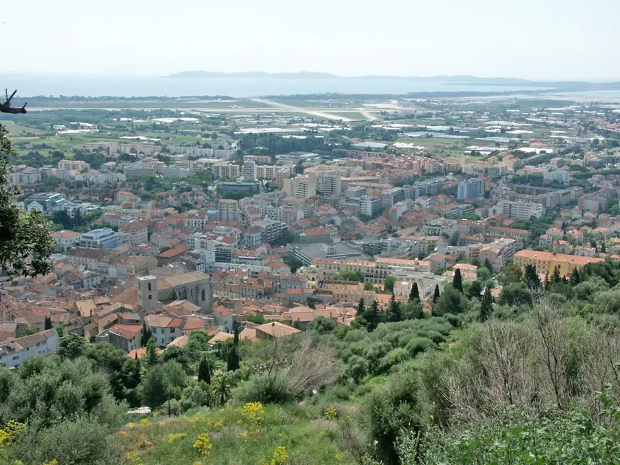
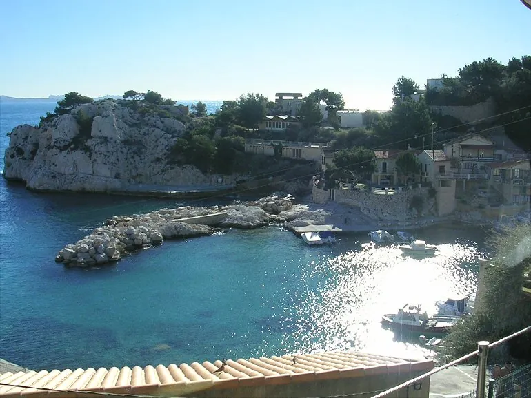
Located in the Bouches-du-Rhône department, Le Rove extends across a broad karstic limestone plateau, with 85 percent of its municipal territory covered by garrigue, the dense Mediterranean scrubland. Gastronomically, the village is recognized across France for the Brousse du Rove, a fresh, mildly sweet goat cheese traditionally molded in small conical tubes, which secured its official AOC certification in 2018. The area features a significant engineering landmark in the Tunnel du Rove, a 7-kilometer underground shipping canal inaugurated in 1927 as part of the Canal de Marseille au Rhône, though it has remained entirely blocked following a massive roof collapse in 1963. The southern boundary of the commune meets the Mediterranean Sea along the rugged Côte Bleue, characterized by steep limestone inlets such as the Calanque de Niolon and the Calanque de la Vésubie. These narrow coastal notches hide historic military forts and converted fishing cabins, accessible primarily via winding single-lane roads or the regional coastal railway. Hikers frequent the GR51 long-distance trail passing over the coastal ridges, yielding clear sightlines toward the Bay of Marseille.
- Location: Provence-Alpes-Côte d'Azur, France
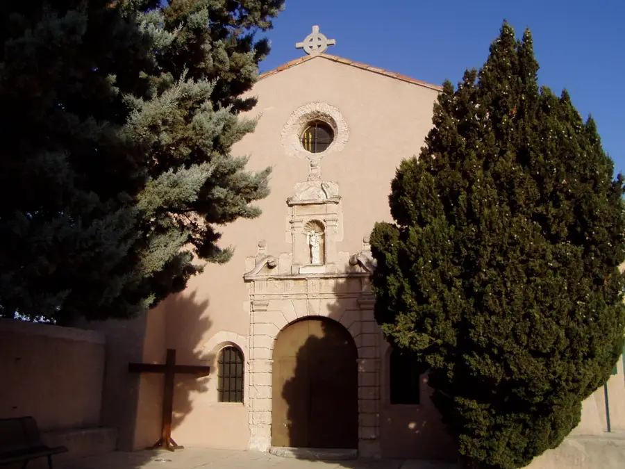
- Top sights: Fort de Figuerolles · Chapelle Saint-Michel · Calanque de Niolon
- Nearby: Ensuès-la-Redonne (4 km)
- Population: ~5.246
Best time to visit & climate
The most pleasant time to visit is Jun, Aug, Sep.
| Jan | Feb | Mar | Apr | May | Jun | Jul | Aug | Sep | Oct | Nov | Dec | |
|---|---|---|---|---|---|---|---|---|---|---|---|---|
| Avg °C | 5 | 6 | 9 | 12 | 17 | 22 | 25 | 24 | 20 | 15 | 10 | 6 |
| Rain mm | 48 | 38 | 40 | 47 | 47 | 29 | 13 | 21 | 50 | 75 | 94 | 54 |
Geography
Facts
- Postal code: 13740
- Gastronomy: Brousse du Rove cheese
- Max altitude: 263 meters
- Total area: 23 sq km
- Famous inlets: Niolon and La Vesse
- Protected coastline (Conservatoire du Littoral)
Explore nearby
Notable places around
Route planner — Car & Motorhome
Where do you start? We build the route here, with stops and country notes along the way.
© OpenStreetMap contributors · OpenRouteService
Begin your day by the crystal-clear waters of Niolon and La Vesse, breathing in the fresh sea air. Following a coastal walk, you will reach the historic Fort de Figuerolles to enjoy breathtaking maritime vistas. Your afternoon is dedicated to the soothing pebble beaches, accompanied by the gentle sound of crashing waves. Conclude your evening relaxing on the serene shoreline as the sun dips below the horizon.
Calanque de Niolon
Calanque de la Vesse
Fort de Figuerolles
Plage de la Batterie
Plage de La Lave
Start your morning at the dramatic Niolon calanque, where the rain adds a moody atmosphere to the cliffs. Midday takes you through the coastal paths; wear sturdy, slip-resistant shoes. Afternoon brings you to the historic fort ruins, best viewed with an umbrella. End the day at the beaches, watching the sea foam under the overcast sky.
Calanque de Niolon
Calanque de la Vesse
Fort de Figuerolles
Plage de la Batterie
Plage de La Lave
Enjoy a crisp morning at the Niolon calanque, embracing the cold, clear sea air. Midday offers peaceful walks along the coast; dress in warm, windproof layers. Afternoon shadows lengthen quickly at the historic fort, offering stunning sunset colors. Conclude at the beaches before the early 5 PM sunset brings a chill to the air.
Calanque de Niolon
Calanque de la Vesse
Fort de Figuerolles
Plage de la Batterie
Plage de La Lave
Your cycling journey starts inland at the picturesque Saint-Michel Chapel before heading to the impressive Tunnel du Rove engineering marvel. By midday, pedal up towards the Oppidum de la Campane to uncover fascinating ancient ruins. In the afternoon, coast downhill to explore the coastal fortifications of Fort de Figuerolles. The ride gracefully concludes with the stunning sunset views from the calanques of La Vesse and Niolon.
Chapelle Saint-Michel
Tunnel du Rove
Oppidum de la Campane
Fort de Figuerolles
Calanque de la Vesse
Calanque de Niolon
Cycle out in the morning to the hidden chapel, wearing full rain gear to brave the elements. Midday takes you past the historic tunnel and ancient oppidum; brake carefully on wet descents. Afternoon paths to the fort and calanques require extra caution on slippery stones. End the damp ride watching the stormy waves crash.
Chapelle Saint-Michel
Tunnel du Rove
Oppidum de la Campane
Fort de Figuerolles
Calanque de la Vesse
Calanque de Niolon
Morning riding to the chapel is brisk; layered clothing is essential against the cold wind. Midday brings you to the Rove tunnel and historic oppidum, where cycling keeps you comfortably warm. Afternoon descents to the fort and calanques are stunning in the golden hour. Finish the ride by 5 PM as temperatures drop rapidly.
Chapelle Saint-Michel
Tunnel du Rove
Oppidum de la Campane
Fort de Figuerolles
Calanque de la Vesse
Calanque de Niolon
This driving tour seamlessly connects the engineering wonder of the Tunnel du Rove with the rustic tranquility of the Saint-Michel Chapel up north. Following a scenic drive to the Oppidum de la Campane, you are treated to sweeping regional views. The afternoon allows plenty of time to comfortably beach-hop along the beautiful southern coastline. Ultimately, the hidden calanques draw you in for a captivating maritime sunset experience.
Tunnel du Rove
Chapelle Saint-Michel
Oppidum de la Campane
Plage de La Lave
Plage de la Batterie
Fort de Figuerolles
Calanque de la Vesse
Calanque de Niolon
Start your driving tour at the historic tunnel, using your car as a cozy refuge between stops. Midday brings you to the chapel and oppidum; pack an umbrella for short walks. Afternoon coastal roads are slick, so drive the winding curves carefully to the beaches. Finish at the stormy calanques, enjoying the dramatic sea safely.
Tunnel du Rove
Chapelle Saint-Michel
Oppidum de la Campane
Plage de La Lave
Plage de la Batterie
Fort de Figuerolles
Calanque de la Vesse
Calanque de Niolon
Morning drives to the tunnel and chapel are comfortable with the heater on, contrasting the cold outside. Midday stops at the oppidum and beaches offer crisp air and fewer crowds; wrap up warm for exploring. Afternoon driving along the coast is spectacular in the low light. Finish the calanques just before the 5 PM darkness sets in.
Tunnel du Rove
Chapelle Saint-Michel
Oppidum de la Campane
Plage de La Lave
Plage de la Batterie
Fort de Figuerolles
Calanque de la Vesse
Calanque de Niolon
Sights in the town Le Rove (8)
Frequently asked questions
What is the specialty of Le Rove?
Can you go to the sea in Le Rove?
Are there good hiking trails?
How do you get from Marseille to Le Rove?
Where is the best view?
Le Rove: where is it located?
Le Rove: what is there to see?
Le Rove: when is the best time to visit?
Le Rove: why is it worth visiting?

Nearby cities