Plizio Visual Lab
Björköby
ℹ️Practical info — Björköby
▾
🌤 Weather — 5 days
📍 Nearby
Sights nearby
💡 Tips
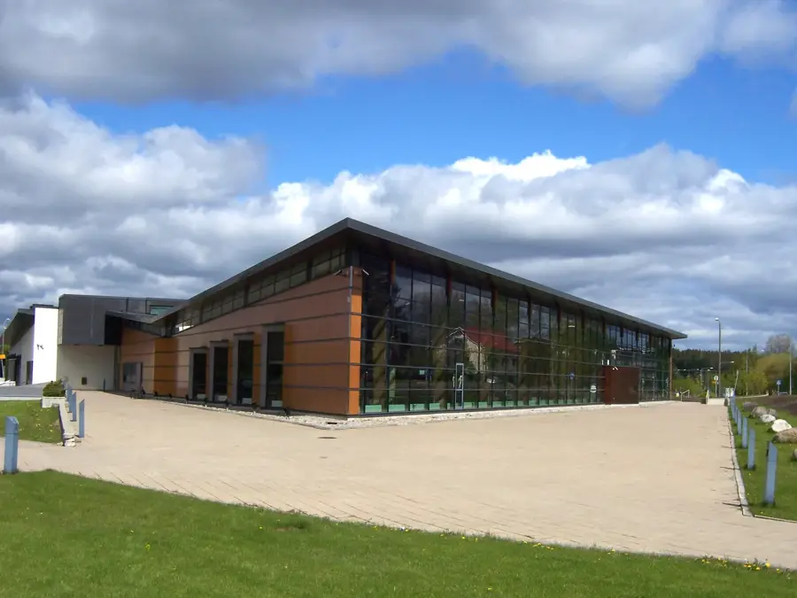
- Climb the Saltkaret observation tower early in the morning for the best light over the De Geer moraines.
- The nature trails cross rocky terrain; wear sturdy hiking shoes instead of casual sneakers.
- Due to post-glacial land uplift, the waters are very shallow-renting a kayak is the best way to explore between the ridges.
- Parking at Svedjehamn fills up rapidly by midday in July; aim to arrive before 10 AM.
- Look closely at the red boathouses; you'll notice many are now far from the shoreline due to the rising land.
🍽 Food
Look for juices, jams, and pastries featuring this tart, bright orange local berry at Cafe Salteriet.
Try the traditional fish soup or smoked salmon served directly at the harbor cafes in Svedjehamn.
Pair a traditional sweet bun with filter coffee at a red boathouse cafe before a hike.
🛍 Shopping · 🧘 Quiet spots
A small shop near the observation tower sells maps, postcards, and local guidebooks.
Local artisans occasionally sell traditional Finnish rugs and linens near the harbor during summer weekends.
A peaceful 4km circular nature trail passing through serene birch forests and right over the rocky moraines.
A quiet rest spot along the water where you can grill sausages while listening to the sea birds.
Water temperature…
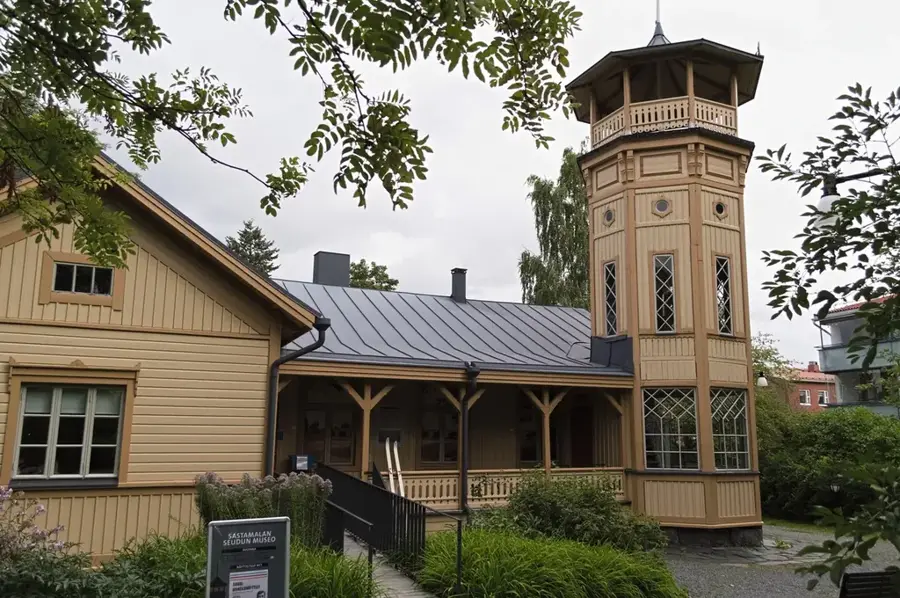
Björköby is located on Björkö Island in the heart of the Kvarken Archipelago and is one of Finland's most authentic fishing villages. The village serves as a gateway to the UNESCO World Heritage site, as the post-glacial land uplift here (8-8.5 mm per year) is among the fastest in the world. The hub of the village is Svedjehamn harbor, where traditional red boathouses line the shore. From here, a nature trail leads to the Saltkaret observation tower, a modern wooden structure offering spectacular views of the characteristic De Geer moraines, long, narrow ridges formed during the last Ice Age. Visitors can experience maritime history at the Mårtes Gård museum, an old farmstead documenting 19th-century island life. The area is great for kayaking through the shallow, labyrinthine archipelago. Tasting the locally smoked fish is a must for any visitor. The village is connected to the mainland via the Replot Bridge, Finland's longest bridge, making the journey from Vaasa both easy and exceptionally scenic.
- Location: Finland
- Nearby: Grönvik (21 km)
- Population: ~294
Best time to visit & climate
The most pleasant time to visit is Jul–Sep.
| Jan | Feb | Mar | Apr | May | Jun | Jul | Aug | Sep | Oct | Nov | Dec | |
|---|---|---|---|---|---|---|---|---|---|---|---|---|
| Avg °C | -3 | -5 | -3 | 1 | 6 | 11 | 15 | 16 | 12 | 7 | 3 | 0 |
| Rain mm | 52 | 39 | 37 | 40 | 57 | 47 | 63 | 72 | 68 | 77 | 68 | 59 |
Geography
Facts
- Highest rate of land uplift globally (over 8 mm/year)
- Svedjehamn harbor with historic boathouses
- Saltkaret tower offers views of the UNESCO heritage
- Part of the Korsholm municipality
- Accessible via Finland's longest bridge (Replot Bridge)
- Mårtes Gård open-air museum shows 19th-century life
- Central hub for hiking trails in the archipelago
- Significant nesting area for white-tailed eagles
Explore nearby
Notable places around
Route planner — Car & Motorhome
Where do you start? We build the route here, with stops and country notes along the way.
© OpenStreetMap contributors · OpenRouteService
Sights in the town Björköby (1)
Frequently asked questions
What is Björköby?
What is Svedjehamn?
What is the Saltkaret observation tower?
Can you go hiking in Björköby?
How to get to Björköby?
Björköby: where is it located?
Björköby: when is the best time to visit?
Björköby: why is it worth visiting?

Nearby cities