Plizio Visual Lab
Degehabur

ℹ️Practical info — Degehabur
▾
🌤 Weather — 5 days
📍 Nearby
Sights nearby
💡 Tips
- The region is predominantly Muslim; dress modestly and be mindful of prayer times and Ramadan customs.
- The climate is hot and arid, so staying hydrated is crucial.
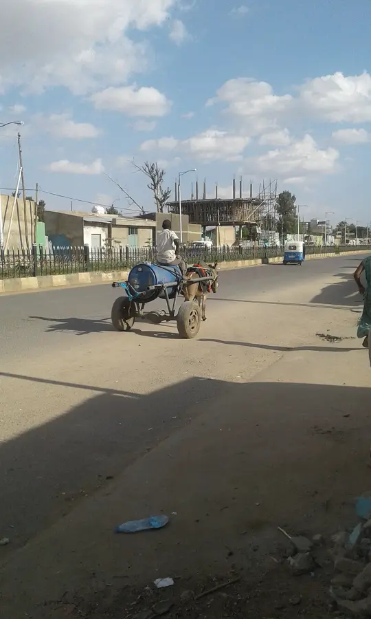
- Transportation options can be limited; hiring a private 4x4 is often necessary for traveling outside the town.
- Always ask permission before taking photographs of people or local dwellings.
🍽 Food
A local specialty often served roasted or in stews at traditional eateries.
A legacy of Italian influence, commonly served with a spiced meat sauce.
Heavily sweetened and flavored with cardamom, available at any local tea stall.
🛍 Shopping · 🧘 Quiet spots
Aromatic resins sold in the local markets.
Brightly colored cloths worn by local women.
The arid landscape provides a stark, quiet beauty, especially at sunrise.
During off-peak hours, a good place to sit quietly and watch daily life.
Water temperature…
Degehabur, also known as Dagahbur, is a significant administrative and commercial center in the Jarar Zone of Ethiopia's Somali Region. Situated along the Jerer River, the town serves as a crucial hub for the livestock trade and agricultural exchange within the semi-arid eastern plains. Historically, Degehabur gained international prominence during the Ogaden War in the late 1970s due to its strategic position on the road to Jijiga. The surrounding geography is defined by vast rangelands that support the pastoralist economy of the local Somali population. In recent years, the town has seen steady urban expansion, supported by improvements in regional infrastructure and basic service delivery. Today, Degehabur functions as a vital service node, providing healthcare, education, and administrative functions to the surrounding rural districts while maintaining its role as a key transit point for cross-border regional movements.
- Location: Ethiopia
- Population: ~47.200 (2026)
Best time to visit & climate
The most pleasant time to visit is Jan, Jul, Dec.
| Jan | Feb | Mar | Apr | May | Jun | Jul | Aug | Sep | Oct | Nov | Dec | |
|---|---|---|---|---|---|---|---|---|---|---|---|---|
| Avg °C | 23 | 25 | 26 | 26 | 24 | 23 | 23 | 24 | 25 | 25 | 23 | 23 |
| Rain mm | 2 | 2 | 20 | 114 | 90 | 36 | 28 | 37 | 56 | 57 | 30 | 5 |
Geography
Facts
- Located in the Jarar Zone of the Somali Region of Ethiopia.
- Situated on the banks of the seasonal Jerer River.
- Was a key strategic site during the 1977 Ogaden War.
- Serves as a major hub for regional livestock marketing.
- The population is predominantly composed of ethnic Somalis.
- Located approximately 165 kilometers south of the city of Jijiga.
Explore nearby
Notable places around
Route planner — Car & Motorhome
Where do you start? We build the route here, with stops and country notes along the way.
© OpenStreetMap contributors · OpenRouteService
Frequently asked questions
How many days should I spend in Degehabur?
What is the best time to visit Degehabur?
How do I get to Degehabur?
What local specialties should I try?
Is Degehabur family-friendly?
Degehabur: where is it located?
Degehabur: when is the best time to visit?
Degehabur: why is it worth visiting?

Nearby cities

History & landmarks
Nature

More places