Plizio Visual Lab
Malabo Estuary
Weather…
Water temperature…
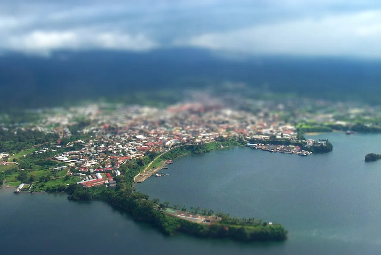
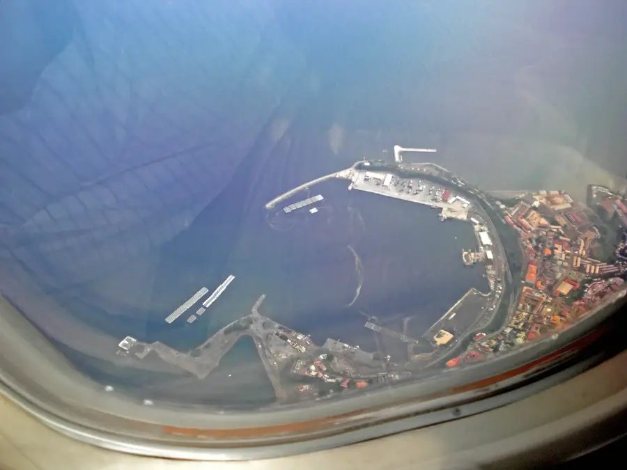
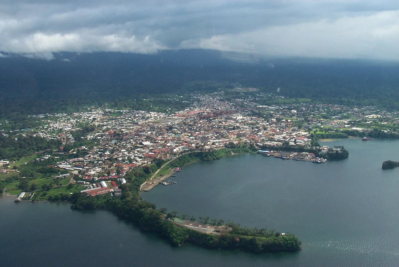
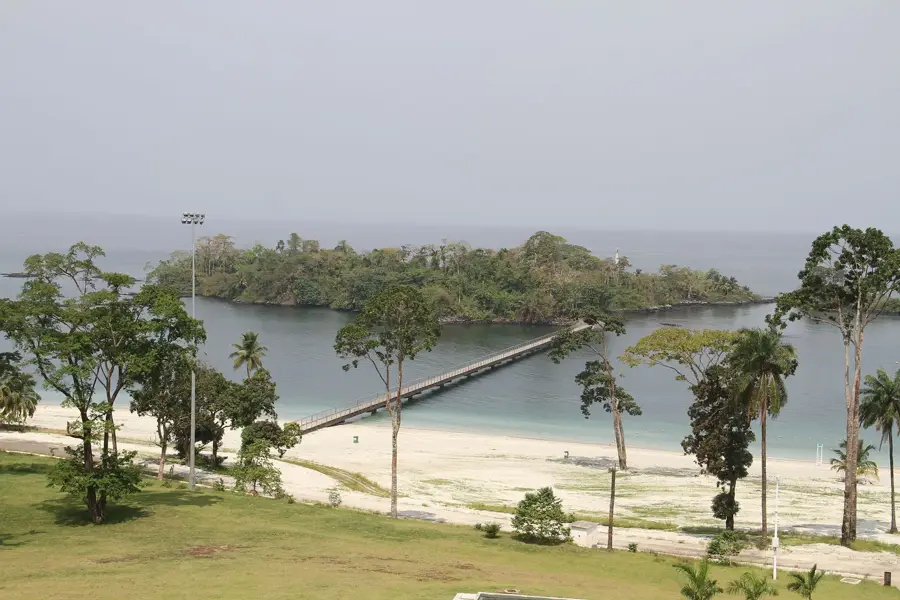
The Malabo Estuary is a natural sea inlet on the northern coast of Bioko Island, providing a sheltered and deep-water environment that has made it the primary harbor for the nation's capital. This volcanic inlet is protected from the full force of the Atlantic storms, creating a well-suited location for the Malabo Sea Port and other maritime infrastructure. Beyond its logistical importance, the estuary is an interesting ecological zone where the island's runoff meets the salt waters of the Gulf of Guinea. The surrounding cliffs and volcanic rocks provide nesting sites for various seabirds and a unique coastal landscape. The estuary's development is central to the history and continued economic growth of Malabo. Curriculum: Geography K6, Economics K7.
- Location: Equatorial Guinea
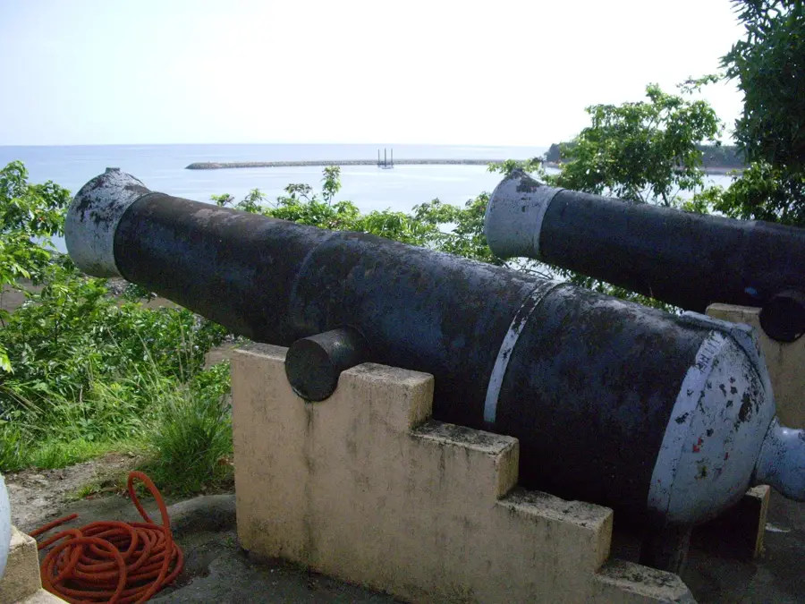
- Top sights: Operation Postmaster · Black Beach
- Nearby: Bilelipa (4 km)
Best time to visit & climate
The most pleasant time to visit is Jan, Feb, Dec.
| Jan | Feb | Mar | Apr | May | Jun | Jul | Aug | Sep | Oct | Nov | Dec | |
|---|---|---|---|---|---|---|---|---|---|---|---|---|
| Avg °C | 28 | 28 | 28 | 28 | 28 | 27 | 26 | 26 | 26 | 27 | 27 | 27 |
| Rain mm | 30 | 74 | 148 | 190 | 202 | 347 | 424 | 480 | 410 | 257 | 150 | 26 |
📋 Practical info
Geography
Facts
- A deep natural sea inlet of volcanic origin on Bioko.
- Provides a sheltered harbor for the capital city, Malabo.
- Primary location for the nation's most advanced seaport.
- Protects the city's waterfront from powerful Atlantic surges.
- An important site for observing regional coastal bird species.
- Central to the maritime and colonial history of the island.
- A vital node for international and domestic cargo transit.
Explore nearby
Notable places around
Route planner — Car & Motorhome
Where do you start? We build the route here, with stops and country notes along the way.
© OpenStreetMap contributors · OpenRouteService
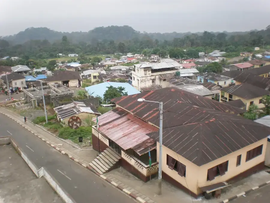
Sights in the town Malabo Estuary (2)
Sights nearby
Frequently asked questions
What can you see in the Malabo Estuary?
Can you go fishing in the estuary?
Is the water clean enough for swimming?
Are there boat tours for tourists?
When is the best view of the estuary?
Malabo Estuary: where is it located?
Malabo Estuary: what is there to see?
Malabo Estuary: when is the best time to visit?
Malabo Estuary: why is it worth visiting?

Nearby cities
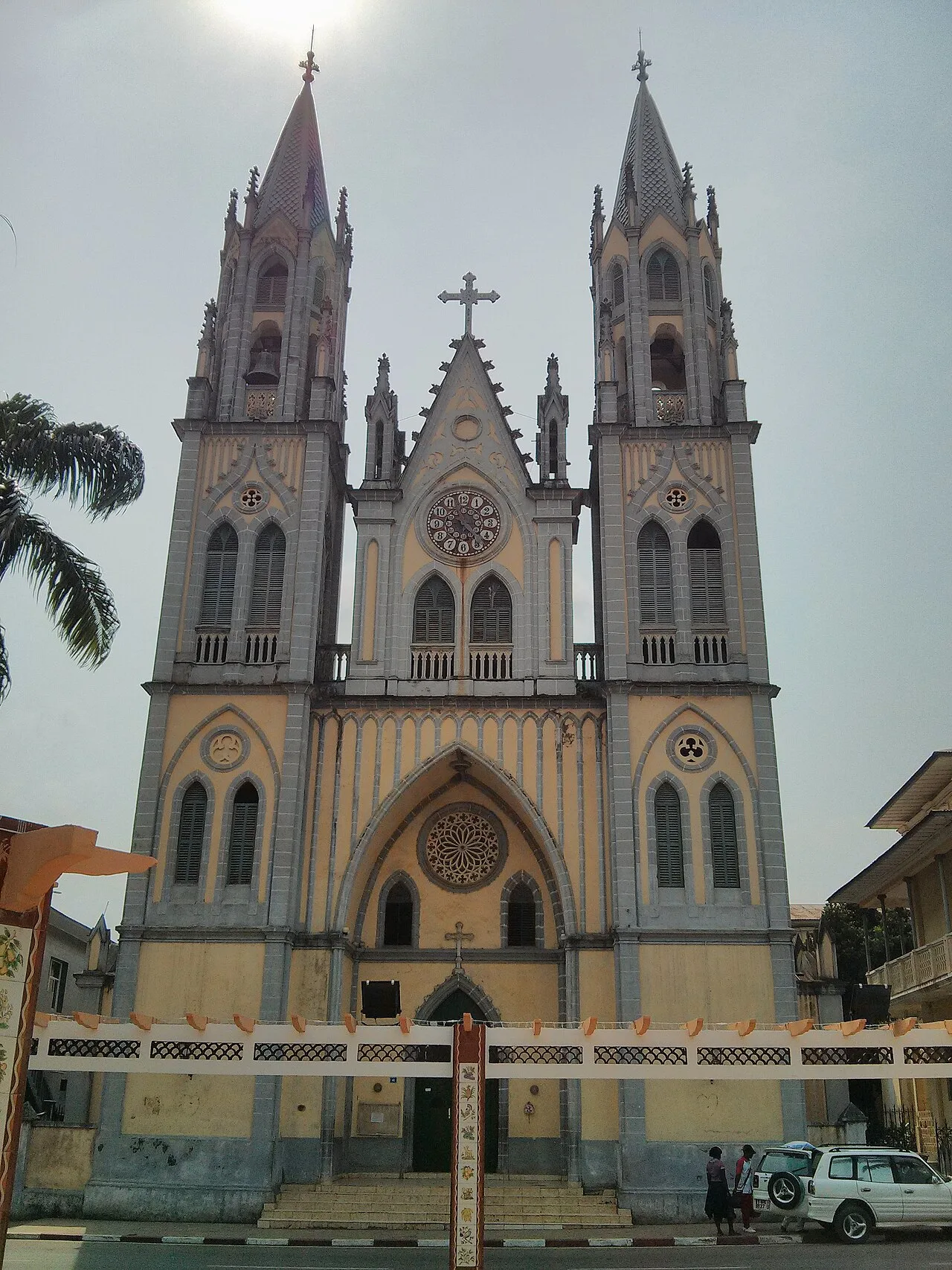


History & landmarks


More places