Plizio Visual Lab
Niangara
ℹ️Practical info — Niangara
▾
🌤 Weather — 5 days
📍 Nearby
Sights nearby
💡 Tips
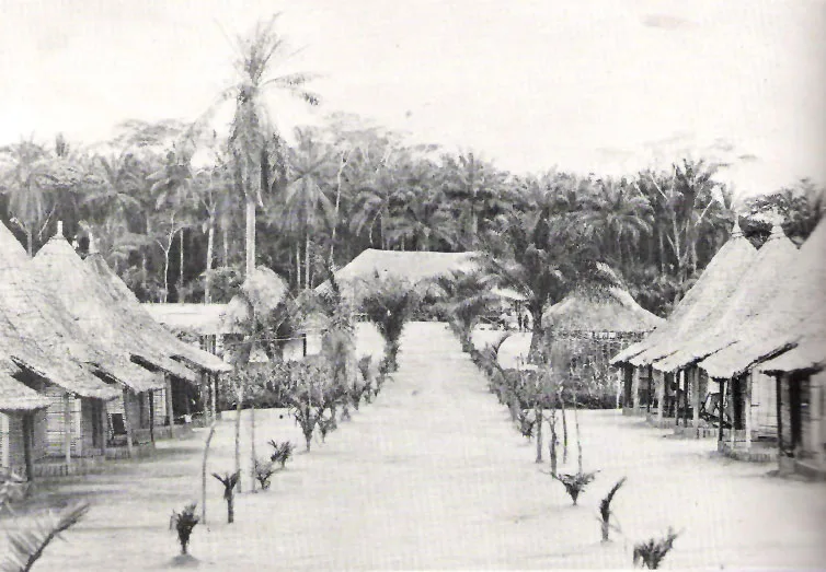
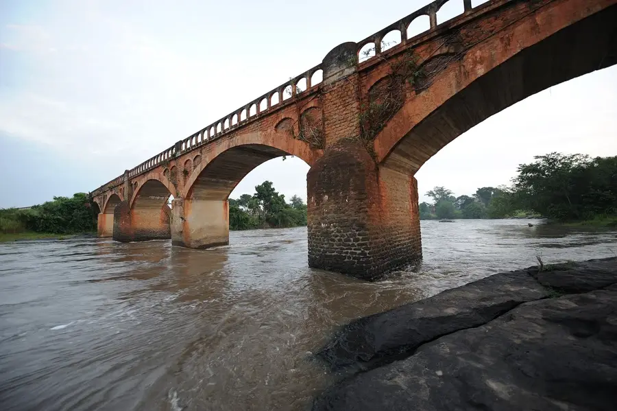
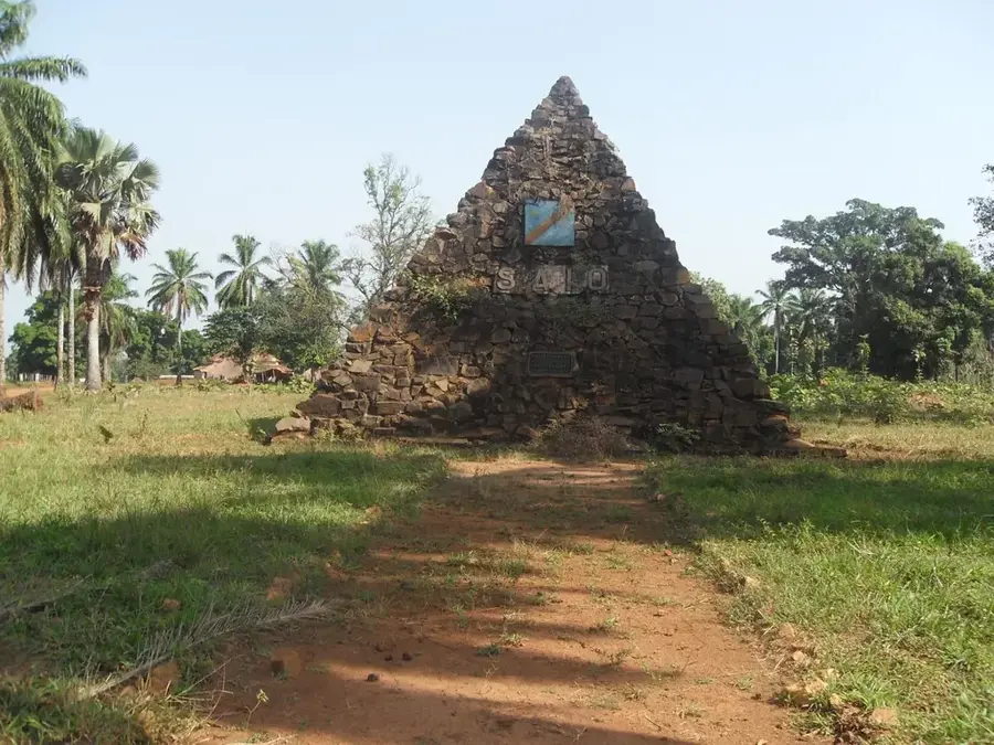
- Situated on the Uele River, the town is home to historical colonial-era remnants, many of which are picturesquely ruined.
- Travel here requires careful planning and local contacts due to the extremely remote location and rough road conditions.
- Lingala and French are widely spoken, with Swahili being less common.
- Respect local customs and always ask permission politely before taking photographs of people or historical structures.
🍽 Food
Fresh from the Uele River, best enjoyed grilled or in a rich moambe sauce at riverside eateries.
Fish slow-cooked in large banana leaves, which perfectly seals in the flavor of the spices.
Fried plantains, a delicious and filling snack to grab while walking around town.
🛍 Shopping · 🧘 Quiet spots
The best place to see the morning catch from local fishermen alongside fresh agricultural goods.
Keep an eye out at small village stalls for hand-carved wooden items and local pottery.
Find a shady spot to watch the tranquil water flow and the dugout canoes of local fishermen.
The remains of old administrative buildings, now reclaimed by nature, offer a melancholic and very quiet atmosphere.
Water temperature…
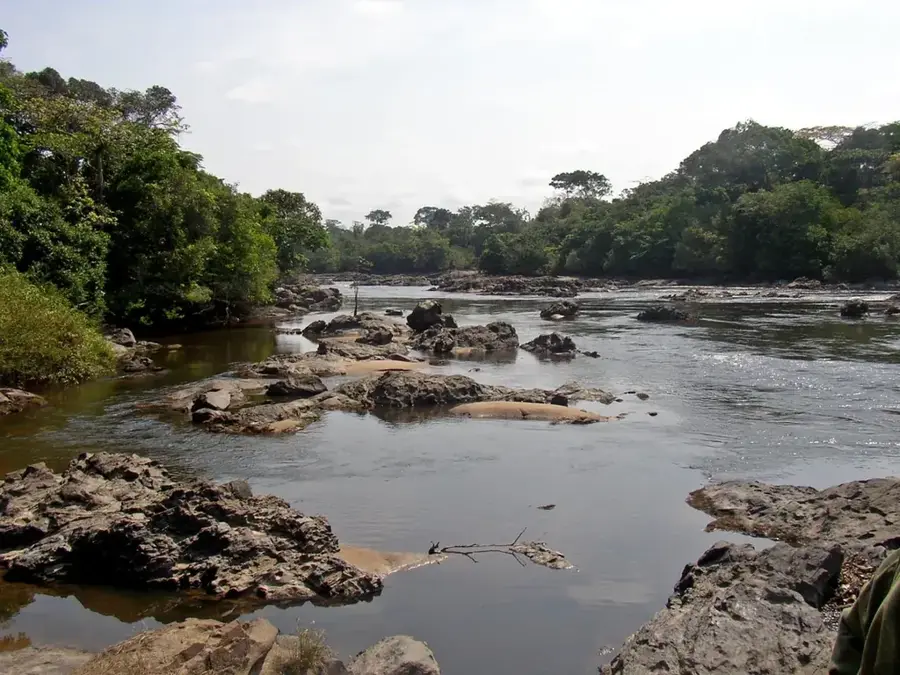
Niangara is a town steeped in history, located on the banks of the Uele River in the Haut-Uele Province of northern Democratic Republic of the Congo. The town has a long tradition as an administrative and cultural center for the region and is closely linked to the history of the Mangbetu and Azande peoples. During the colonial period, Niangara served as a vital administrative post and a trading center for ivory and agricultural products. The architecture of some older buildings still evokes this era today. Geographically, the town is situated in a region characterized by a mix of forest and savanna landscapes, supporting diverse flora and fauna. The Uele River plays a central role in the local economy, both as a transport route and a source for fishing. In recent decades, the region has unfortunately been affected by armed conflicts, which have hindered the town's development. Nevertheless, Niangara remains a symbol of the cultural heritage of northeastern Congo, hosting traditional communities with rich artistic expression.
- Location: Congo - Kinshasa
- Nearby: Dungu (77 km)
Best time to visit & climate
The most pleasant time to visit is Jan, Feb, Dec.
| Jan | Feb | Mar | Apr | May | Jun | Jul | Aug | Sep | Oct | Nov | Dec | |
|---|---|---|---|---|---|---|---|---|---|---|---|---|
| Avg °C | 25 | 26 | 25 | 24 | 24 | 23 | 23 | 23 | 23 | 23 | 24 | 24 |
| Rain mm | 28 | 48 | 136 | 214 | 195 | 172 | 153 | 199 | 198 | 219 | 131 | 44 |
Geography
Facts
- Located on the strategically important Uele River
- Cultural center of the Mangbetu and Azande peoples
- Former major trading post for ivory in the region
- Administrative capital of the Niangara Territory
- Region is characterized by gallery forests and savannas
- Known for traditional music and artisanal crafts
Explore nearby
Notable places around
Route planner — Car & Motorhome
Where do you start? We build the route here, with stops and country notes along the way.
© OpenStreetMap contributors · OpenRouteService
Frequently asked questions
What is the cultural significance of Niangara?
Where is Niangara located?
What can you visit in Niangara?
How is the climate in Niangara?
Is there an airport in Niangara?
Niangara: where is it located?
Niangara: when is the best time to visit?
Niangara: why is it worth visiting?

Nearby cities

History & landmarks
More places