Plizio Visual Lab
Isiro
ℹ️Practical info — Isiro
▾
🌤 Weather — 5 days
📍 Nearby
Sights nearby
💡 Tips
- Expect sudden heavy rainfalls; a compact umbrella or raincoat is highly recommended.
- It's a transport hub for the region, so inquire locally for the latest bush taxi schedules.
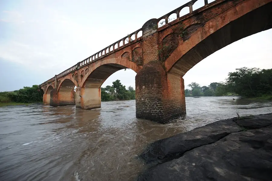
- The Uele Railway is historic but mostly defunct; watch out for old colonial train relics.
- Keep your travel documents handy, as checkpoints are common when entering or leaving the city.
🍽 Food
A nutritious green stew often served with rice or fufu at local diners.
Only eat in established venues to ensure sustainability; alternatively, opt for chicken dishes.
The region is known for rich, dark forest honey sold in local markets.
🛍 Shopping · 🧘 Quiet spots
The main market has incredibly fresh pineapples and bananas directly from the nearby forest.
Look for local artisans selling hand-carved wooden figures representing traditional themes.
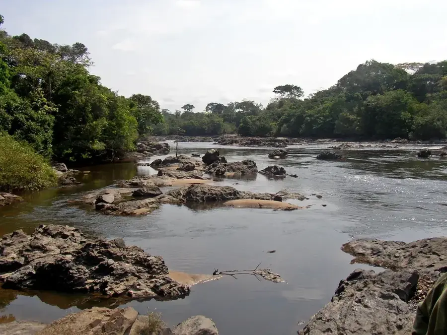
Take a walk to the outskirts for a peaceful view of the dense northeastern tropical forest.
The church yard provides a quiet, shaded place for reflection away from the market buzz.
Water temperature…
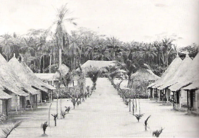
Isiro serves as the provincial capital of Haut-Uele in the northeastern reaches of the Democratic Republic of the Congo, functioning as a critical administrative and commercial hub. Originally established as Paulis during the Belgian colonial era, the city gained prominence as a strategic railhead for the Vicicongo railway system, which was vital for transporting agricultural commodities from the interior. Positioned within the tropical rainforest belt, Isiro benefits from a humid equatorial climate that supports extensive farming activities in the surrounding countryside. For much of its history, the city has been a primary center for the trade of coffee, cotton, and oil palm, with various processing facilities established to prepare these goods for broader markets. The urban landscape of Isiro features a blend of colonial-era administrative buildings and more contemporary residential areas, reflecting its ongoing evolution as a regional center. The Roman Catholic Diocese of Isiro, Niangara is headquartered here, with the Cathedral of St. Therese of the Child Jesus serving as a major religious and community landmark. The cultural fabric of the city is deeply influenced by the Mangbetu people, whose sophisticated artistic heritage and traditional leadership structures are still revered in the Haut-Uele region. Logistics in Isiro are significantly bolstered by Matari Airport, which provides essential air links to the national capital, Kinshasa, overcoming the isolation caused by the challenging condition of regional roads. In recent years, the city has seen efforts to revitalize its role as an educational center, with several institutes of higher learning focusing on agriculture and social sciences. The proximity to mineral-rich areas has also made Isiro a secondary hub for the gold trade, providing a boost to local commerce and service industries. As the province seeks to diversify its economy, Isiro is positioned to become a key player in the development of cross-border trade routes linking the Congo Basin with markets in South Sudan and East Africa.
- Location: Congo - Kinshasa
- Population: ~255.409 (2026)
Best time to visit & climate
The most pleasant time to visit is Jan, Feb, Dec.
| Jan | Feb | Mar | Apr | May | Jun | Jul | Aug | Sep | Oct | Nov | Dec | |
|---|---|---|---|---|---|---|---|---|---|---|---|---|
| Avg °C | 24 | 25 | 24 | 24 | 23 | 23 | 23 | 23 | 23 | 23 | 23 | 23 |
| Rain mm | 38 | 65 | 170 | 242 | 223 | 177 | 159 | 201 | 216 | 257 | 161 | 52 |
Geography
Facts
- Isiro serves as the provincial capital and largest city of the Haut-Uele Province.
- The city was formerly named Paulis during the period of Belgian colonial rule.
- The average elevation of Isiro is approximately 441 meters (1,447 feet).
- Matari Airport provides essential flight connections to Kinshasa and other cities.
- The surrounding region is highly fertile, specializing in coffee and cotton production.
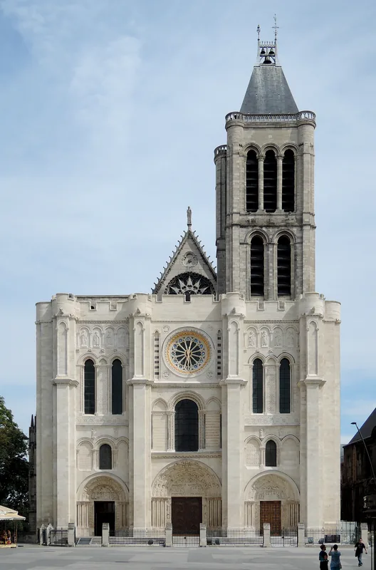
- Isiro is the seat of the Roman Catholic Diocese of Isiro–Niangara.
- The city grew significantly as a railhead for the defunct Uele narrow-gauge railway.
- The Mangbetu people, known for their distinct culture, are prominent in the region.
Explore nearby
Notable places around
Route planner — Car & Motorhome
Where do you start? We build the route here, with stops and country notes along the way.
© OpenStreetMap contributors · OpenRouteService
Sights in the town Isiro (1)
Frequently asked questions
What is Isiro known for?
Are there sights in Isiro?
How do you travel to Isiro?
What is the legacy of Anuarite Nengapeta?
What is the vegetation in the region like?
Isiro: where is it located?
Isiro: when is the best time to visit?
Isiro: why is it worth visiting?

Nearby cities
History & landmarks
More places