Plizio Visual Lab
Chaillu Massif
Weather…
Water temperature…
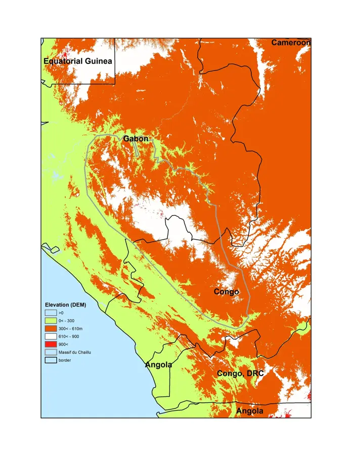
The Chaillu Massif is an extensive mountain range and highland system stretching across the southern Republic of the Congo and central Gabon. Within Congo, it covers significant portions of the Lékoumou and Niari departments, forming a critical watershed between the Ogooué and Kouilou-Niari river basins. Named after the 19th-century French-American explorer Paul Du Chaillu, who was among the first to document the region's unique primates and indigenous cultures, the massif is characterized by its rugged terrain and dense primary rainforest. Geologically, it is composed of ancient Precambrian crystalline rocks, making it one of the most stable parts of the African continent. The massif's high biodiversity includes significant populations of Western lowland gorillas and forest elephants, thriving in the relatively undisturbed forest canopy. Due to its elevation, the region experiences cooler temperatures and higher rainfall than the coastal lowlands, supporting unique montane flora. While rich in minerals like manganese, the Chaillu Massif remains a focus of conservation efforts aimed at balancing economic development with ecological preservation.
- Location: Congo - Brazzaville
- Nearby: Mossendjo (37 km)
Best time to visit & climate
The most pleasant time to visit is Jun–Aug.
| Jan | Feb | Mar | Apr | May | Jun | Jul | Aug | Sep | Oct | Nov | Dec | |
|---|---|---|---|---|---|---|---|---|---|---|---|---|
| Avg °C | 24 | 24 | 24 | 24 | 24 | 23 | 23 | 23 | 24 | 24 | 24 | 24 |
| Rain mm | 187 | 174 | 238 | 213 | 170 | 17 | 4 | 12 | 62 | 224 | 333 | 254 |
📋 Practical info
Geography
Facts
- The massif reaches elevations of up to 900 meters within Congolese territory.
- It serves as the primary source for the Louessé and Niari rivers.
- Paul Du Chaillu's expeditions here in the 1850s were legendary in the history of African exploration.
- The region is a global hotspot for biodiversity, particularly for orchid species.
- Large-scale manganese mining operations are a key part of the local economy.
- The terrain is characterized by steep ridges and narrow, fertile valleys.
Explore nearby
Notable places around
Route planner — Car & Motorhome
Where do you start? We build the route here, with stops and country notes along the way.
© OpenStreetMap contributors · OpenRouteService
Sights nearby
Frequently asked questions
Where does the Chaillu Massif extend?
What is the highest point in the Congolese part?
Why is the massif ecologically important?
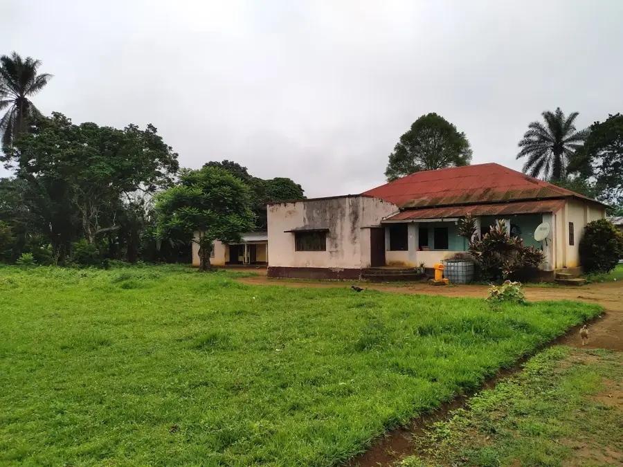
Are there human settlements there?
What is the relief like?
Chaillu Massif: where is it located?
Chaillu Massif: when is the best time to visit?
Chaillu Massif: why is it worth visiting?